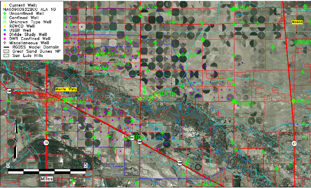
| Well Information Table |
|---|
| Common Well ID | NA03900932BCC ALA 10 |
| RGWCD Confined Aquifer Well ID | ALA10 |
| USGS Well ID | 373457106003801 |
| USGS Station Name | NA03900932BCC ALA 10 |
| USGS Site Type | Well |
| USGS Site Use Information | Withdrawal of Water |
| USGS Groundwater Use Information | Irrigation |
| Data Source(s) | USGS |
| Location Data |
|---|
| TRS | NA03900932BCC ALA 10 |
| USGS TRS 1 | NA03900932BCC ALA 10 |
| Longitude/Latitude (NAD83) | -106.02069968 , 37.58126041 |
| Longitude/Latitude Data Source | Davis Engineering Survey |
| USGS Longitude/Latitude (NAD83) | -106.021413900 , 37.581391000 |
| Easting, Northing RGDSS-NAD83 (US ft) | 99586.65 , 213280.72 |
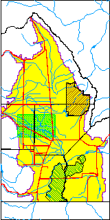
| USGS County | Alamosa County |
| USGS Map Name | HOMELAKE |
| USGS Map Scale | 24000 |
| Elevation and Depth Data |
|---|
| Ground Elevation (ft NAVD88) | 7598.38 |
| Elevation Data Source | Davis Engineering Survey |
| USGS Ground Elevation (ft NGVD29) | 7592.00 |
| 1/3-Arc Second NED Ground Elevation (ft NAVD88) | 7597.78 |
| 1-Arc Second NED Ground Elevation (ft NAVD88) | 7597.10 |
| SRTM Ground Elevation (ft NAVD88) | 7602.62 |
| Total Depth (ft) | 2084.00 |
| USGS Well Depth (ft) | 2084.00 |
| Model Layer | 4 |
| Model Layer Source | Well Depth |
| Depth of Bottom of Layer 1 | 80 |
| Depth of Bottom of Layer 2 | 217 |
| Depth of Bottom of Layer 3 | 692 |
| Depth of Bottom of Layer 4 | 2070 |
| Additional Well Information | Construction |
| Aquifer Information |
|---|
| Aquifer Type | Confined |
| Aquifer Type Source | RGWCD_AQ |
| USGS Aquifer Type | Confined Single Aquifer |
| USGS Hydrologic Unit | Alamosa-Trinchera |
| USGS Data Available | Water-level (GW.LEV) |
| Water-level Database Information |
|---|
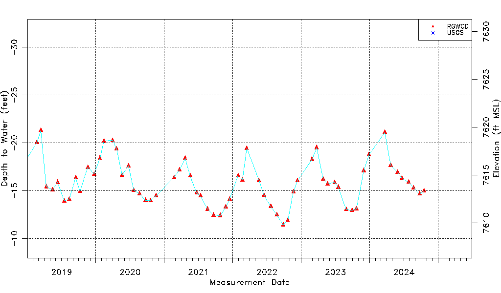
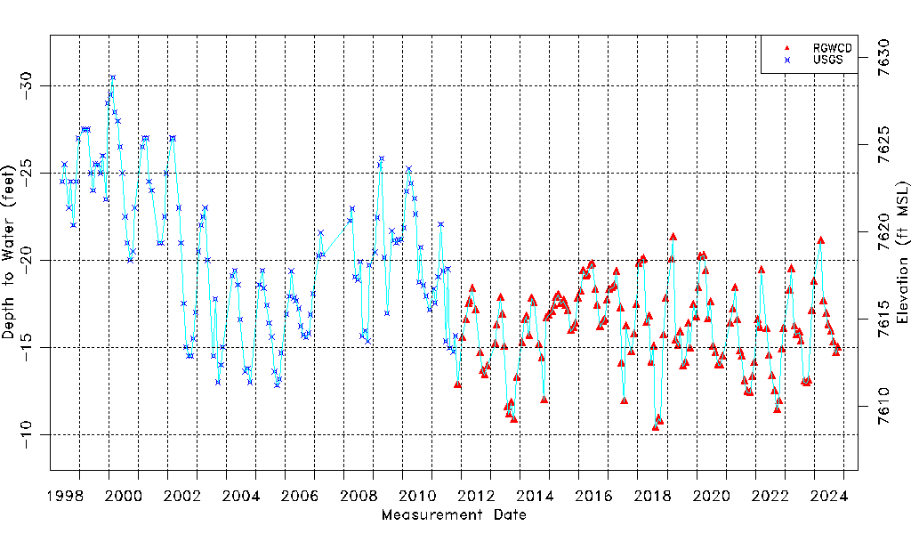
| Water-level Count | 280 |
| Water-level Date Range | 06/01/1998 thru 03/17/2026 |
| Monitored within the last 18 months | Yes, most recently on 03/17/2026 |
| Depth-to-Water Range (ft) | -30.50 to -10.38 |
| Water Table Elevation Range (ft NAVD88) | 7608.76 to 7628.88 |
| Water-Level-Source:Number-of-Measurements | RGWCD:149 USGS:131 |