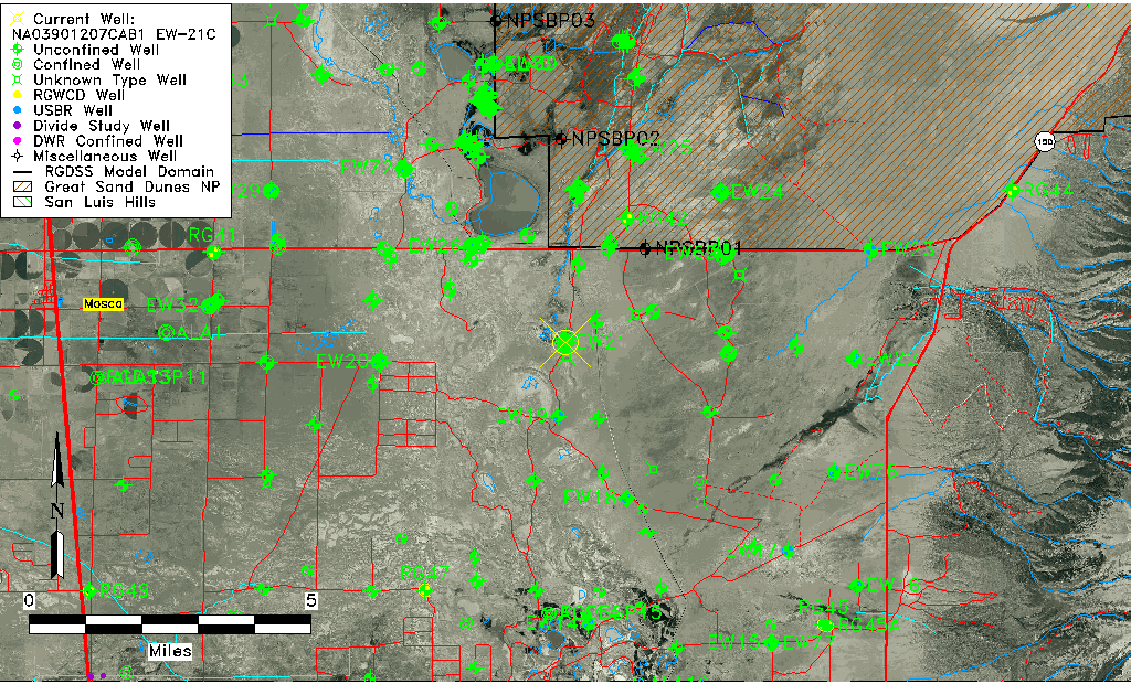
| Well Information Table |
|---|
| Common Well ID | NA03901207CAB1 EW-21C |
| USBR Well ID | EW21C |
| USGS Well ID | 373825105421501 |
| GSDNP Well Name | 373825105421501 |
| USGS Station Name | NA03901207CAB1 EW-21C |
| USGS Construction Date | 11/28/1977 |
| USGS Site Type | Well |
| USGS Site Use Information | Observation |
| USGS Groundwater Use Information | Unknown |
| Data Source(s) | USGS, USBR |
| Location Data |
|---|
| TRS | NA03901207CAB1 EW-21C |
| USBR TRS | NA03901207CAB1 |
| USGS TRS 1 | NA03901207CAB1 EW-21C |
| Longitude/Latitude (NAD83) | -105.70483617 , 37.63921620 |
| Longitude/Latitude Data Source | USBOR EW well locations |
| USGS Longitude/Latitude (NAD83) | -105.704739500 , 37.640279970 |
| USBR Longitude/Latitude (NAD27) | -105.704263337425 , 37.6392139808892 |
| Easting, Northing RGDSS-NAD83 (US ft) | 191100.05 , 234188.43 |
| USGS Topography | Valley flat |
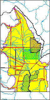
| USGS County | Alamosa County |
| USGS Map Name | MEDANO RANCH |
| USGS Map Scale | 24000 |
| Elevation and Depth Data |
|---|
| Ground Elevation (ft NAVD88) | 7528.61 |
| Elevation Data Source | USBOR EW well database |
| USBR Ground Elevation (ft NGVD29) | 7524.5 |
| USGS Ground Elevation (ft NGVD29) | 7523.60 |
| 1/3-Arc Second NED Ground Elevation (ft NAVD88) | 7528.44 |
| 1-Arc Second NED Ground Elevation (ft NAVD88) | 7527.71 |
| SRTM Ground Elevation (ft NAVD88) | 7536.33 |
| Total Depth (ft) | 198.00 |
| USBR Total Depth (ft) | 198 |
| USGS Hole Depth (ft) | 199.00 |
| USGS Well Depth (ft) | 198.00 |
| Model Layer | 2 |
| Model Layer Source | Well Depth |
| Depth of Bottom of Layer 1 | 114 |
| Depth of Bottom of Layer 2 | 456 |
| Depth of Bottom of Layer 3 | 1445 |
| Depth of Bottom of Layer 4 | 3690 |
| Additional Well Information | Logs, Construction |
| Aquifer Information |
|---|
| Aquifer Type | Confined |
| Aquifer Type Source | EW_AQFR |
| USGS Hydrologic Unit | San Luis |
| USGS Data Available | Water-level (GW.LEV) |
| Water-level Database Information |
|---|
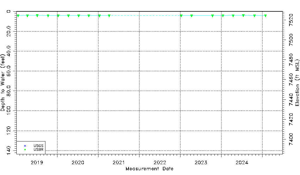
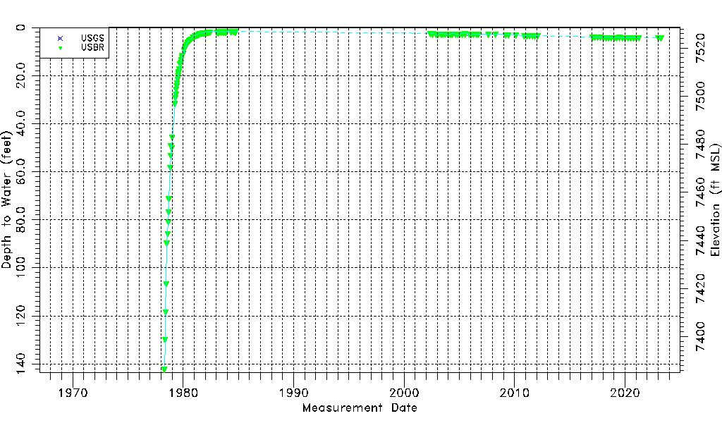
| Water-level Count | 144 |
| Water-level Date Range | 04/21/1978 thru 07/25/2025 |
| Monitored within the last 18 months | Yes, most recently on 07/25/2025 |
| Depth-to-Water Range (ft) | 1.44 to 142.16 |
| Water Table Elevation Range (ft NAVD88) | 7386.45 to 7527.17 |
| Water-Level-Source:Number-of-Measurements | USGS:6 USBR:138 |