| Well Information Table |
|---|
| Common Well ID | NA03801124CAA EW-12U |
| USBR Well ID | EW12U |
| USGS Well ID | 373830105431301 |
| USGS Station Name | NA03801124CAA EW-12U |
| USGS Construction Date | 10/23/1980 |
| USGS Site Type | Well |
| USGS Site Use Information | Observation |
| USGS Groundwater Use Information | Unused |
| Data Source(s) | USGS, Divide Study, USBR |
| Location Data |
|---|
| TRS | NA03801124CAA EW-12U |
| USBR TRS | NA03801124CAA |
| USGS TRS 1 | NA03801124CAA EW-12U |
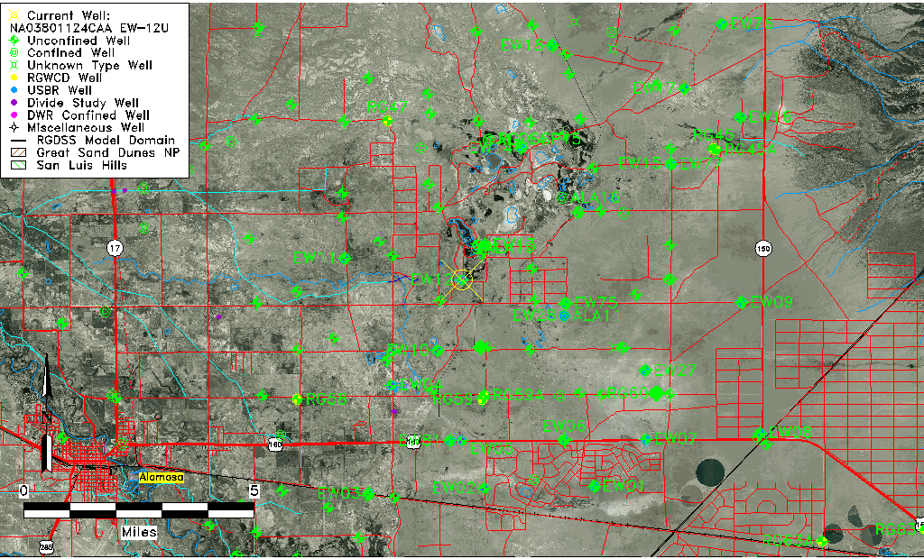
| Longitude/Latitude (NAD83) | -105.72069939 , 37.52539522 |
| Longitude/Latitude Data Source | Divide Study |
| USGS Longitude/Latitude (NAD83) | -105.721267900 , 37.525421100 |
| USBR Longitude/Latitude (NAD27) | -105.720081601729 , 37.5254064749250 |
| Easting, Northing RGDSS-NAD83 (US ft) | 186485.38 , 192758.92 |
| USGS Topography | Valley flat |
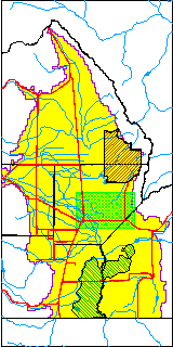
| USGS County | Saguache County |
| USGS Map Name | DRY LAKES |
| USGS Map Scale | 24000 |
| Elevation and Depth Data |
|---|
| Ground Elevation (ft NAVD88) | 7525.69 |
| Elevation Data Source | Divide study surveying by Davis Engineering |
| USBR Ground Elevation (ft NGVD29) | 7522.2 |
| USGS Ground Elevation (ft NGVD29) | 7522.20 |
| 1/3-Arc Second NED Ground Elevation (ft NAVD88) | 7524.13 |
| 1-Arc Second NED Ground Elevation (ft NAVD88) | 7524.86 |
| SRTM Ground Elevation (ft NAVD88) | 7522.25 |
| Total Depth (ft) | 31.00 |
| USBR Total Depth (ft) | 31 |
| USGS Hole Depth (ft) | 31.00 |
| USGS Well Depth (ft) | 31.00 |
| Model Layer | 1 |
| Model Layer Source | Aquifer Type |
| Depth of Bottom of Layer 1 | 38 |
| Depth of Bottom of Layer 2 | 300 |
| Depth of Bottom of Layer 3 | 835 |
| Depth of Bottom of Layer 4 | 2584 |
| Additional Well Information | Logs, Construction |
| Aquifer Information |
|---|
| Aquifer Type | Unconfined |
| Aquifer Type Source | DIV_AQ |
| USGS Hydrologic Unit | San Luis |
| USGS Data Available | Water-level (GW.LEV) |
| Water-level Database Information |
|---|
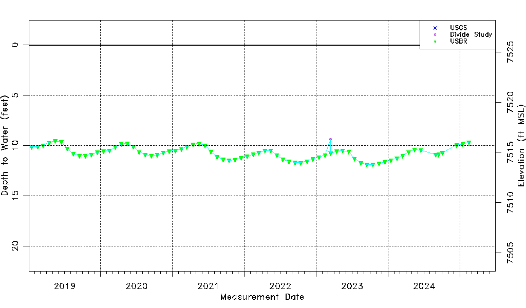
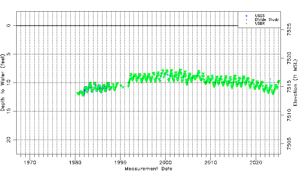
| Water-level Count | 841 |
| Water-level Date Range | 07/19/1980 thru 09/15/2025 |
| Monitored within the last 18 months | Yes, most recently on 09/15/2025 |
| Depth-to-Water Range (ft) | 7.76 to 12.27 |
| Water Table Elevation Range (ft NAVD88) | 7513.42 to 7517.93 |
| Water-Level-Source:Number-of-Measurements | USGS:345 Divide Study:11 USBR:505 |