| Well Information Table |
|---|
| Common Well ID | NA03901203BBA EW-69C |
| USBR Well ID | EW69C |
| USGS Well ID | 373946105390801 |
| GSDNP Well Name | 373946105390801 |
| USGS Station Name | NA03901203BBA EW-69C |
| USGS Construction Date | 11/21/1977 |
| USGS Site Type | Well |
| USGS Site Use Information | Observation |
| USGS Groundwater Use Information | Unused |
| Data Source(s) | USGS, USBR |
| Location Data |
|---|
| TRS | NA03901203BBA EW-69C |
| USBR TRS | NA03901203BBA |
| USGS TRS 1 | NA03901203BBA EW-69C |
| USGS TRS | NENWNWS003T0039NR0012EN |
| Longitude/Latitude (NAD83) | -105.65251984 , 37.66218385 |
| Longitude/Latitude Data Source | USBOR EW well locations |
| USGS Longitude/Latitude (NAD83) | -105.652793600 , 37.662779790 |
| USBR Longitude/Latitude (NAD27) | -105.651948508696 , 37.6621818250014 |
| Easting, Northing RGDSS-NAD83 (US ft) | 206242.50 , 242547.16 |
| USGS Topography | Valley flat |
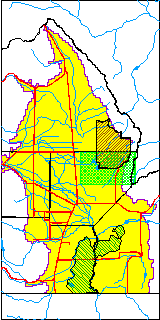
| USGS County | Alamosa County |
| USGS Map Name | MEDANO RANCH |
| USGS Map Scale | 24000 |
| Elevation and Depth Data |
|---|
| Ground Elevation (ft NAVD88) | 7588.67 |
| Elevation Data Source | USBOR EW well database |
| USBR Ground Elevation (ft NGVD29) | 7584.5 |
| USGS Ground Elevation (ft NGVD29) | 7583.40 |
| 1/3-Arc Second NED Ground Elevation (ft NAVD88) | 7590.70 |
| 1-Arc Second NED Ground Elevation (ft NAVD88) | 7588.76 |
| SRTM Ground Elevation (ft NAVD88) | 7586.21 |
| Total Depth (ft) | 143.00 |
| USBR Total Depth (ft) | 143 |
| USGS Hole Depth (ft) | 144.00 |
| USGS Well Depth (ft) | 144.00 |
| Model Layer | 2 |
| Model Layer Source | Aquifer Type |
| Depth of Bottom of Layer 1 | 171 |
| Depth of Bottom of Layer 2 | 547 |
| Depth of Bottom of Layer 3 | 1445 |
| Depth of Bottom of Layer 4 | 3781 |
| Additional Well Information | Logs, Construction |
| Aquifer Information |
|---|
| Aquifer Type | Confined |
| Aquifer Type Source | EW_AQFR |
| USGS Primary Aquifer | Tertiary System |
| USGS Aquifer Type | Confined Single Aquifer |
| USGS Hydrologic Unit | San Luis |
| USGS Data Available | Water-level (GW.LEV) |
| Water-level Database Information |
|---|
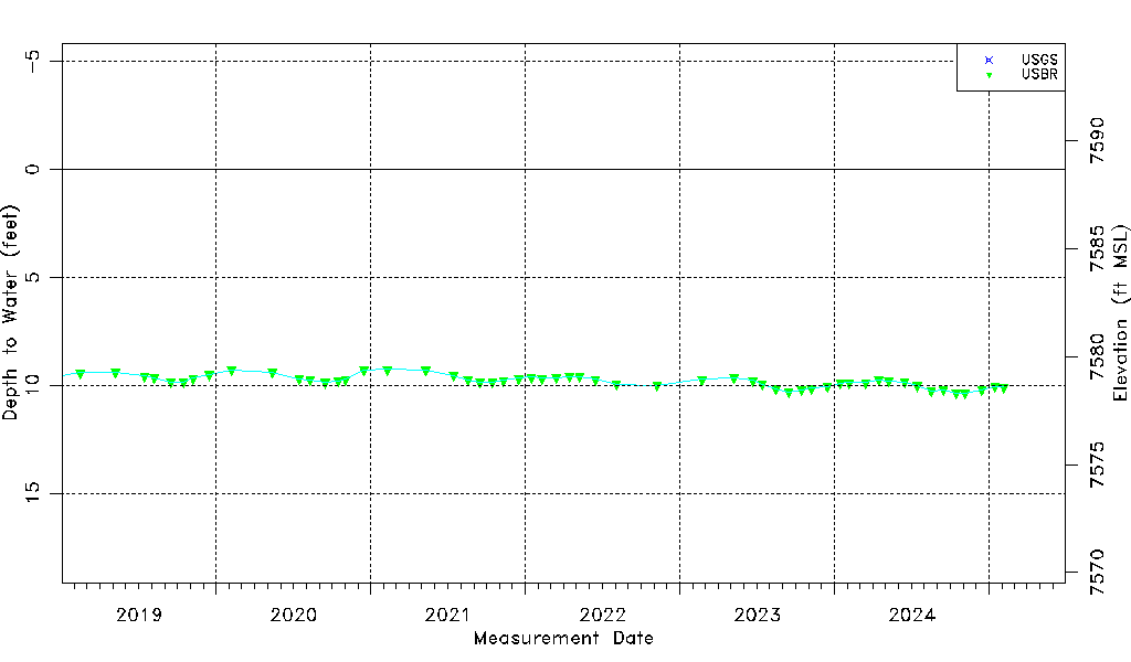
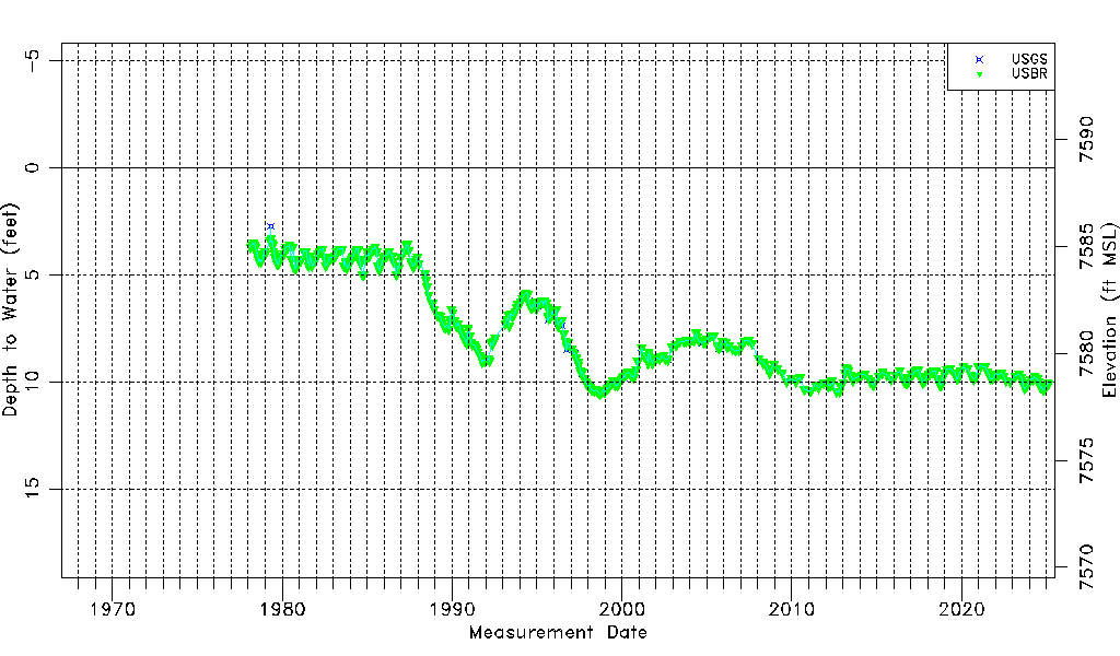
| Water-level Count | 487 |
| Water-level Date Range | 02/18/1978 thru 09/15/2025 |
| Monitored within the last 18 months | Yes, most recently on 09/15/2025 |
| Depth-to-Water Range (ft) | 2.75 to 10.68 |
| Water Table Elevation Range (ft NAVD88) | 7577.99 to 7585.92 |
| Water-Level-Source:Number-of-Measurements | USGS:24 USBR:468 |