| Well Information Table |
|---|
| Common Well ID | NA04001233AAA2 EW-24C |
| USBR Well ID | EW24C |
| USGS Well ID | 374040105392002 |
| GSDNP Well Name | 374040105392002 |
| USGS Station Name | NA04001233AAA2 EW-24C |
| USGS Construction Date | 06/23/1980 |
| USGS Site Type | Well |
| USGS Site Use Information | Observation |
| USGS Groundwater Use Information | Unused |
| Data Source(s) | USGS, USBR |
| Location Data |
|---|
| TRS | NA04001233AAA2 EW-24C |
| USBR TRS | NA04001233AAA2 |
| USGS TRS 1 | NA04001233AAA2 EW-24C |
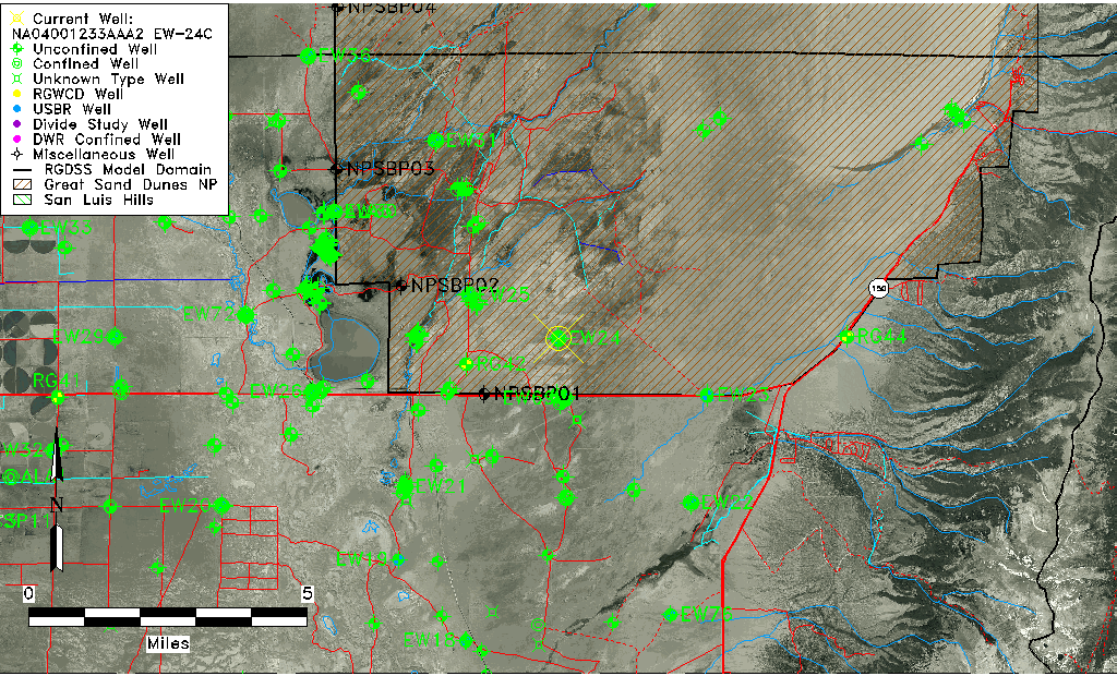
| Longitude/Latitude (NAD83) | -105.65470797 , 37.67781865 |
| Longitude/Latitude Data Source | USBOR EW well locations |
| USGS Longitude/Latitude (NAD83) | -105.656127000 , 37.677779470 |
| USBR Longitude/Latitude (NAD27) | -105.654136603703 , 37.6778169552557 |
| Easting, Northing RGDSS-NAD83 (US ft) | 205608.51 , 248238.28 |
| USGS Topography | Valley flat |
| USGS County | Alamosa County |
| USGS Map Name | MEDANO RANCH |
| USGS Map Scale | 24000 |
| Elevation and Depth Data |
|---|
| Ground Elevation (ft NAVD88) | 7589.07 |
| Elevation Data Source | USBOR EW well database |
| USBR Ground Elevation (ft NGVD29) | 7584.9 |
| USGS Ground Elevation (ft NGVD29) | 7584.90 |
| 1/3-Arc Second NED Ground Elevation (ft NAVD88) | 7588.93 |
| 1-Arc Second NED Ground Elevation (ft NAVD88) | 7587.89 |
| SRTM Ground Elevation (ft NAVD88) | 7584.96 |
| Total Depth (ft) | 169.00 |
| USBR Total Depth (ft) | 169 |
| USGS Hole Depth (ft) | 173.00 |
| USGS Well Depth (ft) | 169.00 |
| Model Layer | 2 |
| Model Layer Source | Aquifer Type |
| Depth of Bottom of Layer 1 | 188 |
| Depth of Bottom of Layer 2 | 551 |
| Depth of Bottom of Layer 3 | 1501 |
| Depth of Bottom of Layer 4 | 3896 |
| Additional Well Information | Logs, Construction |
| Aquifer Information |
|---|
| Aquifer Type | Confined |
| Aquifer Type Source | EW_AQFR |
| USGS Hydrologic Unit | San Luis |
| USGS Data Available | Water-level (GW.LEV) |
| Water-level Database Information |
|---|
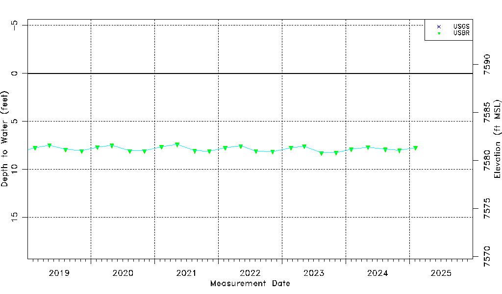
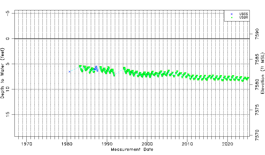
| Water-level Count | 318 |
| Water-level Date Range | 09/04/1980 thru 08/28/2025 |
| Monitored within the last 18 months | Yes, most recently on 08/28/2025 |
| Depth-to-Water Range (ft) | 5.40 to 8.48 |
| Water Table Elevation Range (ft NAVD88) | 7580.59 to 7583.67 |
| Water-Level-Source:Number-of-Measurements | USGS:192 USBR:254 |