| Well Information Table |
|---|
| Common Well ID | NA04000625CBC RG35 |
| RGWCD Well ID | RG35 |
| USGS Well ID | 374046106163801 |
| USGS Station Name | NA04000625CBC RG35 |
| USGS Site Type | Well |
| USGS Site Use Information | Unused |
| USGS Groundwater Use Information | Unused |
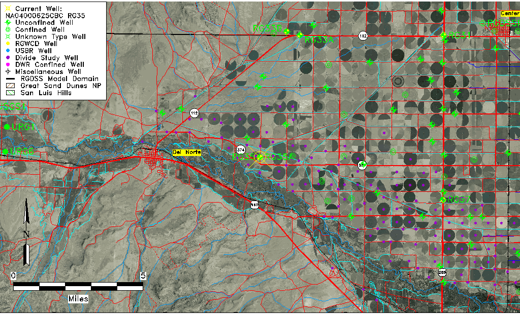
| Data Source(s) | USGS, RGWCD |
| Location Data |
|---|
| TRS | NA04000625CBC RG35 |
| RGWCD TRS | NA04000625CBC |
| USGS TRS 1 | NA04000625CBC RG35 |
| Longitude/Latitude (NAD83) | -106.27752283 , 37.67986113 |
| Longitude/Latitude Data Source | RGWCD/Davis Engineering |
| RGWCD Longitude/Latitude (NAD83) | -106:16:39.0822 , 37:40:47.50006 |
| USGS Longitude/Latitude (NAD83) | -106.277810100 , 37.679447200 |
| Easting, Northing RGDSS-NAD83 (US ft) | 25415.08 , 249555.75 |
| USGS Topography | Flat Surface |
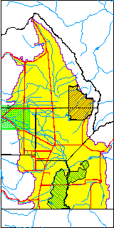
| USGS County | Rio Grande County |
| USGS Map Name | DEL NORTE |
| USGS Map Scale | 24000 |
| Elevation and Depth Data |
|---|
| Ground Elevation (ft NAVD88) | 7810.76 |
| Elevation Data Source | RGWCD well database |
| RGWCD Measuring Point Elevation (ft NAVD88) | 7811.260 |
| RGWCD Well Riser Height (ft) | 0.500 |
| RGWCD Ground Surface (ft NAVD88) | 7810.76 |
| USGS Ground Elevation (ft NGVD29) | 7807.00 |
| 1/3-Arc Second NED Ground Elevation (ft NAVD88) | 7810.85 |
| 1-Arc Second NED Ground Elevation (ft NAVD88) | 7809.81 |
| SRTM Ground Elevation (ft NAVD88) | 7823.03 |
| Total Depth (ft) | 48.00 |
| USGS Well Depth (ft) | 48.00 |
| Model Layer | 1 |
| Model Layer Source | RGWCD |
| Depth of Bottom of Layer 1 | 73 |
| Depth of Bottom of Layer 2 | 208 |
| Depth of Bottom of Layer 3 | 265 |
| Depth of Bottom of Layer 4 | 326 |
| Additional Well Information | NONE |
| Aquifer Information |
|---|
| Aquifer Type | Unconfined |
| Aquifer Type Source | RGWCD_AQ |
| USGS Hydrologic Unit | Saguache |
| USGS Data Available | Water-level (GW.LEV) |
| Water-level Database Information |
|---|
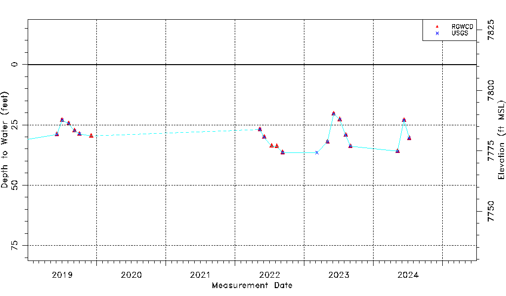
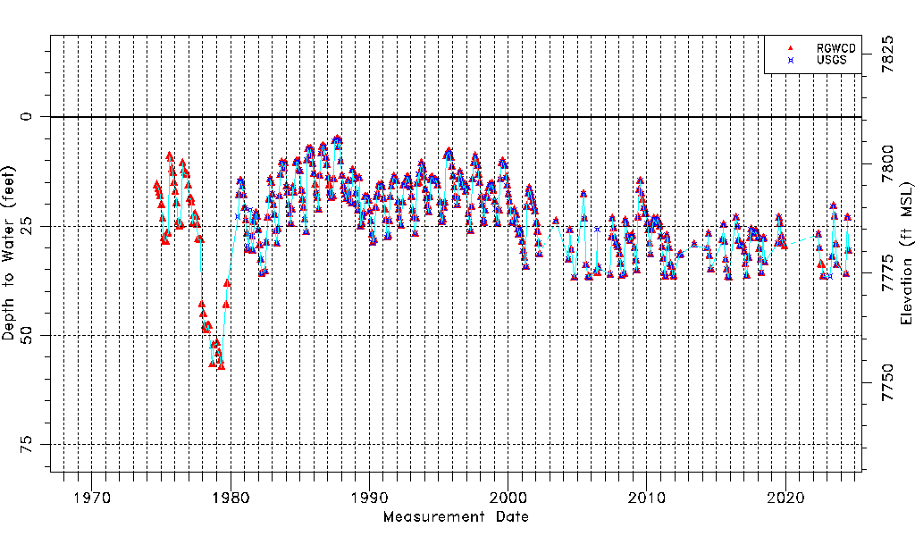
| Water-level Count | 573 |
| Water-level Date Range | 09/10/1974 thru 06/15/2026 |
| Monitored within the last 18 months | Yes, most recently on 06/15/2026 |
| Depth-to-Water Range (ft) | 5.23 to 57.32 |
| Water Table Elevation Range (ft NAVD88) | 7753.44 to 7805.53 |
| Water-Level-Source:Number-of-Measurements | RGWCD:552 USGS:376 |