| Well Information Table |
|---|
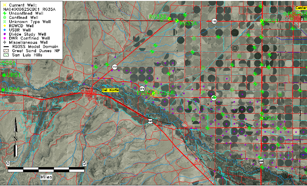
| Common Well ID | NA04000625CBC1 RG35A |
| RGWCD Well ID | RG35A |
| USGS Well ID | 374048106163901 |
| USGS Station Name | NA04000625CBC1 RG35A |
| USGS Construction Date | 04/02/2012 |
| USGS Site Type | Well |
| USGS Site Use Information | Unknown |
| USGS Groundwater Use Information | Unknown |
| Data Source(s) | USGS, RGWCD |
| Location Data |
|---|
| TRS | NA04000625CBC1 RG35A |
| RGWCD TRS | NA04000625CBC1 |
| USGS TRS 1 | NA04000625CBC1 RG35A |
| USGS TRS | NWSWS25 T40N R06E |
| Longitude/Latitude (NAD83) | -106.27752778 , 37.67984444 |
| Longitude/Latitude Data Source | RGWCD/Davis Engineering |
| RGWCD Longitude/Latitude (NAD83) | -106:16:39.10 , 37:40:47.44 |
| USGS Longitude/Latitude (NAD83) | -106.277522200 , 37.680080560 |
| Easting, Northing RGDSS-NAD83 (US ft) | 25413.61 , 249549.69 |
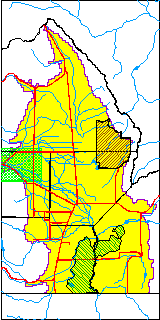
| USGS County | Rio Grande County |
| USGS Map Name | DEL NORTE, CO |
| USGS Map Scale | 24000 |
| Elevation and Depth Data |
|---|
| Ground Elevation (ft NAVD88) | 7811.09 |
| Elevation Data Source | RGWCD well database |
| RGWCD Measuring Point Elevation (ft NAVD88) | 7814.394 |
| RGWCD Well Riser Height (ft) | 3.300 |
| RGWCD Ground Surface (ft NAVD88) | 7811.09 |
| USGS Ground Elevation (ft NAVD88) | 7811.00 |
| 1/3-Arc Second NED Ground Elevation (ft NAVD88) | 7810.78 |
| 1-Arc Second NED Ground Elevation (ft NAVD88) | 7809.85 |
| SRTM Ground Elevation (ft NAVD88) | 7822.82 |
| Total Depth (ft) | 60.00 |
| USGS Hole Depth (ft) | 60.00 |
| USGS Well Depth (ft) | 60.00 |
| Model Layer | 1 |
| Model Layer Source | RGWCD |
| Depth of Bottom of Layer 1 | 74 |
| Depth of Bottom of Layer 2 | 208 |
| Depth of Bottom of Layer 3 | 265 |
| Depth of Bottom of Layer 4 | 326 |
| Additional Well Information | NONE |
| Aquifer Information |
|---|
| Aquifer Type | Unconfined |
| Aquifer Type Source | RGWCD_AQ |
| USGS Primary Aquifer | Quaternary System |
| USGS Aquifer Type | Unconfined Single Aquifer |
| USGS Hydrologic Unit | San Luis |
| USGS Data Available | Discharge (GW.DISC) |
| Water-level Database Information |
|---|
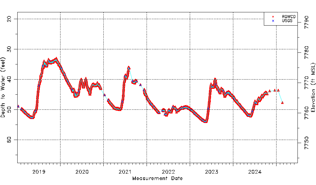
| Water-level Count | 3955 |
| Water-level Date Range | 07/09/2012 thru 06/15/2026 |
| Monitored within the last 18 months | Yes, most recently on 06/15/2026 |
| Depth-to-Water Range (ft) | 29.57 to 55.78 |
| Water Table Elevation Range (ft NAVD88) | 7755.31 to 7781.52 |
| Water-Level-Source:Number-of-Measurements | RGWCD:3946 USGS:106 |