| Well Information Table |
|---|
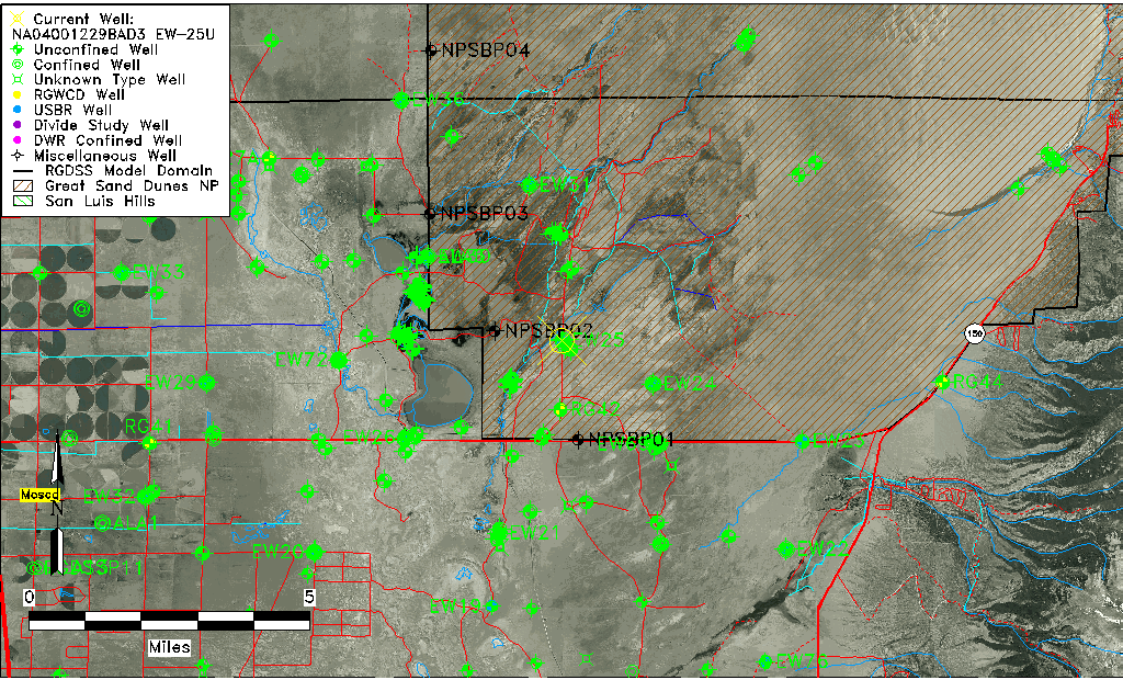
| Common Well ID | NA04001229BAD3 EW-25U |
| USBR Well ID | EW25U |
| USGS Well ID | 374122105410002 |
| GSDNP Well Name | 374122105410002 |
| USGS Station Name | NA04001229BAD3 EW-25U |
| USGS Construction Date | 10/09/1980 |
| USGS Site Type | Well |
| USGS Site Use Information | Observation |
| USGS Groundwater Use Information | Unused |
| Data Source(s) | USGS, USBR |
| Location Data |
|---|
| TRS | NA04001229BAD3 EW-25U |
| USBR TRS | NA04001229BAD3 |
| USGS TRS 1 | NA04001229BAD3 EW-25U |
| Longitude/Latitude (NAD83) | -105.68442442 , 37.68906321 |
| Longitude/Latitude Data Source | USBOR EW well locations |
| USGS Longitude/Latitude (NAD83) | -105.683905500 , 37.689445750 |
| USBR Longitude/Latitude (NAD27) | -105.683852253609 , 37.6890619006176 |
| Easting, Northing RGDSS-NAD83 (US ft) | 197011.79 , 252331.62 |
| USGS Topography | Valley flat |
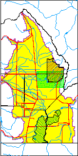
| USGS County | Alamosa County |
| USGS Map Name | MEDANO RANCH |
| USGS Map Scale | 24000 |
| Elevation and Depth Data |
|---|
| Ground Elevation (ft NAVD88) | 7540.84 |
| Elevation Data Source | USBOR EW well database |
| USBR Ground Elevation (ft NGVD29) | 7536.7 |
| USGS Ground Elevation (ft NGVD29) | 7537.10 |
| 1/3-Arc Second NED Ground Elevation (ft NAVD88) | 7541.46 |
| 1-Arc Second NED Ground Elevation (ft NAVD88) | 7540.22 |
| SRTM Ground Elevation (ft NAVD88) | 7557.00 |
| Total Depth (ft) | 31.00 |
| USBR Total Depth (ft) | 31 |
| USGS Hole Depth (ft) | 31.00 |
| USGS Well Depth (ft) | 29.00 |
| Model Layer | 1 |
| Model Layer Source | Aquifer Type |
| Depth of Bottom of Layer 1 | 183 |
| Depth of Bottom of Layer 2 | 501 |
| Depth of Bottom of Layer 3 | 1652 |
| Depth of Bottom of Layer 4 | 4269 |
| Additional Well Information | Logs, Construction |
| Aquifer Information |
|---|
| Aquifer Type | Unconfined |
| Aquifer Type Source | EW_AQFR |
| USGS Hydrologic Unit | San Luis |
| USGS Data Available | Water-level (GW.LEV) |
| Water-level Database Information |
|---|
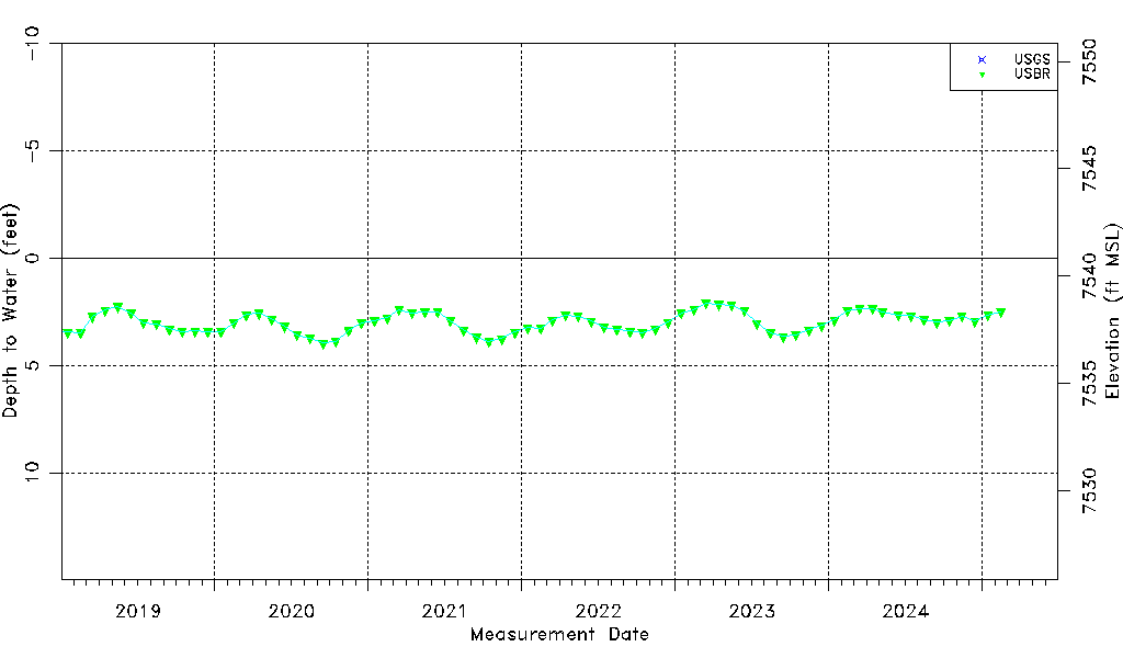
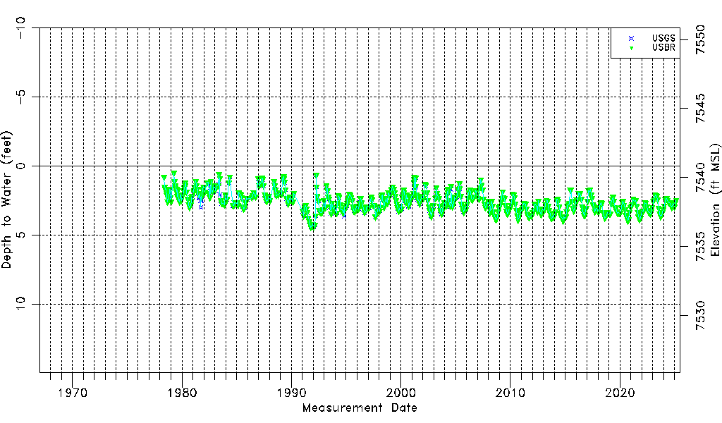
| Water-level Count | 628 |
| Water-level Date Range | 05/12/1978 thru 09/17/2025 |
| Monitored within the last 18 months | Yes, most recently on 09/17/2025 |
| Depth-to-Water Range (ft) | 0.50 to 4.44 |
| Water Table Elevation Range (ft NAVD88) | 7536.40 to 7540.34 |
| Water-Level-Source:Number-of-Measurements | USGS:304 USBR:585 |