| Well Information Table |
|---|
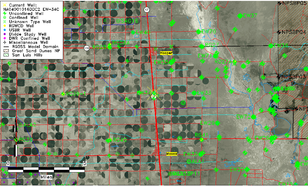
| Common Well ID | NA04001016DDC2 EW-34C |
| USBR Well ID | EW34C |
| USGS Well ID | 374223105522902 |
| USGS Station Name | NA04001016DDC2 EW-34C |
| USGS Construction Date | 09/05/1982 |
| USGS Site Type | Well |
| USGS Site Use Information | Observation |
| USGS Groundwater Use Information | Unknown |
| Data Source(s) | USGS, USBR |
| Location Data |
|---|
| TRS | NA04001016DDC2 EW-34C |
| USBR TRS | NA04001016DDC1 |
| USGS TRS 1 | NA04001016DDC2 EW-34C |
| Longitude/Latitude (NAD83) | -105.87541547 , 37.70632272 |
| Longitude/Latitude Data Source | USBOR EW well locations |
| USGS Longitude/Latitude (NAD83) | -105.875298900 , 37.706389300 |
| USBR Longitude/Latitude (NAD27) | -105.874838810660 , 37.7063223078899 |
| Easting, Northing RGDSS-NAD83 (US ft) | 141776.43 , 258680.78 |
| USGS Topography | Valley flat |
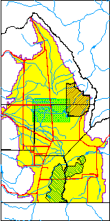
| USGS County | Alamosa County |
| USGS Map Name | HOOPER EAST |
| USGS Map Scale | 24000 |
| Elevation and Depth Data |
|---|
| Ground Elevation (ft NAVD88) | 7555.86 |
| Elevation Data Source | USBOR EW well database |
| USBR Ground Elevation (ft NGVD29) | 7552.0 |
| USGS Ground Elevation (ft NGVD29) | 7552.00 |
| 1/3-Arc Second NED Ground Elevation (ft NAVD88) | 7558.11 |
| 1-Arc Second NED Ground Elevation (ft NAVD88) | 7555.95 |
| SRTM Ground Elevation (ft NAVD88) | 7567.31 |
| Total Depth (ft) | 150.00 |
| USBR Total Depth (ft) | 150 |
| USGS Hole Depth (ft) | 130.00 |
| USGS Well Depth (ft) | 113.00 |
| Model Layer | 2 |
| Model Layer Source | Well Depth |
| Depth of Bottom of Layer 1 | 78 |
| Depth of Bottom of Layer 2 | 253 |
| Depth of Bottom of Layer 3 | 1218 |
| Depth of Bottom of Layer 4 | 2250 |
| Additional Well Information | Logs, Construction |
| Aquifer Information |
|---|
| Aquifer Type | Confined |
| Aquifer Type Source | EW_AQFR |
| USGS Hydrologic Unit | San Luis |
| USGS Data Available | Water-level (GW.LEV) |
| Water-level Database Information |
|---|
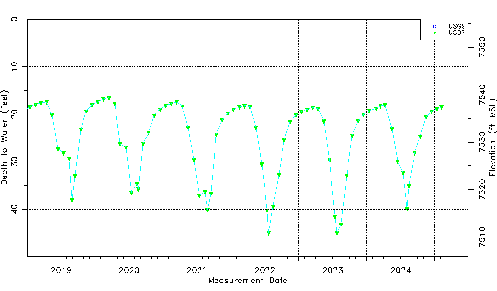
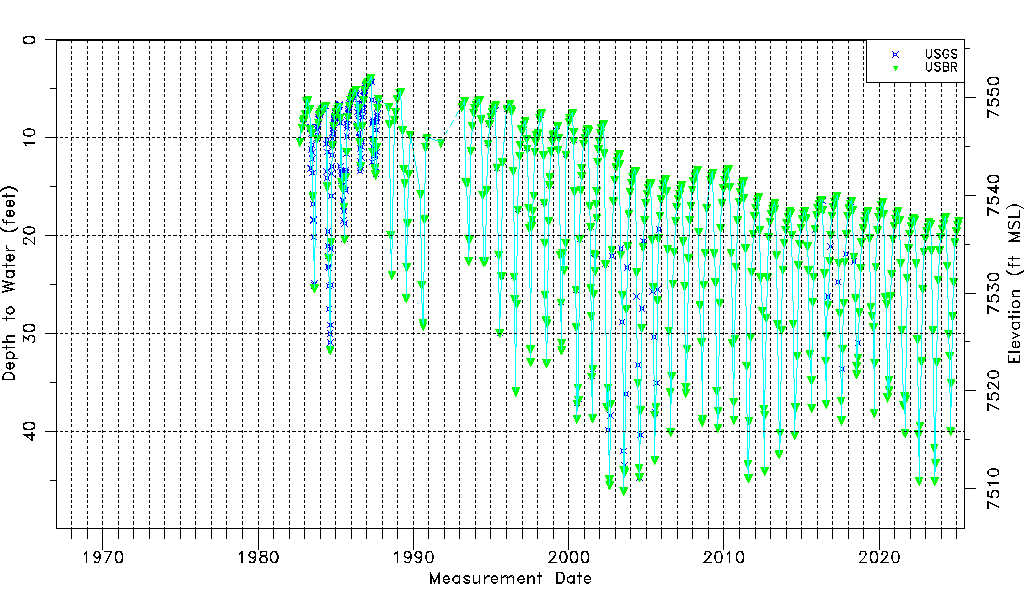
| Water-level Count | 842 |
| Water-level Date Range | 09/11/1982 thru 09/15/2025 |
| Monitored within the last 18 months | Yes, most recently on 09/15/2025 |
| Depth-to-Water Range (ft) | 3.79 to 46.03 |
| Water Table Elevation Range (ft NAVD88) | 7509.83 to 7552.07 |
| Water-Level-Source:Number-of-Measurements | USGS:326 USBR:534 |