| Well Information Table |
|---|
| Common Well ID | NA04001115CCC1 |
| USGS Well ID | 374234105454301 |
| GSDNP Well Name | 374234105454301 |
| USGS Station Name | NA04001115CCC1 |
| USGS Site Type | Well |
| USGS Site Use Information | Observation |
| USGS Groundwater Use Information | Unused |
| Data Source(s) | USGS |
| Location Data |
|---|
| TRS | NA04001115CCC1 |
| USGS TRS 1 | NA04001115CCC1 |
| Longitude/Latitude (NAD83) | -105.76251870 , 37.70944497 |
| Longitude/Latitude Data Source | GWSI decimal LAT/LONG field |
| USGS Longitude/Latitude (NAD83) | -105.762518700 , 37.709444970 |
| Easting, Northing RGDSS-NAD83 (US ft) | 174428.63 , 259764.42 |
| USGS Topography | Valley flat |
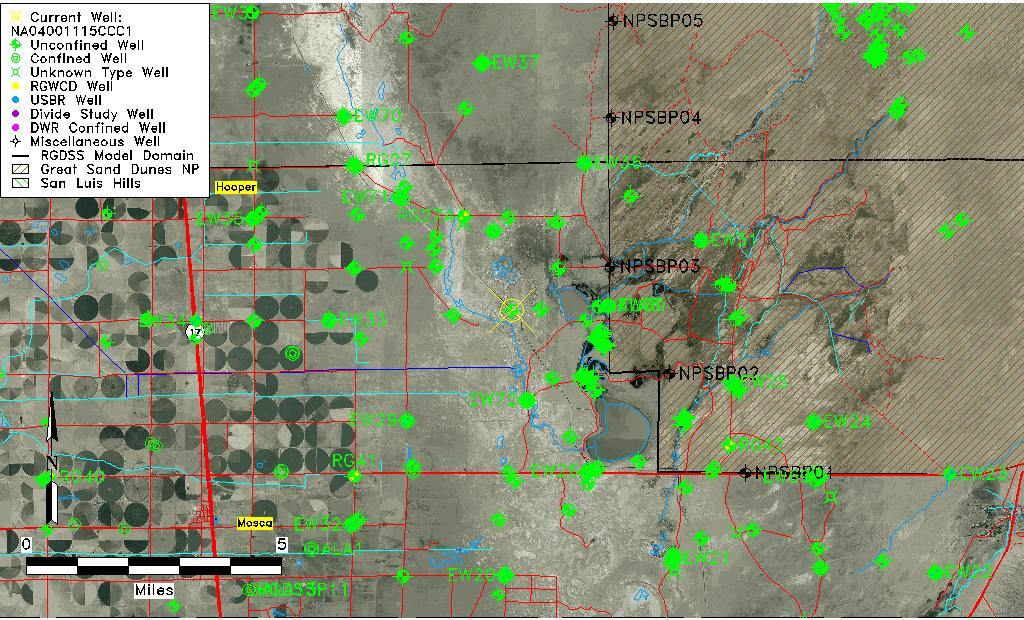
| USGS County | Alamosa County |
| USGS Map Name | HOOPER E. |
| USGS Map Scale | 24000 |
| Elevation and Depth Data |
|---|
| Ground Elevation (ft NAVD88) | 7524.00 |
| Elevation Data Source | USGS GWSI database |
| USGS Ground Elevation (ft NGVD29) | 7520.00 |
| 1/3-Arc Second NED Ground Elevation (ft NAVD88) | 7531.66 |
| 1-Arc Second NED Ground Elevation (ft NAVD88) | 7534.00 |
| SRTM Ground Elevation (ft NAVD88) | 7539.36 |
| Total Depth (ft) | 40.00 |
| USGS Well Depth (ft) | 40.00 |
| Model Layer | 1 |
| Model Layer Source | Well Depth |
| Depth of Bottom of Layer 1 | 114 |
| Depth of Bottom of Layer 2 | 372 |
| Depth of Bottom of Layer 3 | 1574 |
| Depth of Bottom of Layer 4 | 2742 |
| Additional Well Information | Construction |
| Aquifer Information |
|---|
| Aquifer Type | Unconfined |
| Aquifer Type Source | TD Elevation/Model Layer |
| USGS Aquifer Type | Unconfined Single Aquifer |
| USGS Hydrologic Unit | San Luis |
| USGS Data Available | Miscellaneous (GW.MISC) |
| Water-level Database Information |
|---|
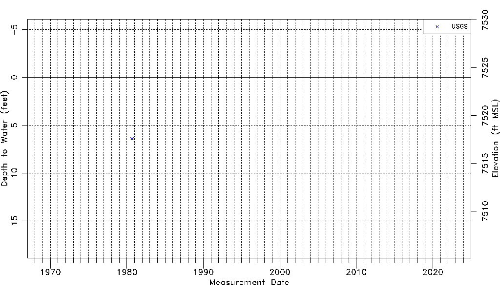
| Water-level Count | 1 |
| Water-level Date Range | 09/11/1980 thru 09/11/1980 |
| Monitored within the last 18 months | No, most recently on 09/11/1980 |
| Depth-to-Water Range (ft) | 6.40 to 6.40 |
| Water Table Elevation Range (ft NAVD88) | 7517.60 to 7517.60 |
| Water-Level-Source:Number-of-Measurements | USGS:1 |