| Well Information Table |
|---|
| Common Well ID | NA04000814AAA5 |
| USGS Well ID | 374310106032405 |
| USGS Station Name | NA04000814AAA5 |
| USGS Construction Date | 11/06/2006 |
| USGS Site Type | Well |
| USGS Site Use Information | Unknown |
| USGS Groundwater Use Information | Unknown |
| Data Source(s) | USGS |
| Location Data |
|---|
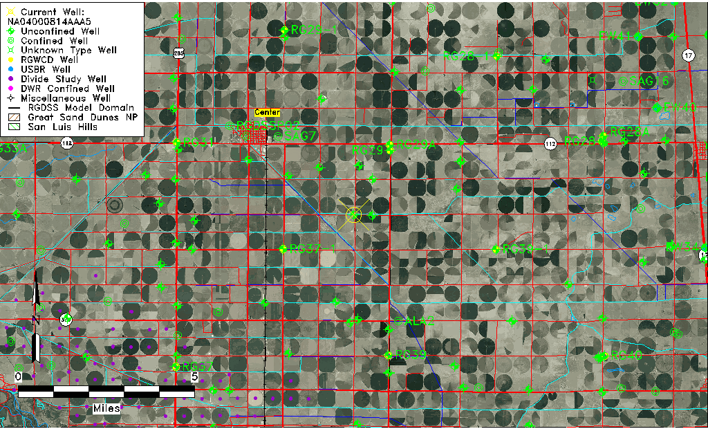
| TRS | NA04000814AAA5 |
| USGS TRS 1 | NA04000814AAA5 |
| USGS TRS | NENENES14 T40N R8E N |
| Longitude/Latitude (NAD83) | -106.05706940 , 37.71927220 |
| Longitude/Latitude Data Source | GWSI decimal LAT/LONG field |
| USGS Longitude/Latitude (NAD83) | -106.057069400 , 37.719272200 |
| Easting, Northing RGDSS-NAD83 (US ft) | 89258.52 , 263562.56 |
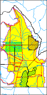
| USGS County | Rio Grande County |
| USGS Map Name | CENTER SOUTH |
| USGS Map Scale | 24000 |
| Elevation and Depth Data |
|---|
| Ground Elevation (ft NAVD88) | 7627.00 |
| Elevation Data Source | USGS GWSI database |
| USGS Ground Elevation (ft NAVD88) | 7627.00 |
| 1/3-Arc Second NED Ground Elevation (ft NAVD88) | 7621.72 |
| 1-Arc Second NED Ground Elevation (ft NAVD88) | 7622.11 |
| SRTM Ground Elevation (ft NAVD88) | 7625.59 |
| Total Depth (ft) | 35.83 |
| USGS Hole Depth (ft) | 41.00 |
| USGS Well Depth (ft) | 35.83 |
| Model Layer | 1 |
| Model Layer Source | Well Depth |
| Depth of Bottom of Layer 1 | 117 |
| Depth of Bottom of Layer 2 | 197 |
| Depth of Bottom of Layer 3 | 751 |
| Depth of Bottom of Layer 4 | 2387 |
| Additional Well Information | NONE |
| Aquifer Information |
|---|
| Aquifer Type | Unconfined |
| Aquifer Type Source | TD Elevation/Model Layer |
| USGS Primary Aquifer | 112ALMS |
| USGS Hydrologic Unit | San Luis |
| USGS Data Available | Geohydrologic |
| Water-level Database Information |
|---|
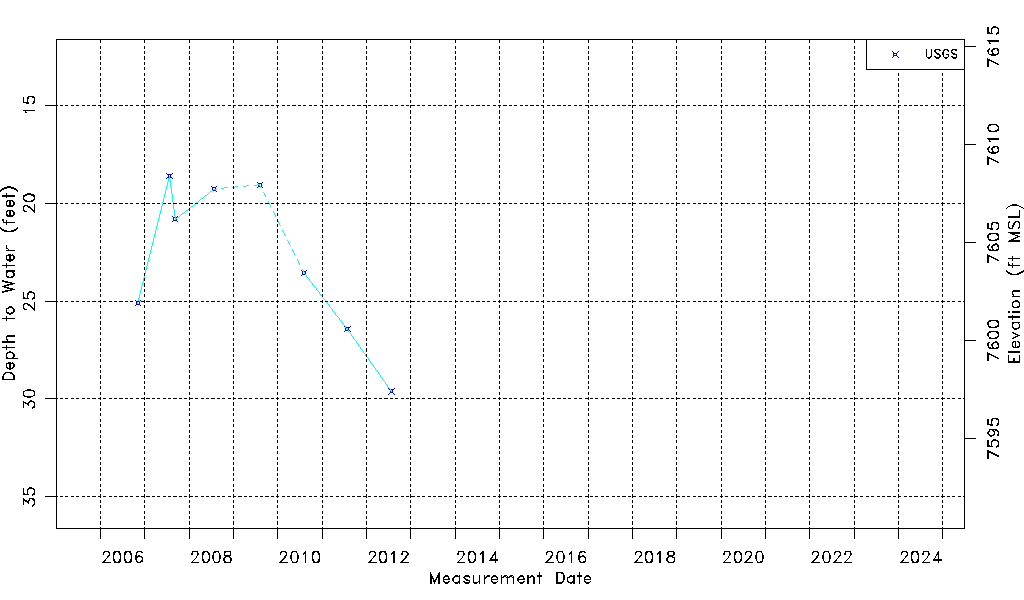
| Water-level Count | 8 |
| Water-level Date Range | 11/06/2006 thru 07/27/2012 |
| Monitored within the last 18 months | No, most recently on 07/27/2012 |
| Depth-to-Water Range (ft) | 18.62 to 29.61 |
| Water Table Elevation Range (ft NAVD88) | 7597.39 to 7608.38 |
| Water-Level-Source:Number-of-Measurements | USGS:8 |