| Well Information Table |
|---|
| Common Well ID | NA04001207ADC2 EW-31C |
| USBR Well ID | EW31C |
| USGS Well ID | 374345105414002 |
| GSDNP Well Name | 374345105414002 |
| USGS Station Name | NA04001207ADC2 EW-31C |
| USGS Construction Date | 09/04/1982 |
| USGS Site Type | Well |
| USGS Site Use Information | Observation |
| USGS Groundwater Use Information | Unknown |
| Data Source(s) | USGS, USBR |
| Location Data |
|---|
| TRS | NA04001207ADC2 EW-31C |
| USBR TRS | NA04001207ADC2 |
| USGS TRS 1 | NA04001207ADC2 EW-31C |
| Longitude/Latitude (NAD83) | -105.69493192 , 37.72927722 |
| Longitude/Latitude Data Source | USBOR EW well locations |
| USGS Longitude/Latitude (NAD83) | -105.695016800 , 37.729167100 |
| USBR Longitude/Latitude (NAD27) | -105.694359529708 , 37.7292767843257 |
| Easting, Northing RGDSS-NAD83 (US ft) | 193976.60 , 266970.80 |
| USGS Topography | Valley flat |
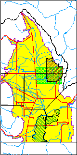
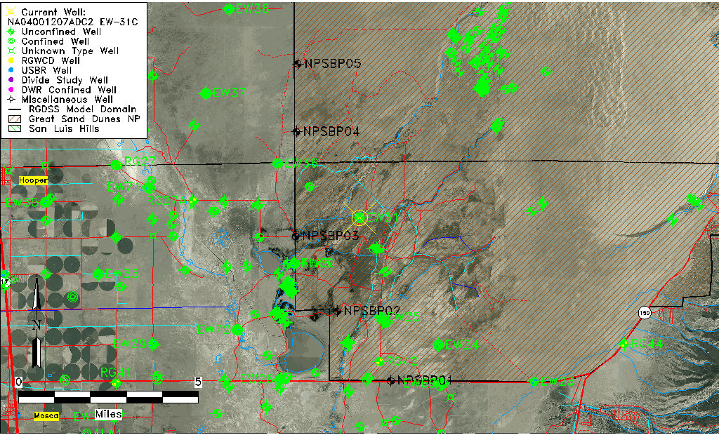
| USGS County | Alamosa County |
| USGS Map Name | MEDANO RANCH |
| USGS Map Scale | 24000 |
| Elevation and Depth Data |
|---|
| Ground Elevation (ft NAVD88) | 7558.46 |
| Elevation Data Source | USBOR EW well database |
| USBR Ground Elevation (ft NGVD29) | 7554.3 |
| USGS Ground Elevation (ft NGVD29) | 7554.30 |
| 1/3-Arc Second NED Ground Elevation (ft NAVD88) | 7558.75 |
| 1-Arc Second NED Ground Elevation (ft NAVD88) | 7557.20 |
| SRTM Ground Elevation (ft NAVD88) | 7562.65 |
| Total Depth (ft) | 139.00 |
| USBR Total Depth (ft) | 139 |
| USGS Hole Depth (ft) | 150.00 |
| USGS Well Depth (ft) | 135.00 |
| Model Layer | 2 |
| Model Layer Source | Aquifer Type |
| Depth of Bottom of Layer 1 | 142 |
| Depth of Bottom of Layer 2 | 464 |
| Depth of Bottom of Layer 3 | 1530 |
| Depth of Bottom of Layer 4 | 3487 |
| Additional Well Information | Logs, Construction |
| Aquifer Information |
|---|
| Aquifer Type | Confined |
| Aquifer Type Source | EW_AQFR |
| USGS Hydrologic Unit | San Luis |
| USGS Data Available | Water-level (GW.LEV) |
| Water-level Database Information |
|---|
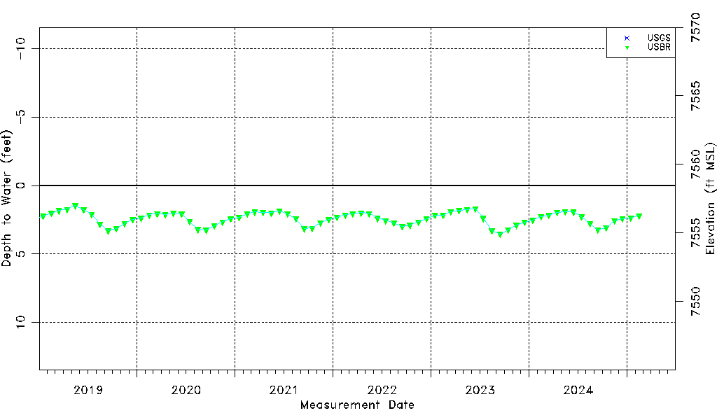
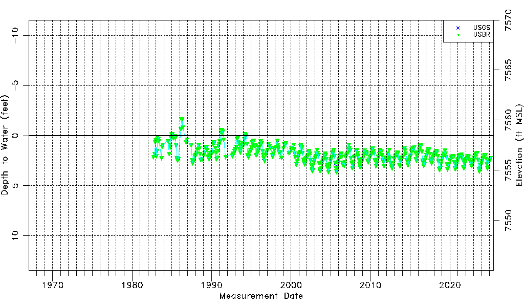
| Water-level Count | 482 |
| Water-level Date Range | 09/11/1982 thru 09/17/2025 |
| Monitored within the last 18 months | Yes, most recently on 09/17/2025 |
| Depth-to-Water Range (ft) | -1.69 to 3.60 |
| Water Table Elevation Range (ft NAVD88) | 7554.86 to 7560.15 |
| Water-Level-Source:Number-of-Measurements | USGS:26 USBR:473 |