| Well Information Table |
|---|
| Common Well ID | SC02707303ABB |
| USGS Well ID | 374410105312701 |
| GSDNP Well Name | 374410105312701 |
| USGS Station Name | SC02707303ABB |
| USGS Site Type | Well |
| USGS Site Use Information | Observation |
| USGS Groundwater Use Information | Unused |
| Data Source(s) | USGS, HRS |
| Location Data |
|---|
| TRS | SC02707303ABB |
| USGS TRS 1 | SC02707303ABB |
| USGS TRS | NWNWNES003T0027SR0073W |
| Longitude/Latitude (NAD83) | -105.52462830 , 37.73618034 |
| Longitude/Latitude Data Source | Davis Engineering Survey |
| USGS Longitude/Latitude (NAD83) | -105.524734300 , 37.736112300 |
| HRS Longitude/Latitude (UTM-N13) | -105.52417 , 37.73611 |
| Easting, Northing RGDSS-NAD83 (US ft) | 243210.00 , 269513.60 |
| USGS Topography | Dunes |
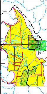
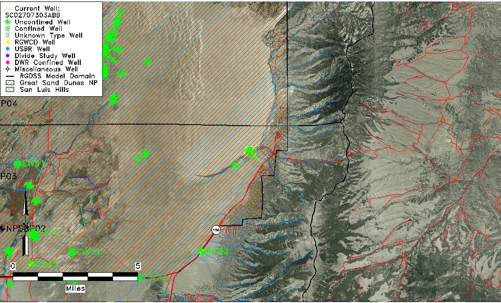
| USGS County | Alamosa County |
| USGS Map Name | ZAPATA RANCH |
| USGS Map Scale | 240000 |
| Elevation and Depth Data |
|---|
| Ground Elevation (ft NAVD88) | 8027.92 |
| Elevation Data Source | Davis Engineering Survey |
| USGS Ground Elevation (ft NGVD29) | 8019.06 |
| GRSA Dunes Well database (ft NGVD29) | 8019.06 |
| HRS Dunes Well database (ft NGVD29) | 8019.06006 |
| 1/3-Arc Second NED Ground Elevation (ft NAVD88) | 8013.77 |
| 1-Arc Second NED Ground Elevation (ft NAVD88) | 8018.41 |
| SRTM Ground Elevation (ft NAVD88) | 8009.69 |
| Total Depth (ft) | 13.00 |
| Depth to Top of Screen (ft) | 8.0 |
| Depth to Bottom of Screen (ft) | 13.00 |
| USGS Hole Depth (ft) | 13.00 |
| USGS Well Depth (ft) | 13.00 |
| Model Layer | 1 |
| Model Layer Source | Aquifer Type |
| Depth of Bottom of Layer 1 | 509 |
| Depth of Bottom of Layer 2 | 978 |
| Depth of Bottom of Layer 3 | 1136 |
| Depth of Bottom of Layer 4 | 1285 |
| Additional Well Information | Construction |
| Aquifer Information |
|---|
| Aquifer Type | Unconfined |
| Aquifer Type Source | GRSA_AQUFR |
| USGS Aquifer Type | Unconfined Single Aquifer |
| USGS Hydrologic Unit | San Luis |
| USGS Data Available | Water-level (GW.LEV) |
| Water-level Database Information |
|---|
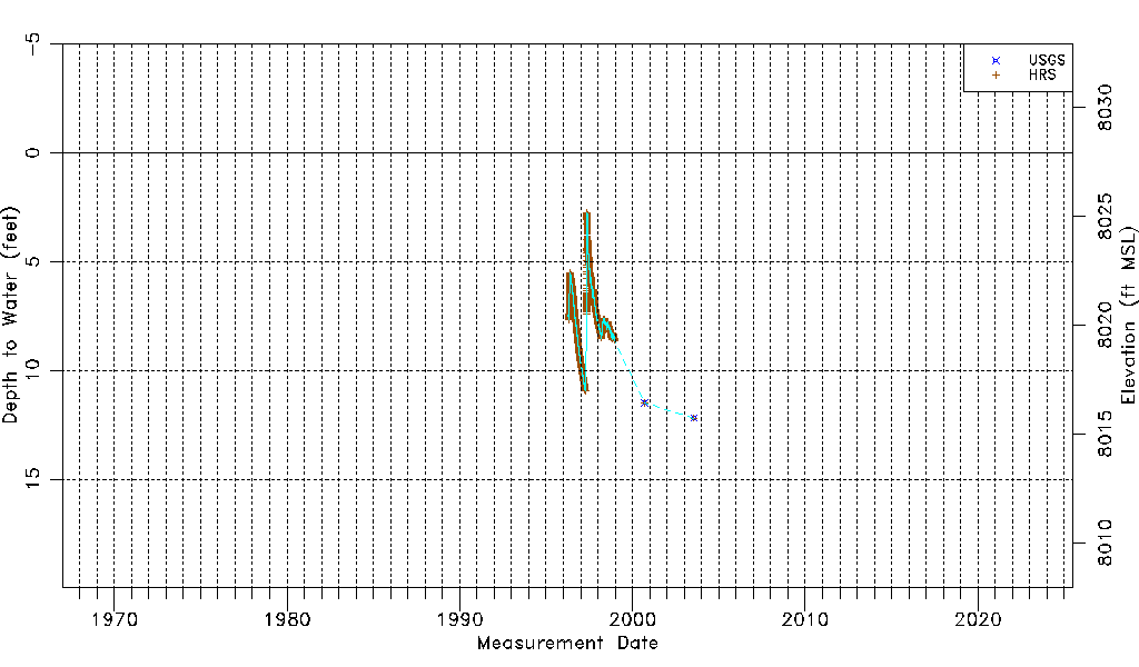
| Water-level Count | 3555 |
| Water-level Date Range | 04/15/1996 thru 07/19/2003 |
| Monitored within the last 18 months | No, most recently on 07/19/2003 |
| Depth-to-Water Range (ft) | 2.75 to 12.20 |
| Water Table Elevation Range (ft NAVD88) | 8015.72 to 8025.17 |
| Water-Level-Source:Number-of-Measurements | USGS:2 HRS:3553 |