| Well Information Table |
|---|
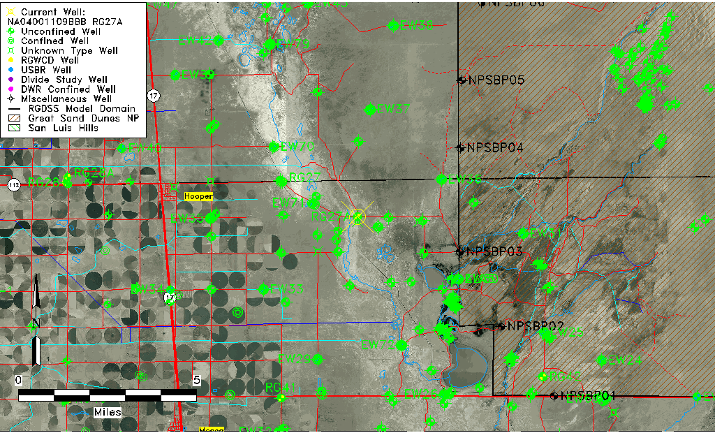
| Common Well ID | NA04001109BBB RG27A |
| RGWCD Well ID | RG27A |
| USGS Well ID | 374410105464701 |
| GSDNP Well Name | RG27A |
| USGS Station Name | NA04001109BBB RG27A |
| USGS Construction Date | 01/01/1946 |
| USGS Site Type | Well |
| USGS Site Use Information | Observation |
| USGS Groundwater Use Information | Unused |
| Data Source(s) | USGS, RGWCD |
| Location Data |
|---|
| TRS | NA04001109BBB RG27A |
| RGWCD TRS | NA04001109BBB |
| USGS TRS 1 | NA04001109BBB RG27A |
| USGS TRS | NWNWNWS009T0040NR0009ES |
| Longitude/Latitude (NAD83) | -105.77975000 , 37.73608333 |
| Longitude/Latitude Data Source | RGWCD/Davis Engineering |
| RGWCD Longitude/Latitude (NAD83) | -105:46:47.10 , 37:44:09.90 |
| USGS Longitude/Latitude (NAD83) | -105.780296800 , 37.736111090 |
| Easting, Northing RGDSS-NAD83 (US ft) | 169457.06 , 269466.83 |
| USGS Topography | Valley flat |
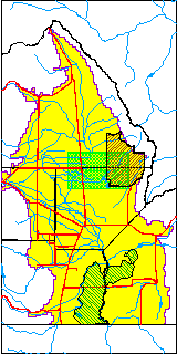
| USGS County | Alamosa County |
| USGS Map Name | HOOPER EAST |
| USGS Map Scale | 24000 |
| Elevation and Depth Data |
|---|
| Ground Elevation (ft NAVD88) | 7533.20 |
| Elevation Data Source | RGWCD well database |
| RGWCD Measuring Point Elevation (ft NAVD88) | 7533.700 |
| RGWCD Well Riser Height (ft) | 0.500 |
| RGWCD Ground Surface (ft NAVD88) | 7533.20 |
| USGS Ground Elevation (ft NGVD29) | 7533.74 |
| 1/3-Arc Second NED Ground Elevation (ft NAVD88) | 7534.34 |
| 1-Arc Second NED Ground Elevation (ft NAVD88) | 7536.92 |
| SRTM Ground Elevation (ft NAVD88) | 7546.23 |
| Total Depth (ft) | 75.30 |
| USGS Well Depth (ft) | 194.00 |
| Model Layer | 1 |
| Model Layer Source | RGWCD |
| Depth of Bottom of Layer 1 | 106 |
| Depth of Bottom of Layer 2 | 344 |
| Depth of Bottom of Layer 3 | 1572 |
| Depth of Bottom of Layer 4 | 2730 |
| Additional Well Information | Logs, Construction |
| Aquifer Information |
|---|
| Aquifer Type | Unconfined |
| Aquifer Type Source | RGWCD_AQ |
| USGS Hydrologic Unit | San Luis |
| USGS Data Available | Water-level (GW.LEV) |
| Water-level Database Information |
|---|
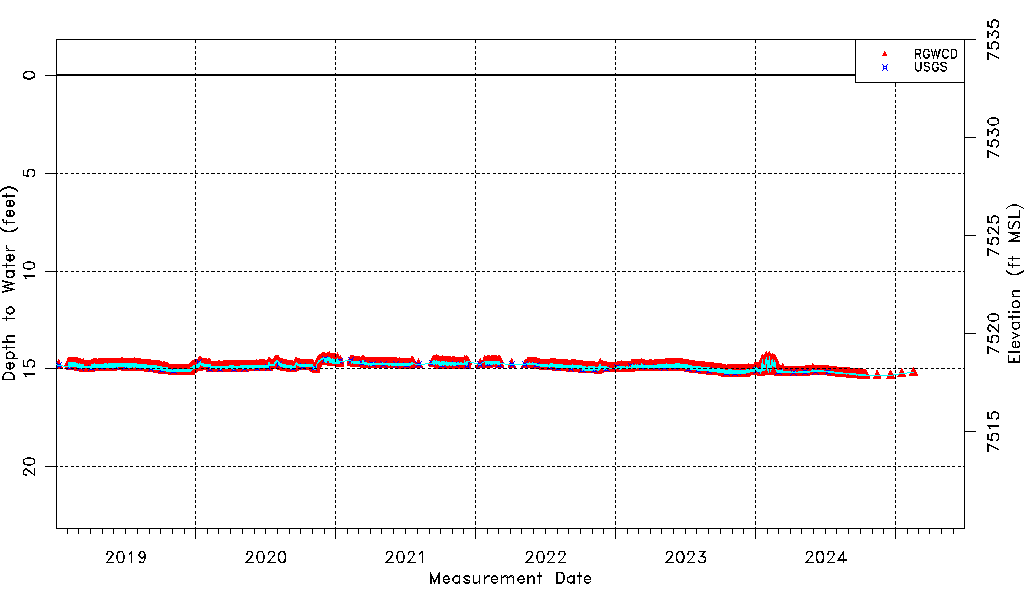
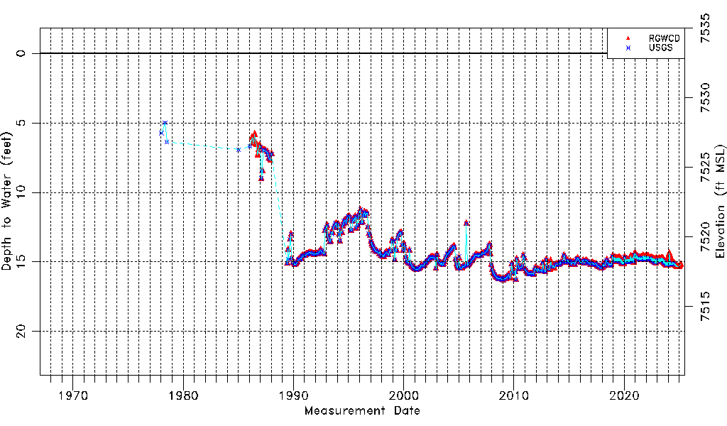
| Water-level Count | 4236 |
| Water-level Date Range | 01/10/1978 thru 07/01/2026 |
| Monitored within the last 18 months | Yes, most recently on 07/01/2026 |
| Depth-to-Water Range (ft) | 5.00 to 16.30 |
| Water Table Elevation Range (ft NAVD88) | 7516.90 to 7528.20 |
| Water-Level-Source:Number-of-Measurements | RGWCD:4217 USGS:425 |