| Well Information Table |
|---|
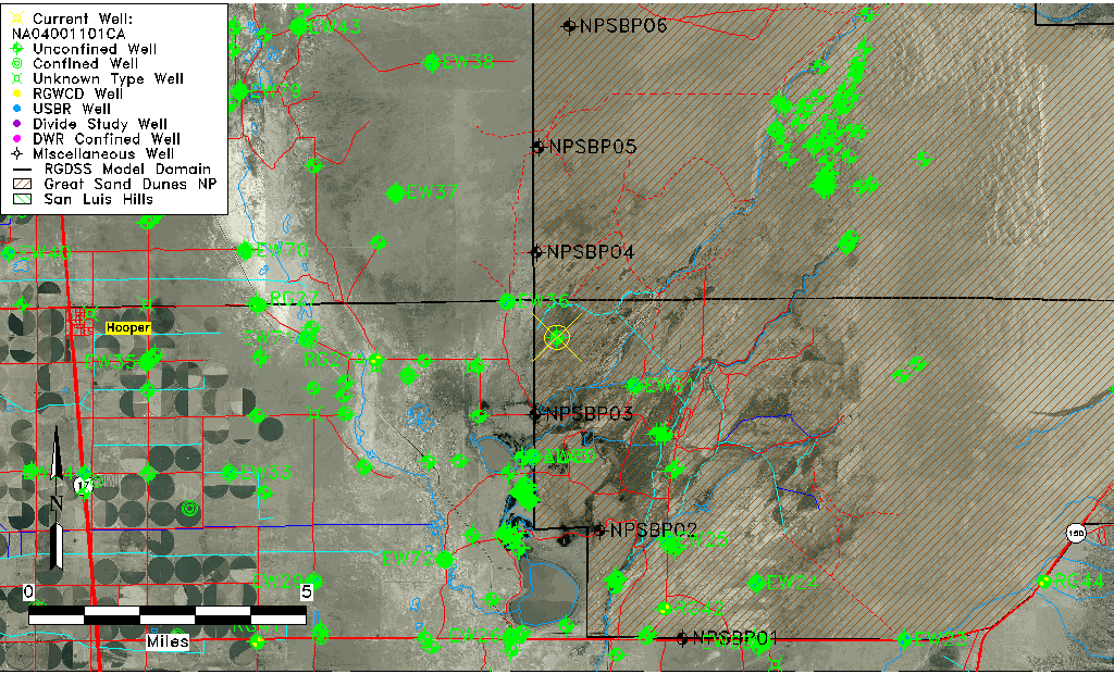
| Common Well ID | NA04001101CA |
| USGS Well ID | 374431105431101 |
| GSDNP Well Name | 374431105431101 |
| USGS Station Name | NA04001101CA |
| USGS Construction Date | 05/29/1946 |
| USGS Site Type | Well |
| USGS Site Use Information | Test |
| USGS Groundwater Use Information | Unknown |
| Data Source(s) | USGS |
| Location Data |
|---|
| TRS | NA04001101CA |
| USGS TRS 1 | NA04001101CA |
| Longitude/Latitude (NAD83) | -105.72029530 , 37.74194449 |
| Longitude/Latitude Data Source | GWSI decimal LAT/LONG field |
| USGS Longitude/Latitude (NAD83) | -105.720295300 , 37.741944490 |
| Easting, Northing RGDSS-NAD83 (US ft) | 186646.23 , 271585.10 |
| USGS Topography | Valley flat |
| USGS County | Alamosa County |
| USGS Map Name | MEDANO RANCH |
| USGS Map Scale | 24000 |
| Elevation and Depth Data |
|---|
| Ground Elevation (ft NAVD88) | 7557.20 |
| Elevation Data Source | USGS GWSI database |
| USGS Ground Elevation (ft NGVD29) | 7553.08 |
| 1/3-Arc Second NED Ground Elevation (ft NAVD88) | 7553.43 |
| 1-Arc Second NED Ground Elevation (ft NAVD88) | 7553.69 |
| SRTM Ground Elevation (ft NAVD88) | 7546.14 |
| Total Depth (ft) | 51.30 |
| USGS Hole Depth (ft) | 103.40 |
| USGS Well Depth (ft) | 51.30 |
| Model Layer | 1 |
| Model Layer Source | Well Depth |
| Depth of Bottom of Layer 1 | 132 |
| Depth of Bottom of Layer 2 | 436 |
| Depth of Bottom of Layer 3 | 1567 |
| Depth of Bottom of Layer 4 | 3323 |
| Additional Well Information | Production, Logs |
| Aquifer Information |
|---|
| Aquifer Type | Unconfined |
| Aquifer Type Source | TD Elevation/Model Layer |
| USGS Primary Aquifer | 112ALMS |
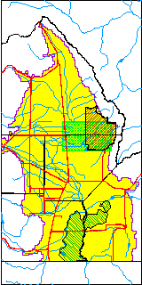
| USGS Hydrologic Unit | San Luis |
| USGS Data Available | Discharge (GW.DISC) |
| Water-level Database Information |
|---|
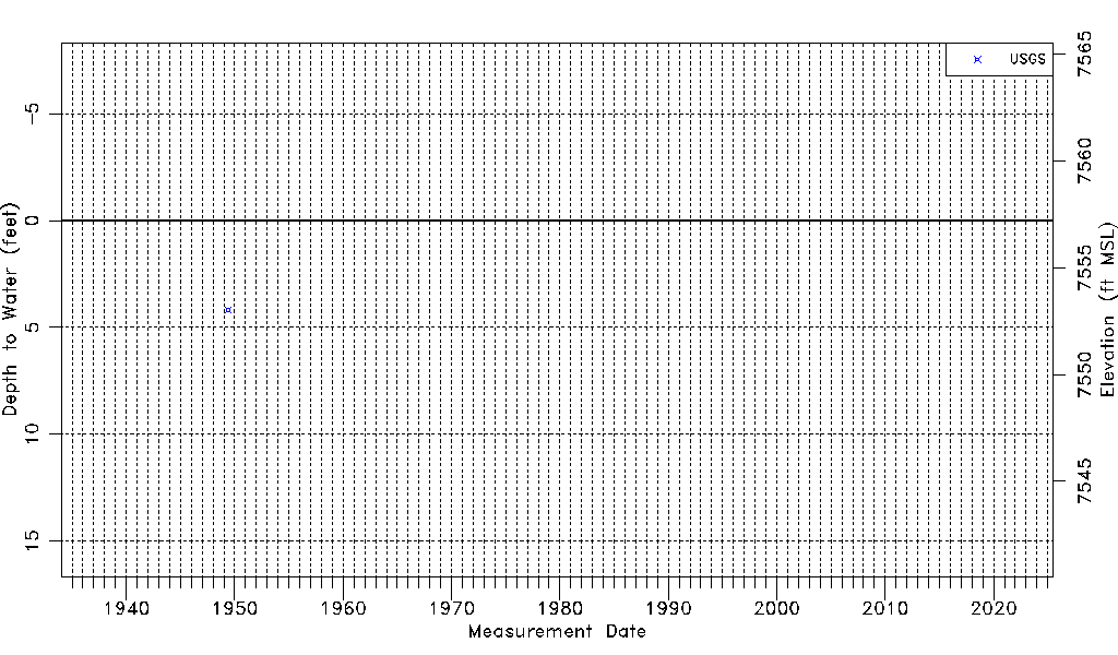
| Water-level Count | 1 |
| Water-level Date Range | 06/02/1949 thru 06/02/1949 |
| Monitored within the last 18 months | No, most recently on 06/02/1949 |
| Depth-to-Water Range (ft) | 4.17 to 4.17 |
| Water Table Elevation Range (ft NAVD88) | 7553.03 to 7553.03 |
| Water-Level-Source:Number-of-Measurements | USGS:1 |