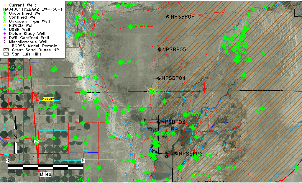
| Well Information Table |
|---|
| Common Well ID | NA04001102BAA2 EW-36C-1 |
| USBR Well ID | EW36C1 |
| USGS Well ID | 374505105440902 |
| GSDNP Well Name | 374505105440902 |
| USGS Station Name | NA04001102BAA2 EW-36C-1 |
| USGS Construction Date | 09/04/1982 |
| USGS Site Type | Well |
| USGS Site Use Information | Observation |
| USGS Groundwater Use Information | Unknown |
| Data Source(s) | USGS, USBR |
| Location Data |
|---|
| TRS | NA04001102BAA2 EW-36C-1 |
| USBR TRS | NA04001102BAA2 |
| USGS TRS 1 | NA04001102BAA2 EW-36C-1 |
| Longitude/Latitude (NAD83) | -105.73664741 , 37.75128934 |
| Longitude/Latitude Data Source | USBOR EW well locations |
| USGS Longitude/Latitude (NAD83) | -105.736406800 , 37.751388680 |
| USBR Longitude/Latitude (NAD27) | -105.736073923927 , 37.7512895452907 |
| Easting, Northing RGDSS-NAD83 (US ft) | 181921.88 , 274989.92 |
| USGS Topography | Valley flat |
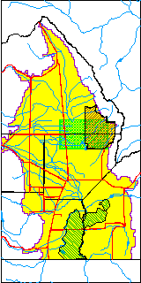
| USGS County | Alamosa County |
| USGS Map Name | SAND CAMP |
| USGS Map Scale | 24000 |
| Elevation and Depth Data |
|---|
| Ground Elevation (ft NAVD88) | 7553.79 |
| Elevation Data Source | USBOR EW well database |
| USBR Ground Elevation (ft NGVD29) | 7549.7 |
| USGS Ground Elevation (ft NGVD29) | 7549.70 |
| 1/3-Arc Second NED Ground Elevation (ft NAVD88) | 7555.25 |
| 1-Arc Second NED Ground Elevation (ft NAVD88) | 7554.02 |
| SRTM Ground Elevation (ft NAVD88) | 7557.49 |
| Total Depth (ft) | 133.00 |
| USBR Total Depth (ft) | 133 |
| USGS Hole Depth (ft) | 160.00 |
| USGS Well Depth (ft) | 133.00 |
| Model Layer | 2 |
| Model Layer Source | Well Depth |
| Depth of Bottom of Layer 1 | 118 |
| Depth of Bottom of Layer 2 | 414 |
| Depth of Bottom of Layer 3 | 1596 |
| Depth of Bottom of Layer 4 | 3253 |
| Additional Well Information | Logs, Construction |
| Aquifer Information |
|---|
| Aquifer Type | Confined |
| Aquifer Type Source | EW_AQFR |
| USGS Hydrologic Unit | San Luis |
| USGS Data Available | Water-level (GW.LEV) |
| Water-level Database Information |
|---|
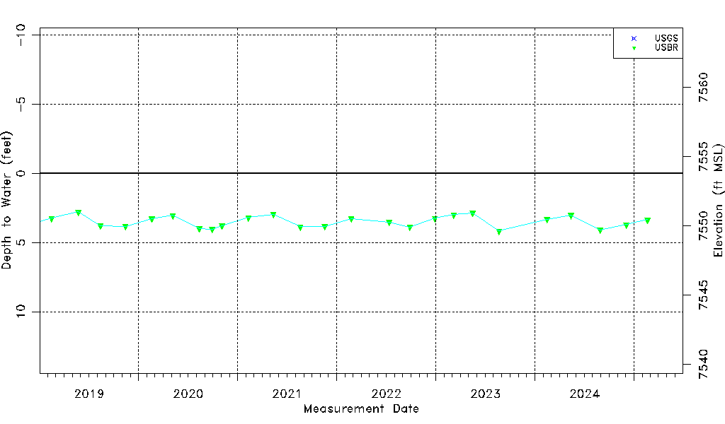
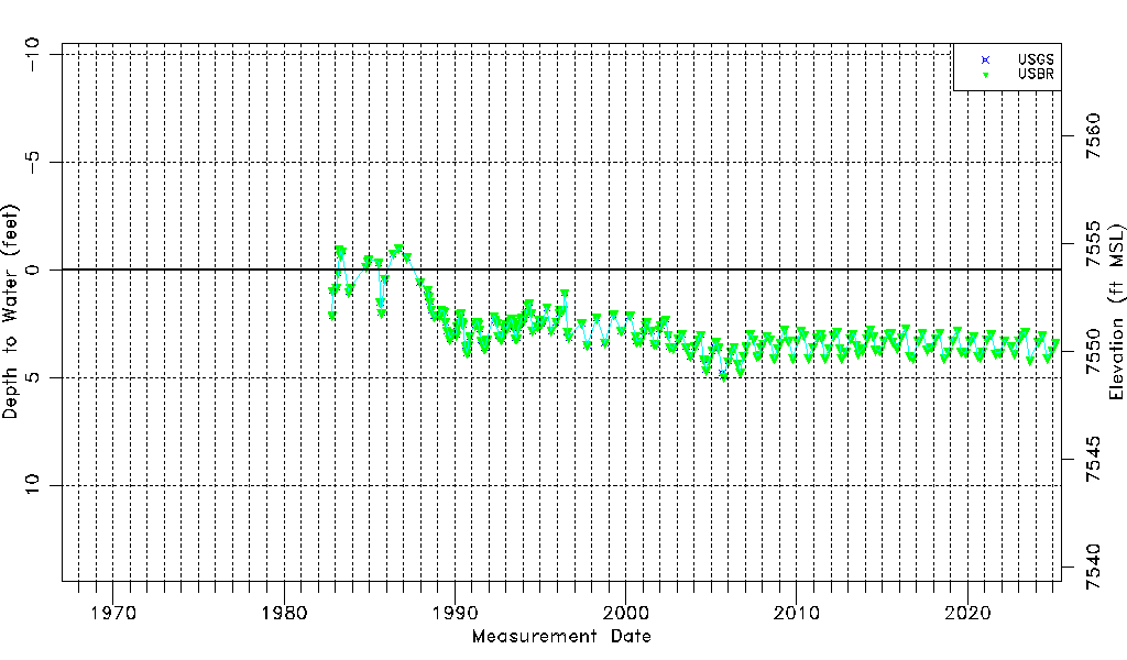
| Water-level Count | 250 |
| Water-level Date Range | 10/30/1982 thru 08/14/2025 |
| Monitored within the last 18 months | Yes, most recently on 08/14/2025 |
| Depth-to-Water Range (ft) | -1.01 to 4.93 |
| Water Table Elevation Range (ft NAVD88) | 7548.86 to 7554.80 |
| Water-Level-Source:Number-of-Measurements | USGS:143 USBR:229 |