| Well Information Table |
|---|
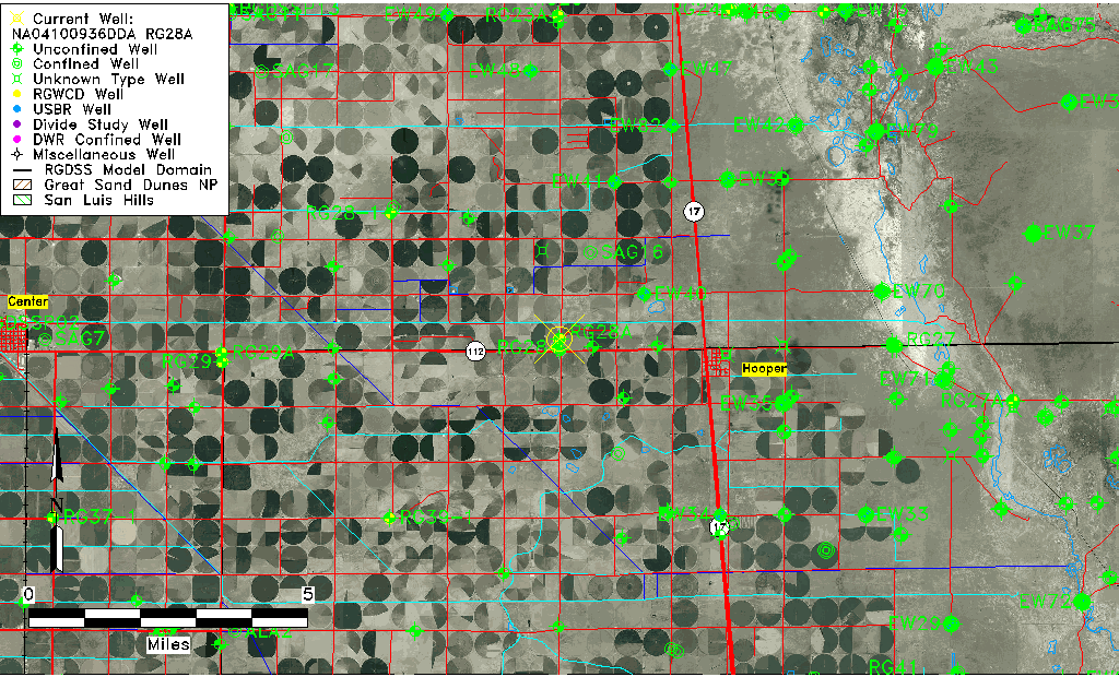
| Common Well ID | NA04100936DDA RG28A |
| RGWCD Well ID | RG28A |
| USGS Well ID | 374505105554001 |
| USGS Station Name | NA04100936DDA RG28A |
| USGS Site Type | Well |
| USGS Site Use Information | Observation |
| USGS Groundwater Use Information | Unknown |
| Data Source(s) | USGS, RGWCD |
| Location Data |
|---|
| TRS | NA04100936DDA RG28A |
| RGWCD TRS | NA04100936DDA |
| USGS TRS 1 | NA04100936DDA RG28A |
| USGS TRS | SESENES036T00041R009N |
| Longitude/Latitude (NAD83) | -105.92816372 , 37.75197957 |
| Longitude/Latitude Data Source | RGWCD/Davis Engineering |
| RGWCD Longitude/Latitude (NAD83) | -105:55:41.3894 , 37:45:07.12644 |
| USGS Longitude/Latitude (NAD83) | -105.928355400 , 37.751388500 |
| Easting, Northing RGDSS-NAD83 (US ft) | 126567.24 , 275339.32 |
| USGS Topography | Valley flat |
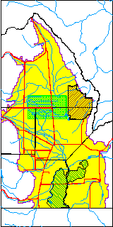
| USGS County | Saguache County |
| USGS Map Name | HOOPER WEST |
| USGS Map Scale | 24000 |
| Elevation and Depth Data |
|---|
| Ground Elevation (ft NAVD88) | 7571.95 |
| Elevation Data Source | RGWCD well database |
| RGWCD Measuring Point Elevation (ft NAVD88) | 7573.950 |
| RGWCD Well Riser Height (ft) | 2.000 |
| RGWCD Ground Surface (ft NAVD88) | 7571.95 |
| USGS Ground Elevation (ft NGVD29) | 7571.00 |
| 1/3-Arc Second NED Ground Elevation (ft NAVD88) | 7570.63 |
| 1-Arc Second NED Ground Elevation (ft NAVD88) | 7573.50 |
| SRTM Ground Elevation (ft NAVD88) | 7578.16 |
| Total Depth (ft) | 53.00 |
| USGS Well Depth (ft) | 53.00 |
| Model Layer | 1 |
| Model Layer Source | RGWCD |
| Depth of Bottom of Layer 1 | 105 |
| Depth of Bottom of Layer 2 | 212 |
| Depth of Bottom of Layer 3 | 1159 |
| Depth of Bottom of Layer 4 | 2806 |
| Additional Well Information | Construction |
| Aquifer Information |
|---|
| Aquifer Type | Unconfined |
| Aquifer Type Source | RGWCD_AQ |
| USGS Hydrologic Unit | San Luis |
| USGS Data Available | Water-level (GW.LEV) |
| Water-level Database Information |
|---|
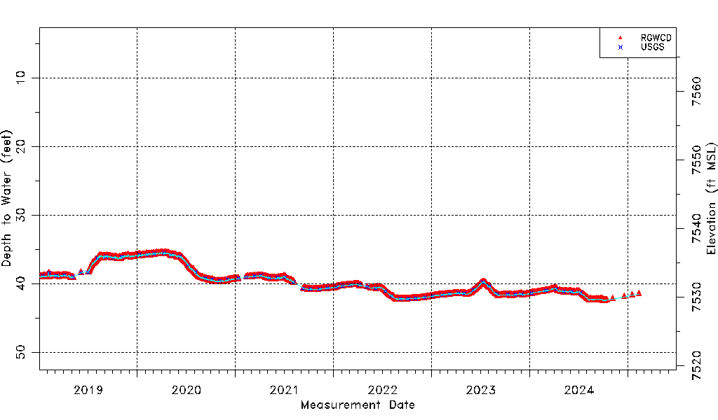
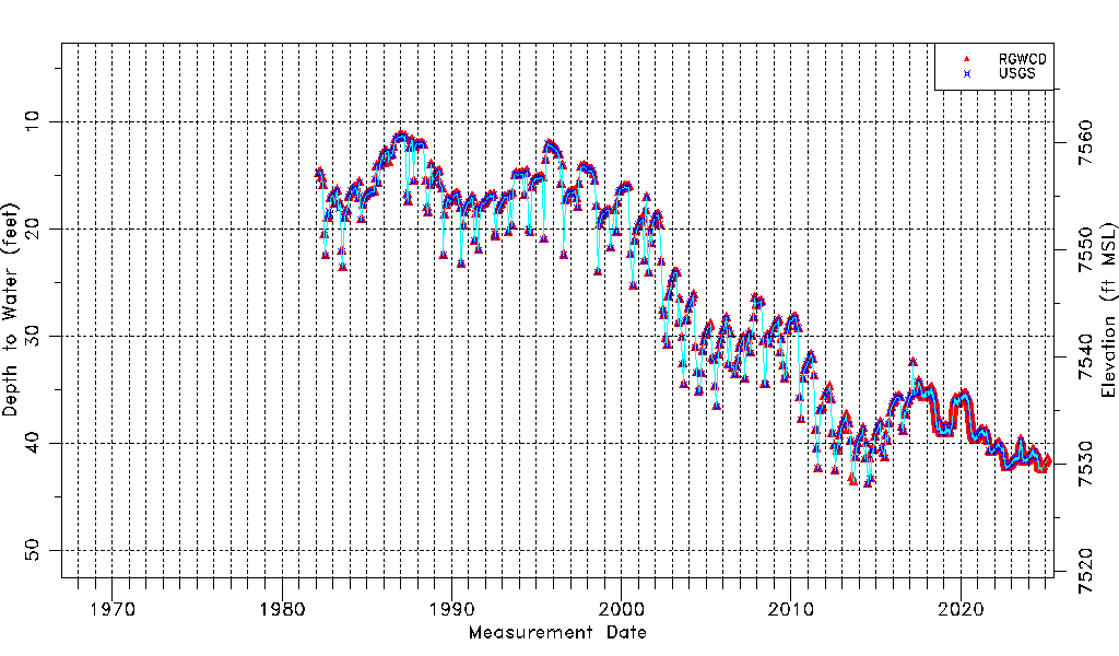
| Water-level Count | 7671 |
| Water-level Date Range | 03/02/1982 thru 07/01/2026 |
| Monitored within the last 18 months | Yes, most recently on 07/01/2026 |
| Depth-to-Water Range (ft) | 11.35 to 44.09 |
| Water Table Elevation Range (ft NAVD88) | 7527.86 to 7560.60 |
| Water-Level-Source:Number-of-Measurements | RGWCD:7650 USGS:493 |