| Well Information Table |
|---|
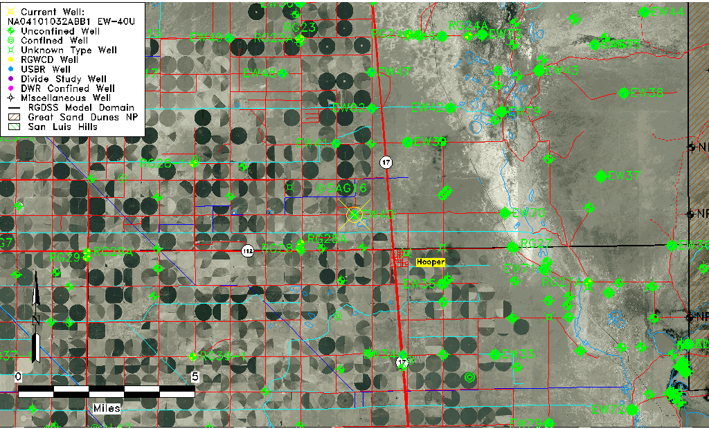
| Common Well ID | NA04101032ABB1 EW-40U |
| USBR Well ID | EW40U |
| USGS Well ID | 374549105540201 |
| USGS Station Name | NA04101032ABB1 EW-40U |
| USGS Construction Date | 09/05/1982 |
| USGS Site Type | Well |
| USGS Site Use Information | Observation |
| USGS Groundwater Use Information | Unknown |
| Data Source(s) | USGS, USBR |
| Location Data |
|---|
| TRS | NA04101032ABB1 EW-40U |
| USBR TRS | NA04101032ABB1 |
| USGS TRS 1 | NA04101032ABB1 EW-40U |
| Longitude/Latitude (NAD83) | -105.90050172 , 37.76367186 |
| Longitude/Latitude Data Source | USBOR EW well locations |
| USGS Longitude/Latitude (NAD83) | -105.901132300 , 37.763610700 |
| USBR Longitude/Latitude (NAD27) | -105.899925012179 , 37.7636722404162 |
| Easting, Northing RGDSS-NAD83 (US ft) | 134573.25 , 279574.46 |
| USGS Topography | Valley flat |
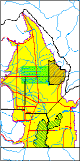
| USGS County | Saguache County |
| USGS Map Name | DEADMAN CAMP SW |
| USGS Map Scale | 24000 |
| Elevation and Depth Data |
|---|
| Ground Elevation (ft NAVD88) | 7555.25 |
| Elevation Data Source | USBOR EW well database |
| USBR Ground Elevation (ft NGVD29) | 7551.4 |
| USGS Ground Elevation (ft NGVD29) | 7551.40 |
| 1/3-Arc Second NED Ground Elevation (ft NAVD88) | 7555.21 |
| 1-Arc Second NED Ground Elevation (ft NAVD88) | 7554.85 |
| SRTM Ground Elevation (ft NAVD88) | 7562.91 |
| Total Depth (ft) | 45.00 |
| USBR Total Depth (ft) | 45 |
| USGS Hole Depth (ft) | 140.00 |
| USGS Well Depth (ft) | 43.00 |
| Model Layer | 1 |
| Model Layer Source | Aquifer Type |
| Depth of Bottom of Layer 1 | 100 |
| Depth of Bottom of Layer 2 | 221 |
| Depth of Bottom of Layer 3 | 1257 |
| Depth of Bottom of Layer 4 | 2972 |
| Additional Well Information | Logs, Construction |
| Aquifer Information |
|---|
| Aquifer Type | Unconfined |
| Aquifer Type Source | EW_AQFR |
| USGS Hydrologic Unit | San Luis |
| USGS Data Available | Water-level (GW.LEV) |
| Water-level Database Information |
|---|
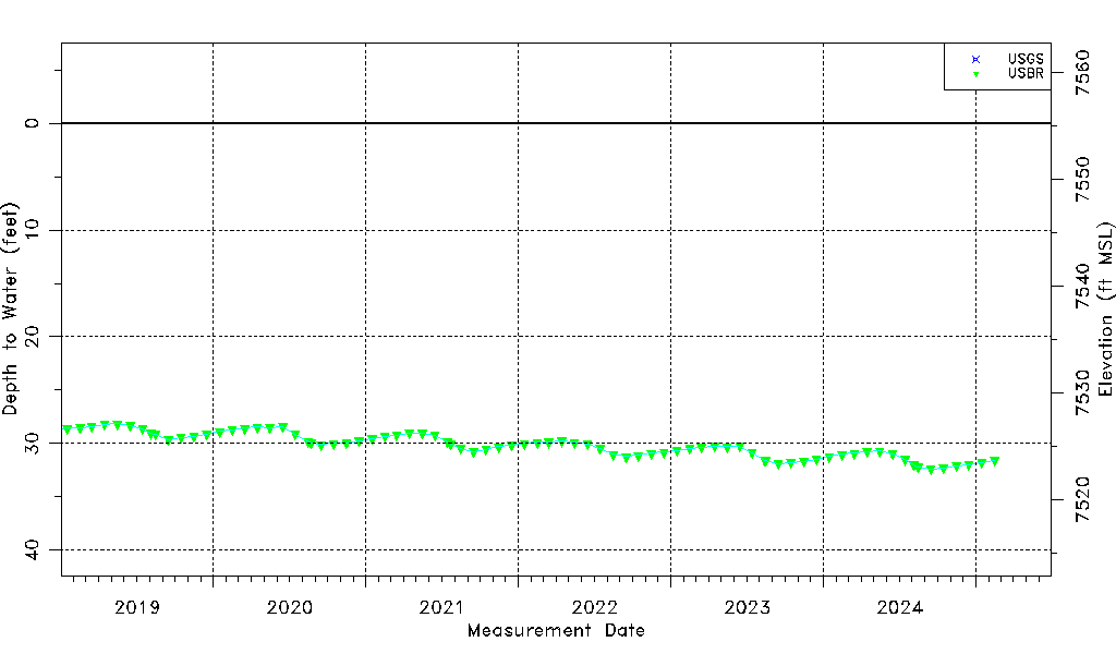
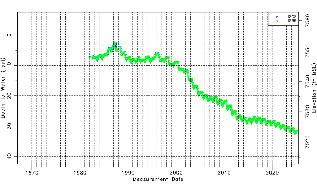
| Water-level Count | 847 |
| Water-level Date Range | 01/28/1982 thru 09/15/2025 |
| Monitored within the last 18 months | Yes, most recently on 09/15/2025 |
| Depth-to-Water Range (ft) | 2.47 to 32.86 |
| Water Table Elevation Range (ft NAVD88) | 7522.39 to 7552.78 |
| Water-Level-Source:Number-of-Measurements | USGS:336 USBR:524 |