| Well Information Table |
|---|
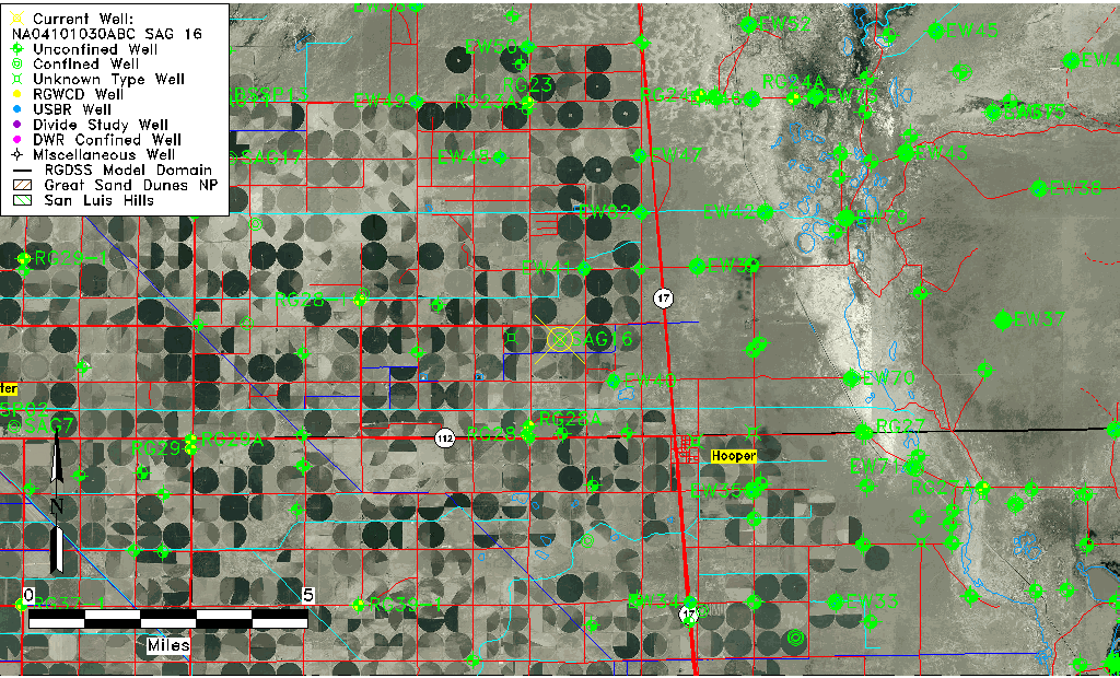
| Common Well ID | NA04101030ABC SAG 16 |
| RGWCD Confined Aquifer Well ID | SAG16 |
| USGS Well ID | 374628105550301 |
| USGS Station Name | NA04101030ABC SAG 16 |
| USGS Site Type | Well |
| USGS Site Use Information | Withdrawal of Water |
| USGS Groundwater Use Information | Unknown |
| Data Source(s) | USGS |
| Location Data |
|---|
| TRS | NA04101030ABC SAG 16 |
| USGS TRS 1 | NA04101030ABC SAG 16 |
| Longitude/Latitude (NAD83) | -105.91807680 , 37.77444404 |
| Longitude/Latitude Data Source | GWSI decimal LAT/LONG field |
| USGS Longitude/Latitude (NAD83) | -105.918076800 , 37.774444040 |
| Easting, Northing RGDSS-NAD83 (US ft) | 129504.75 , 283509.03 |
| USGS County | Saguache County |
| USGS Map Name | DEADMAN CAMP SW, CO |
| USGS Map Scale | 24000 |
| Elevation and Depth Data |
|---|
| Ground Elevation (ft NAVD88) | 7558.88 |
| Elevation Data Source | USGS GWSI database |
| USGS Ground Elevation (ft NGVD29) | 7555.00 |
| 1/3-Arc Second NED Ground Elevation (ft NAVD88) | 7558.90 |
| 1-Arc Second NED Ground Elevation (ft NAVD88) | 7559.07 |
| SRTM Ground Elevation (ft NAVD88) | 7568.39 |
| Total Depth (ft) | 350.00 |
| USGS Well Depth (ft) | 350.00 |
| Model Layer | 3 |
| Model Layer Source | Dunes Layer |
| Depth of Bottom of Layer 1 | 99 |
| Depth of Bottom of Layer 2 | 212 |
| Depth of Bottom of Layer 3 | 1206 |
| Depth of Bottom of Layer 4 | 3053 |
| Additional Well Information | NONE |
| Aquifer Information |
|---|
| Aquifer Type | Confined |
| Aquifer Type Source | RGWCD_AQ |
| USGS Hydrologic Unit | San Luis |
| USGS Data Available | Water-level (GW.LEV) |
| Water-level Database Information |
|---|
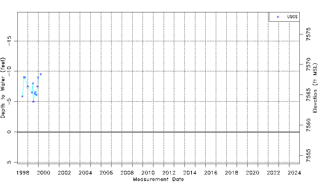
| Water-level Count | 13 |
| Water-level Date Range | 06/23/1998 thru 03/27/2000 |
| Monitored within the last 18 months | No, most recently on 03/27/2000 |
| Depth-to-Water Range (ft) | -9.50 to -5.00 |
| Water Table Elevation Range (ft NAVD88) | 7563.88 to 7568.38 |
| Water-Level-Source:Number-of-Measurements | USGS:13 |