| Well Information Table |
|---|
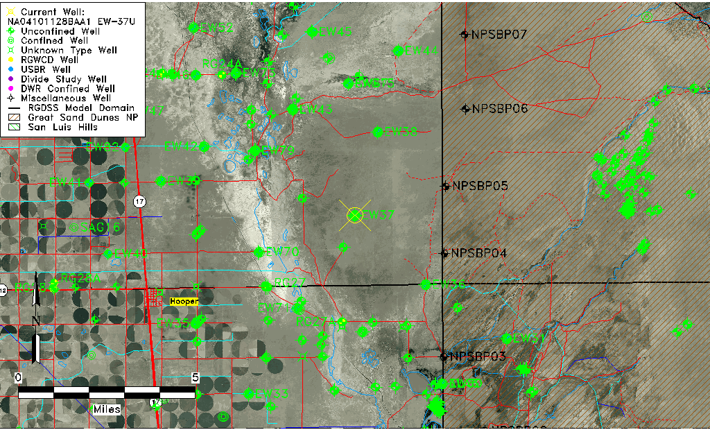
| Common Well ID | NA04101128BAA1 EW-37U |
| USBR Well ID | EW37U |
| USGS Well ID | 374647105462101 |
| GSDNP Well Name | 374647105462101 |
| USGS Station Name | NA04101128BAA1 EW-37U |
| USGS Construction Date | 09/03/1982 |
| USGS Site Type | Well |
| USGS Site Use Information | Observation |
| USGS Groundwater Use Information | Unknown |
| Data Source(s) | USGS, USBR |
| Location Data |
|---|
| TRS | NA04101128BAA1 EW-37U |
| USBR TRS | NA04101128BAA1 |
| USGS TRS 1 | NA04101128BAA1 EW-37U |
| Longitude/Latitude (NAD83) | -105.77316877 , 37.77969554 |
| Longitude/Latitude Data Source | USBOR EW well locations |
| USGS Longitude/Latitude (NAD83) | -105.773073600 , 37.779721850 |
| USBR Longitude/Latitude (NAD27) | -105.772595126576 , 37.7796959189886 |
| Easting, Northing RGDSS-NAD83 (US ft) | 171377.77 , 285340.35 |
| USGS Topography | Valley flat |
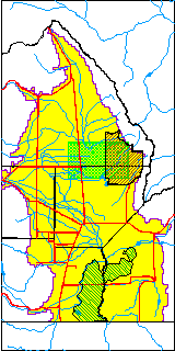
| USGS County | Saguache County |
| USGS Map Name | DEADMAN CAMP |
| USGS Map Scale | 24000 |
| Elevation and Depth Data |
|---|
| Ground Elevation (ft NAVD88) | 7561.73 |
| Elevation Data Source | USBOR EW well database |
| USBR Ground Elevation (ft NGVD29) | 7557.7 |
| USGS Ground Elevation (ft NGVD29) | 7559.20 |
| 1/3-Arc Second NED Ground Elevation (ft NAVD88) | 7563.96 |
| 1-Arc Second NED Ground Elevation (ft NAVD88) | 7562.32 |
| SRTM Ground Elevation (ft NAVD88) | 7569.71 |
| Total Depth (ft) | 45.00 |
| USBR Total Depth (ft) | 45 |
| USGS Hole Depth (ft) | 160.00 |
| USGS Well Depth (ft) | 43.00 |
| Model Layer | 1 |
| Model Layer Source | Aquifer Type |
| Depth of Bottom of Layer 1 | 124 |
| Depth of Bottom of Layer 2 | 373 |
| Depth of Bottom of Layer 3 | 1631 |
| Depth of Bottom of Layer 4 | 3339 |
| Additional Well Information | Logs, Construction |
| Aquifer Information |
|---|
| Aquifer Type | Unconfined |
| Aquifer Type Source | EW_AQFR |
| USGS Hydrologic Unit | San Luis |
| USGS Data Available | Water-level (GW.LEV) |
| Water-level Database Information |
|---|
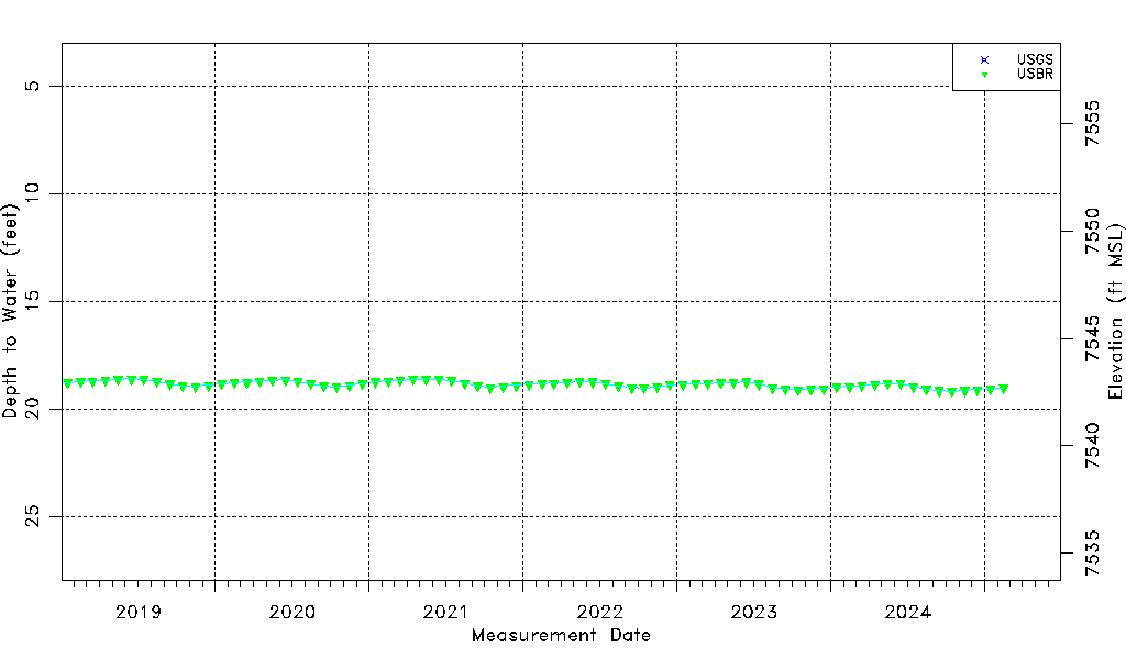
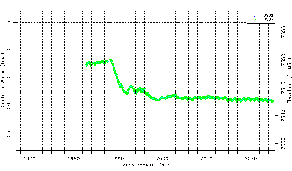
| Water-level Count | 503 |
| Water-level Date Range | 11/02/1982 thru 09/15/2025 |
| Monitored within the last 18 months | Yes, most recently on 09/15/2025 |
| Depth-to-Water Range (ft) | 11.78 to 19.22 |
| Water Table Elevation Range (ft NAVD88) | 7542.51 to 7549.95 |
| Water-Level-Source:Number-of-Measurements | USGS:34 USBR:473 |