| Well Information Table |
|---|
| Common Well ID | SC04101223DDD |
| USGS Well ID | 374655105365901 |
| GSDNP Well Name | 374655105365901 |
| USGS Station Name | SC04101223DDD |
| USGS Site Type | Well |
| USGS Site Use Information | Observation |
| USGS Groundwater Use Information | Unused |
| Data Source(s) | USGS, HRS |
| Location Data |
|---|
| TRS | SC04101223DDD |
| USGS TRS 1 | SC04101223DDD |
| USGS TRS | SESESES023T0041NR0012E |
| Longitude/Latitude (NAD83) | -105.61702064 , 37.78198781 |
| Longitude/Latitude Data Source | Davis Engineering Survey |
| USGS Longitude/Latitude (NAD83) | -105.616958300 , 37.781944770 |
| HRS Longitude/Latitude (UTM-N13) | -105.61639 , 37.78194 |
| Easting, Northing RGDSS-NAD83 (US ft) | 216491.86 , 286160.77 |
| USGS Topography | Dunes |
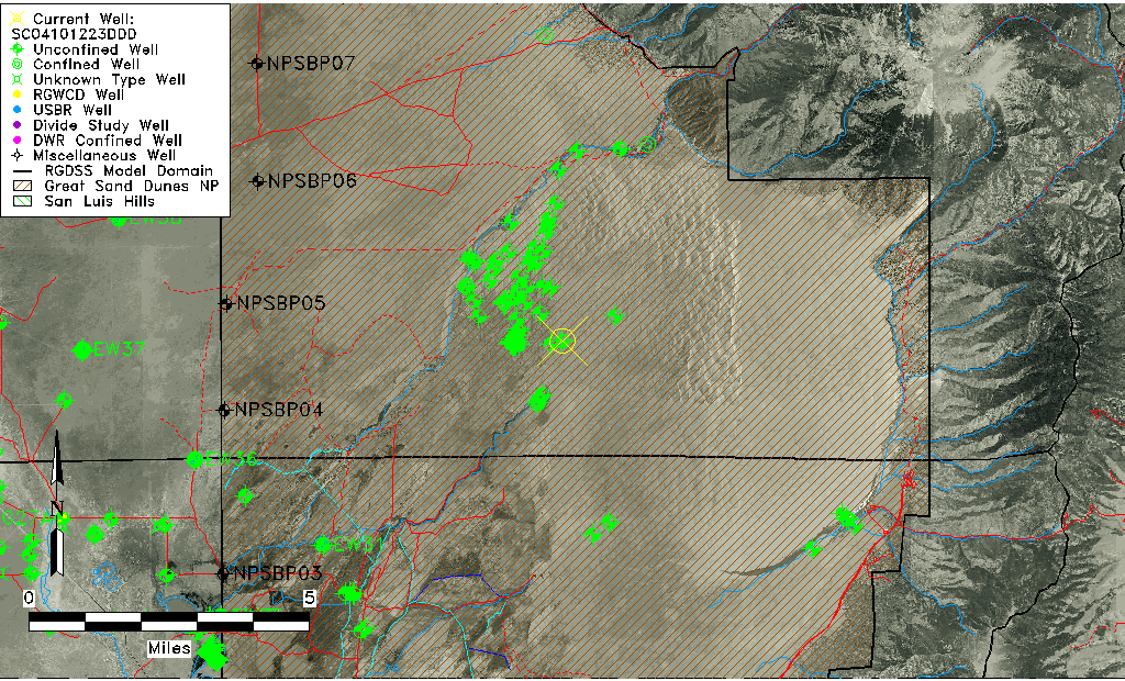
| USGS County | Saguache County |
| USGS Map Name | LIBERTY |
| USGS Map Scale | 24000 |
| Elevation and Depth Data |
|---|
| Ground Elevation (ft NAVD88) | 7730.86 |
| Elevation Data Source | Davis Engineering Survey |
| USGS Ground Elevation (ft NGVD29) | 7718.03 |
| GRSA Dunes Well database (ft NGVD29) | 7718.03 |
| HRS Dunes Well database (ft NGVD29) | 7718.02979 |
| 1/3-Arc Second NED Ground Elevation (ft NAVD88) | 7727.81 |
| 1-Arc Second NED Ground Elevation (ft NAVD88) | 7735.05 |
| SRTM Ground Elevation (ft NAVD88) | 7722.09 |
| Total Depth (ft) | 25.00 |
| Depth to Top of Screen (ft) | 15.0 |
| Depth to Bottom of Screen (ft) | 25.00 |
| USGS Hole Depth (ft) | 25.00 |
| USGS Well Depth (ft) | 25.00 |
| Model Layer | 1 |
| Model Layer Source | Dunes Layer |
| Depth of Bottom of Layer 1 | 290 |
| Depth of Bottom of Layer 2 | 688 |
| Depth of Bottom of Layer 3 | 1210 |
| Depth of Bottom of Layer 4 | 2209 |
| Additional Well Information | Construction |
| Aquifer Information |
|---|
| Aquifer Type | Unconfined |
| Aquifer Type Source | GRSA_AQUFR |
| USGS Aquifer Type | Unconfined Single Aquifer |
| USGS Hydrologic Unit | San Luis |
| USGS Data Available | Water-level (GW.LEV) |
| Water-level Database Information |
|---|
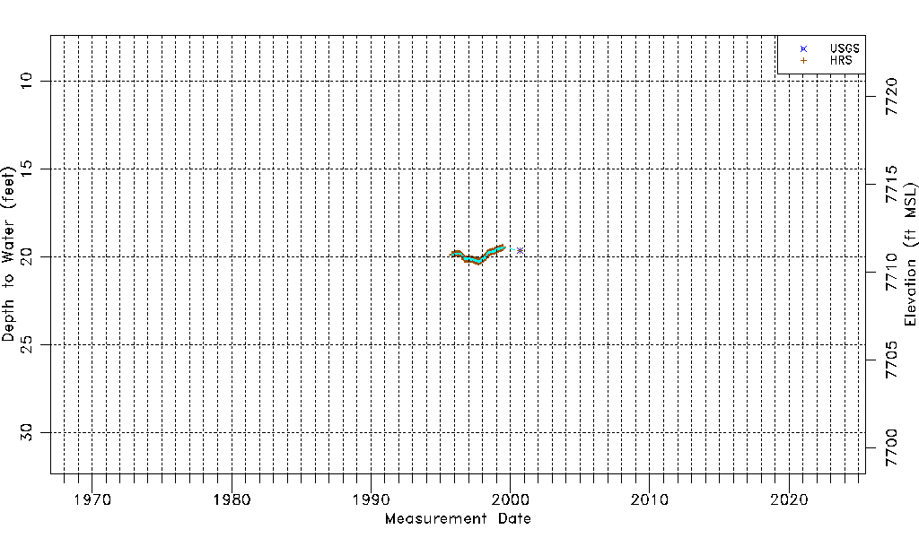
| Water-level Count | 4061 |
| Water-level Date Range | 10/20/1995 thru 09/11/2000 |
| Monitored within the last 18 months | No, most recently on 09/11/2000 |
| Depth-to-Water Range (ft) | 19.41 to 20.30 |
| Water Table Elevation Range (ft NAVD88) | 7710.56 to 7711.45 |
| Water-Level-Source:Number-of-Measurements | USGS:1 HRS:4060 |