| Well Information Table |
|---|
| Common Well ID | SC04101215CDC2 |
| USGS Well ID | 374746105385203 |
| GSDNP Well Name | 374746105385203 |
| USGS Station Name | SC04101215CDC2 |
| USGS Site Type | Well |
| USGS Site Use Information | Observation |
| USGS Groundwater Use Information | Unused |
| Data Source(s) | USGS, HRS |
| Location Data |
|---|
| TRS | SC04101215CDC2 |
| USGS TRS 1 | SC04101215CDC2 |
| USGS TRS | SWSESWS015T0041NR0012E |
| Longitude/Latitude (NAD83) | -105.64821511 , 37.79607081 |
| Longitude/Latitude Data Source | Davis Engineering Survey |
| USGS Longitude/Latitude (NAD83) | -105.648347700 , 37.796111200 |
| HRS Longitude/Latitude (UTM-N13) | -105.64778 , 37.79611 |
| Easting, Northing RGDSS-NAD83 (US ft) | 207478.49 , 291284.00 |
| USGS Topography | Dunes |
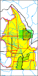
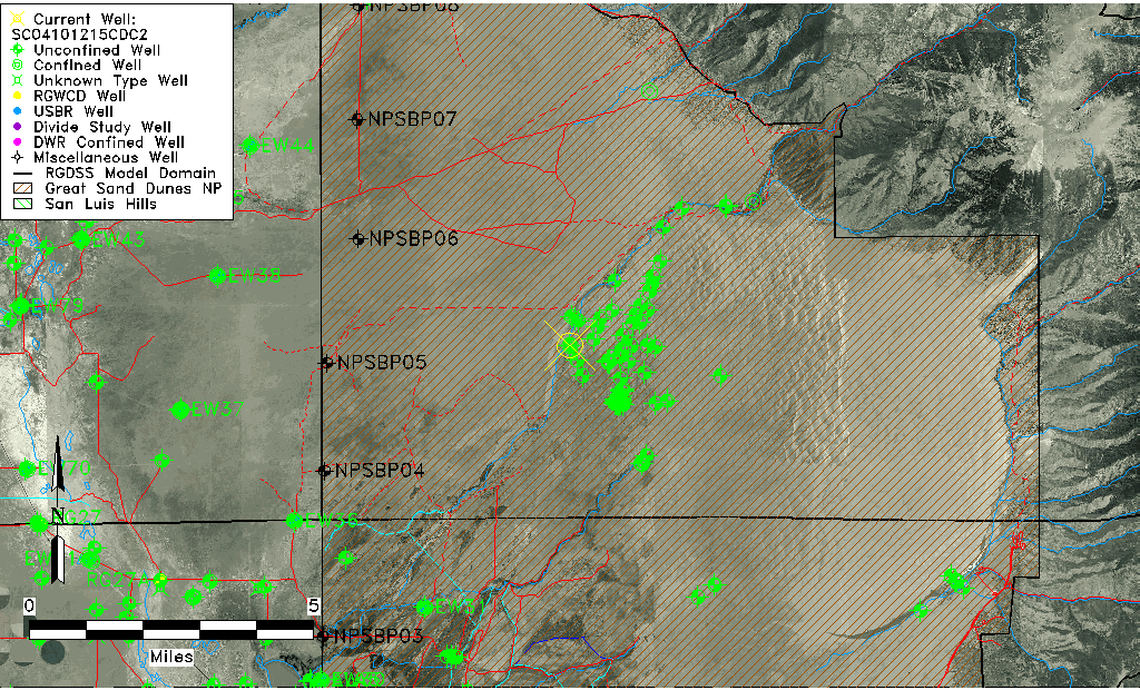
| USGS County | Saguache County |
| USGS Map Name | SAND CAMP |
| USGS Map Scale | 24000 |
| Elevation and Depth Data |
|---|
| Ground Elevation (ft NAVD88) | 7702.84 |
| Elevation Data Source | Davis Engineering Survey |
| USGS Ground Elevation (ft NGVD29) | 7689.79 |
| GRSA Dunes Well database (ft NGVD29) | 7689.79 |
| HRS Dunes Well database (ft NGVD29) | 7689.79004 |
| 1/3-Arc Second NED Ground Elevation (ft NAVD88) | 7704.40 |
| 1-Arc Second NED Ground Elevation (ft NAVD88) | 7694.36 |
| SRTM Ground Elevation (ft NAVD88) | 7709.77 |
| Total Depth (ft) | 394.00 |
| Depth to Top of Screen (ft) | 374.0 |
| Depth to Bottom of Screen (ft) | 394.00 |
| USGS Hole Depth (ft) | 394.00 |
| USGS Well Depth (ft) | 394.00 |
| Model Layer | 2 |
| Model Layer Source | Dunes Layer |
| Depth of Bottom of Layer 1 | 256 |
| Depth of Bottom of Layer 2 | 635 |
| Depth of Bottom of Layer 3 | 1308 |
| Depth of Bottom of Layer 4 | 2595 |
| Additional Well Information | Construction |
| Aquifer Information |
|---|
| Aquifer Type | Confined |
| Aquifer Type Source | GRSA_AQUFR |
| USGS Aquifer Type | Confined Multiple Aquifers |
| USGS Hydrologic Unit | San Luis |
| USGS Data Available | Water-level (GW.LEV) |
| Water-level Database Information |
|---|
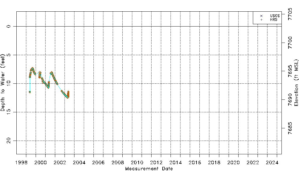
| Water-level Count | 9498 |
| Water-level Date Range | 05/24/1999 thru 05/21/2003 |
| Monitored within the last 18 months | No, most recently on 05/21/2003 |
| Depth-to-Water Range (ft) | 7.27 to 12.47 |
| Water Table Elevation Range (ft NAVD88) | 7690.37 to 7695.57 |
| Water-Level-Source:Number-of-Measurements | USGS:1 HRS:9497 |