| Well Information Table |
|---|
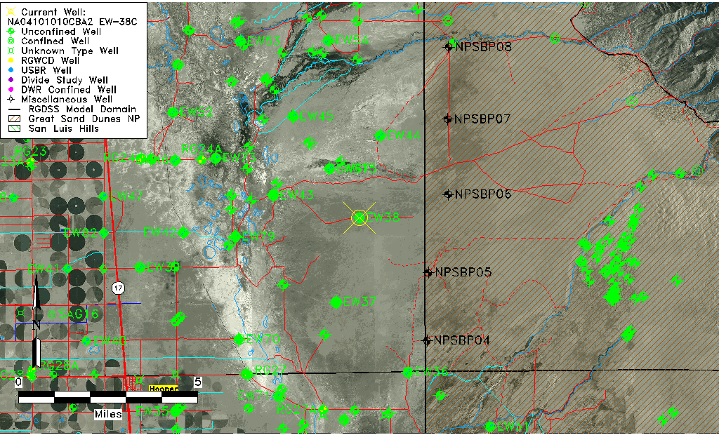
| Common Well ID | NA04101010CBA2 EW-38C |
| USBR Well ID | EW38C |
| USGS Well ID | 374855105453602 |
| GSDNP Well Name | 374855105453602 |
| USGS Station Name | NA04101010CBA2 EW-38C |
| USGS Construction Date | 05/30/1984 |
| USGS Site Type | Well |
| USGS Site Use Information | Observation |
| USGS Groundwater Use Information | Unused |
| Data Source(s) | USGS, USBR |
| Location Data |
|---|
| TRS | NA04101010CBA2 EW-38C |
| USBR TRS | NA04101010CBA2 |
| USGS TRS 1 | NA04101010CBA2 EW-38C |
| Longitude/Latitude (NAD83) | -105.76147493 , 37.81374927 |
| Longitude/Latitude Data Source | USBOR EW well locations |
| USGS Longitude/Latitude (NAD83) | -105.760572500 , 37.815277300 |
| USBR Longitude/Latitude (NAD27) | -105.760902380138 , 37.8137497482582 |
| Easting, Northing RGDSS-NAD83 (US ft) | 174769.09 , 297733.02 |
| USGS Topography | Valley flat |
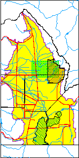
| USGS County | Saguache County |
| USGS Map Name | DEADMAN CAMP |
| USGS Map Scale | 24000 |
| Elevation and Depth Data |
|---|
| Ground Elevation (ft NAVD88) | 7576.19 |
| Elevation Data Source | USBOR EW well database |
| USBR Ground Elevation (ft NGVD29) | 7572.1 |
| USGS Ground Elevation (ft NGVD29) | 7572.10 |
| 1/3-Arc Second NED Ground Elevation (ft NAVD88) | 7578.74 |
| 1-Arc Second NED Ground Elevation (ft NAVD88) | 7577.99 |
| SRTM Ground Elevation (ft NAVD88) | 7585.30 |
| Total Depth (ft) | 139.00 |
| USBR Total Depth (ft) | 139 |
| USGS Hole Depth (ft) | 145.00 |
| USGS Well Depth (ft) | 137.00 |
| Model Layer | 2 |
| Model Layer Source | Aquifer Type |
| Depth of Bottom of Layer 1 | 138 |
| Depth of Bottom of Layer 2 | 410 |
| Depth of Bottom of Layer 3 | 1661 |
| Depth of Bottom of Layer 4 | 3786 |
| Additional Well Information | Logs, Construction |
| Aquifer Information |
|---|
| Aquifer Type | Confined |
| Aquifer Type Source | EW_AQFR |
| USGS Hydrologic Unit | San Luis |
| USGS Data Available | Water-level (GW.LEV) |
| Water-level Database Information |
|---|
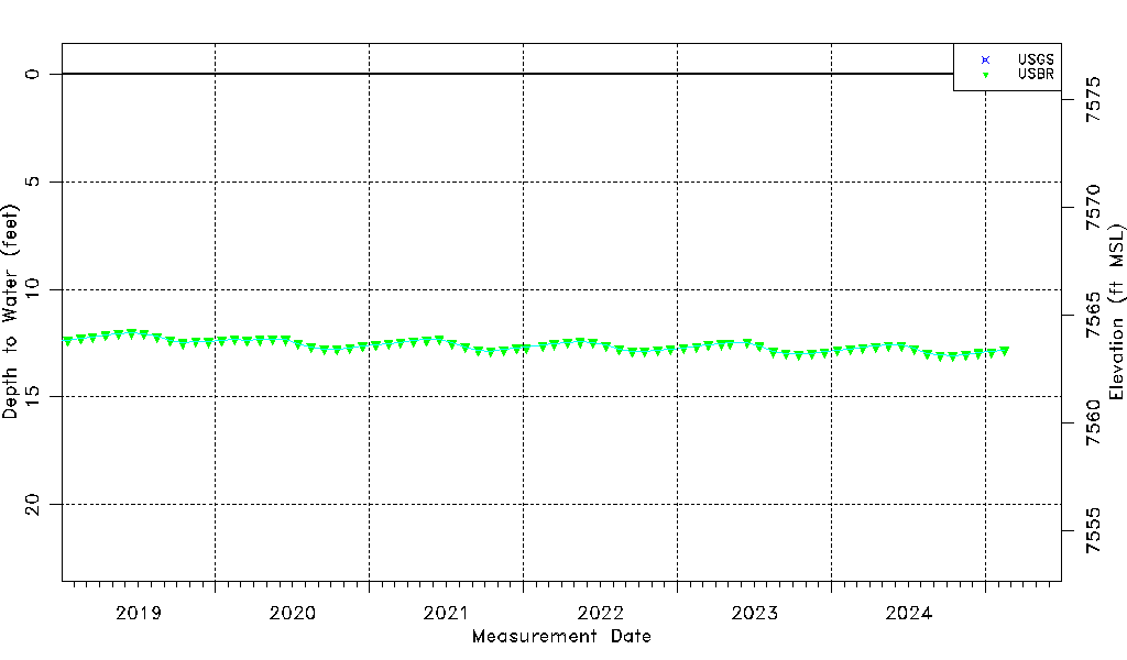
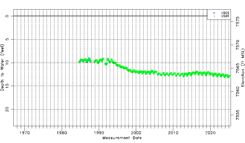
| Water-level Count | 578 |
| Water-level Date Range | 09/14/1984 thru 09/16/2025 |
| Monitored within the last 18 months | Yes, most recently on 09/16/2025 |
| Depth-to-Water Range (ft) | 9.03 to 13.18 |
| Water Table Elevation Range (ft NAVD88) | 7563.01 to 7567.16 |
| Water-Level-Source:Number-of-Measurements | USGS:275 USBR:406 |