| Well Information Table |
|---|
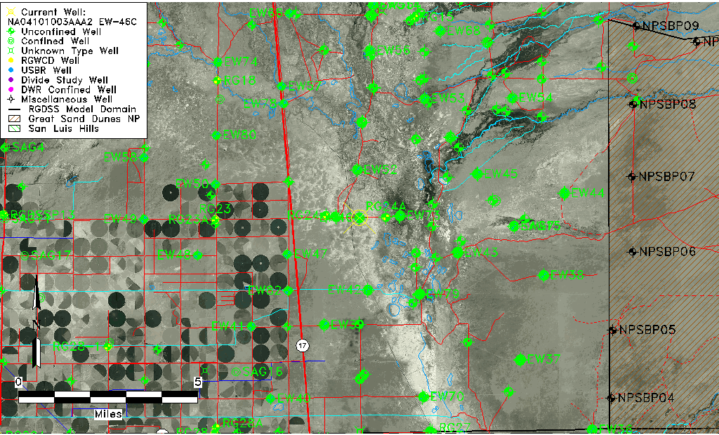
| Common Well ID | NA04101003AAA2 EW-46C |
| USBR Well ID | EW46C |
| USGS Well ID | 375013105511702 |
| GSDNP Well Name | 375013105511702 |
| USGS Station Name | NA04101003AAA2 EW-46C |
| USGS Site Type | Well |
| USGS Site Use Information | Observation |
| USGS Groundwater Use Information | Unknown |
| Data Source(s) | USGS, USBR |
| Location Data |
|---|
| TRS | NA04101003AAA2 EW-46C |
| USBR TRS | NA04101003AAA2 |
| USGS TRS 1 | NA04101003AAA2 EW-46C |
| Longitude/Latitude (NAD83) | -105.85540798 , 37.83691351 |
| Longitude/Latitude Data Source | USBOR EW well locations |
| USGS Longitude/Latitude (NAD83) | -105.855296200 , 37.836943940 |
| USBR Longitude/Latitude (NAD27) | -105.854833999179 , 37.8369140198985 |
| Easting, Northing RGDSS-NAD83 (US ft) | 147659.03 , 306206.95 |
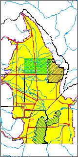
| USGS County | Saguache County |
| Elevation and Depth Data |
|---|
| Ground Elevation (ft NAVD88) | 7536.76 |
| Elevation Data Source | USBOR EW well database |
| USBR Ground Elevation (ft NGVD29) | 7532.9 |
| USGS Ground Elevation (ft NGVD29) | 7532.92 |
| 1/3-Arc Second NED Ground Elevation (ft NAVD88) | 7537.88 |
| 1-Arc Second NED Ground Elevation (ft NAVD88) | 7536.71 |
| SRTM Ground Elevation (ft NAVD88) | 7534.36 |
| Total Depth (ft) | 115.00 |
| USBR Total Depth (ft) | 115 |
| USGS Well Depth (ft) | 110.00 |
| Model Layer | 2 |
| Model Layer Source | Well Depth |
| Depth of Bottom of Layer 1 | 93 |
| Depth of Bottom of Layer 2 | 255 |
| Depth of Bottom of Layer 3 | 1454 |
| Depth of Bottom of Layer 4 | 3906 |
| Additional Well Information | NONE |
| Aquifer Information |
|---|
| Aquifer Type | Confined |
| Aquifer Type Source | EW_AQFR |
| USGS Hydrologic Unit | San Luis |
| USGS Data Available | Water-level (GW.LEV) |
| Water-level Database Information |
|---|
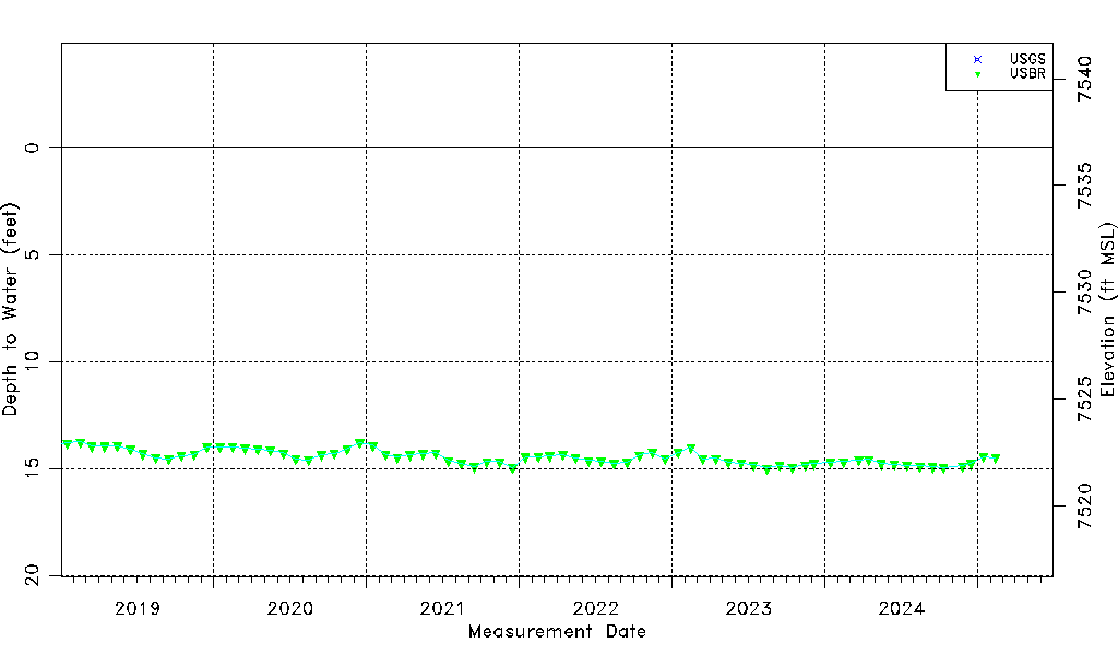
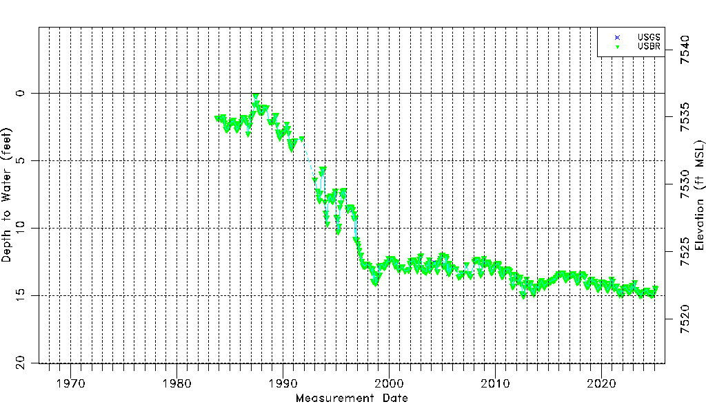
| Water-level Count | 490 |
| Water-level Date Range | 10/20/1983 thru 09/15/2025 |
| Monitored within the last 18 months | Yes, most recently on 09/15/2025 |
| Depth-to-Water Range (ft) | 0.15 to 15.87 |
| Water Table Elevation Range (ft NAVD88) | 7520.89 to 7536.61 |
| Water-Level-Source:Number-of-Measurements | USGS:24 USBR:467 |