| Well Information Table |
|---|
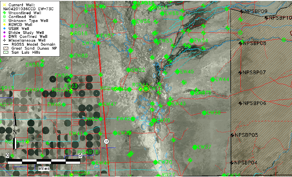
| Common Well ID | NA04201036CCD EW-73C |
| USBR Well ID | EW73C |
| USGS Well ID | 375020105500401 |
| GSDNP Well Name | 375020105500401 |
| USGS Station Name | NA04201036CCD EW-73C |
| USGS Construction Date | 01/20/1978 |
| USGS Site Type | Well |
| USGS Site Use Information | Observation |
| USGS Groundwater Use Information | Unknown |
| Data Source(s) | USGS, USBR |
| Location Data |
|---|
| TRS | NA04201036CCD EW-73C |
| USBR TRS | NA04201036CCD |
| USGS TRS 1 | NA04201036CCD EW-73C |
| Longitude/Latitude (NAD83) | -105.83470764 , 37.83774302 |
| Longitude/Latitude Data Source | USBOR EW well locations |
| USGS Longitude/Latitude (NAD83) | -105.835018000 , 37.837499480 |
| USBR Longitude/Latitude (NAD27) | -105.834134122810 , 37.8377435411727 |
| Easting, Northing RGDSS-NAD83 (US ft) | 153635.85 , 306497.41 |
| USGS Topography | Valley flat |
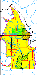
| USGS County | Saguache County |
| USGS Map Name | DEADMAN CAMP |
| USGS Map Scale | 24000 |
| Elevation and Depth Data |
|---|
| Ground Elevation (ft NAVD88) | 7537.40 |
| Elevation Data Source | USBOR EW well database |
| USBR Ground Elevation (ft NGVD29) | 7533.5 |
| USGS Ground Elevation (ft NGVD29) | 7532.10 |
| 1/3-Arc Second NED Ground Elevation (ft NAVD88) | 7538.28 |
| 1-Arc Second NED Ground Elevation (ft NAVD88) | 7536.69 |
| SRTM Ground Elevation (ft NAVD88) | 7538.96 |
| Total Depth (ft) | 97.00 |
| USBR Total Depth (ft) | 97 |
| USGS Hole Depth (ft) | 97.00 |
| USGS Well Depth (ft) | 97.00 |
| Model Layer | 2 |
| Model Layer Source | Aquifer Type |
| Depth of Bottom of Layer 1 | 97 |
| Depth of Bottom of Layer 2 | 281 |
| Depth of Bottom of Layer 3 | 1554 |
| Depth of Bottom of Layer 4 | 4097 |
| Additional Well Information | Logs, Construction |
| Aquifer Information |
|---|
| Aquifer Type | Confined |
| Aquifer Type Source | EW_AQFR |
| USGS Primary Aquifer | Tertiary System |
| USGS Aquifer Type | Unconfined Single Aquifer |
| USGS Hydrologic Unit | San Luis |
| USGS Data Available | Water-level (GW.LEV) |
| Water-level Database Information |
|---|
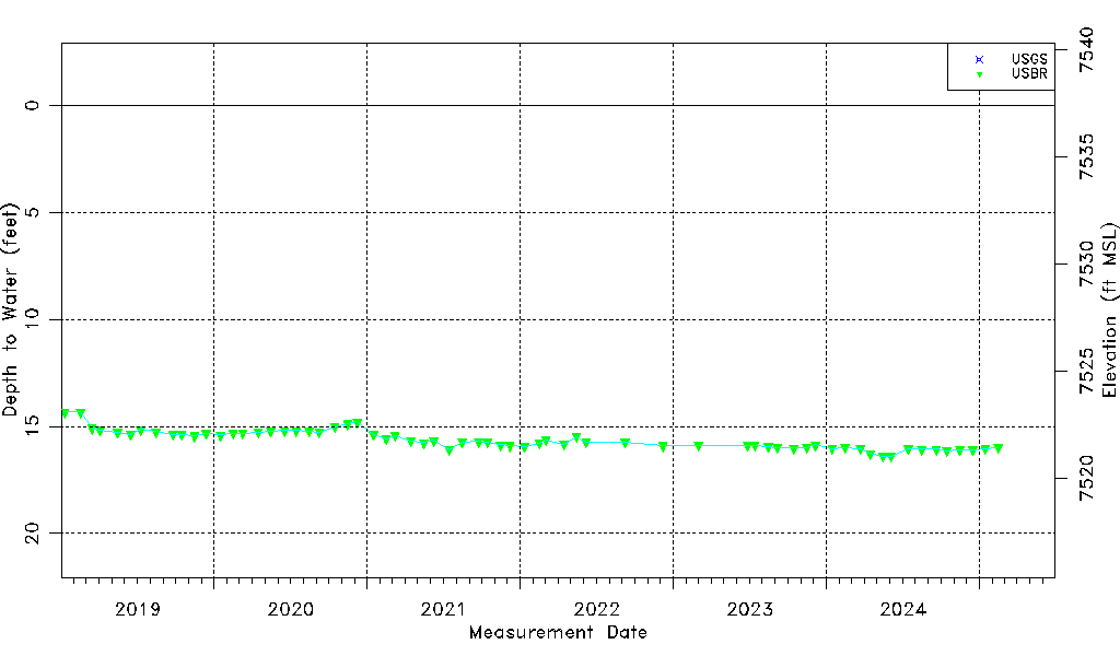
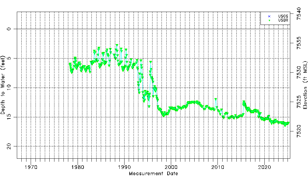
| Water-level Count | 470 |
| Water-level Date Range | 05/12/1978 thru 09/15/2025 |
| Monitored within the last 18 months | Yes, most recently on 09/15/2025 |
| Depth-to-Water Range (ft) | 2.74 to 16.40 |
| Water Table Elevation Range (ft NAVD88) | 7521.00 to 7534.66 |
| Water-Level-Source:Number-of-Measurements | USGS:24 USBR:467 |