| Well Information Table |
|---|
| Common Well ID | NA04201029CDB1 EW-45U |
| USBR Well ID | EW45U |
| USGS Well ID | 375118105474001 |
| GSDNP Well Name | 375118105474001 |
| USGS Station Name | NA04201029CDB1 EW-45U |
| USGS Construction Date | 06/09/1984 |
| USGS Site Type | Well |
| USGS Site Use Information | Observation |
| USGS Groundwater Use Information | Unused |
| Data Source(s) | USGS, USBR |
| Location Data |
|---|
| TRS | NA04201029CDB1 EW-45U |
| USBR TRS | NA04201029CDB1 |
| USGS TRS 1 | NA04201029CDB1 EW-45U |
| Longitude/Latitude (NAD83) | -105.79529824 , 37.85465574 |
| Longitude/Latitude Data Source | USBOR EW well locations |
| USGS Longitude/Latitude (NAD83) | -105.795016700 , 37.854999400 |
| USBR Longitude/Latitude (NAD27) | -105.794725972814 , 37.8546563139126 |
| Easting, Northing RGDSS-NAD83 (US ft) | 165021.92 , 312635.86 |
| USGS Topography | Valley flat |
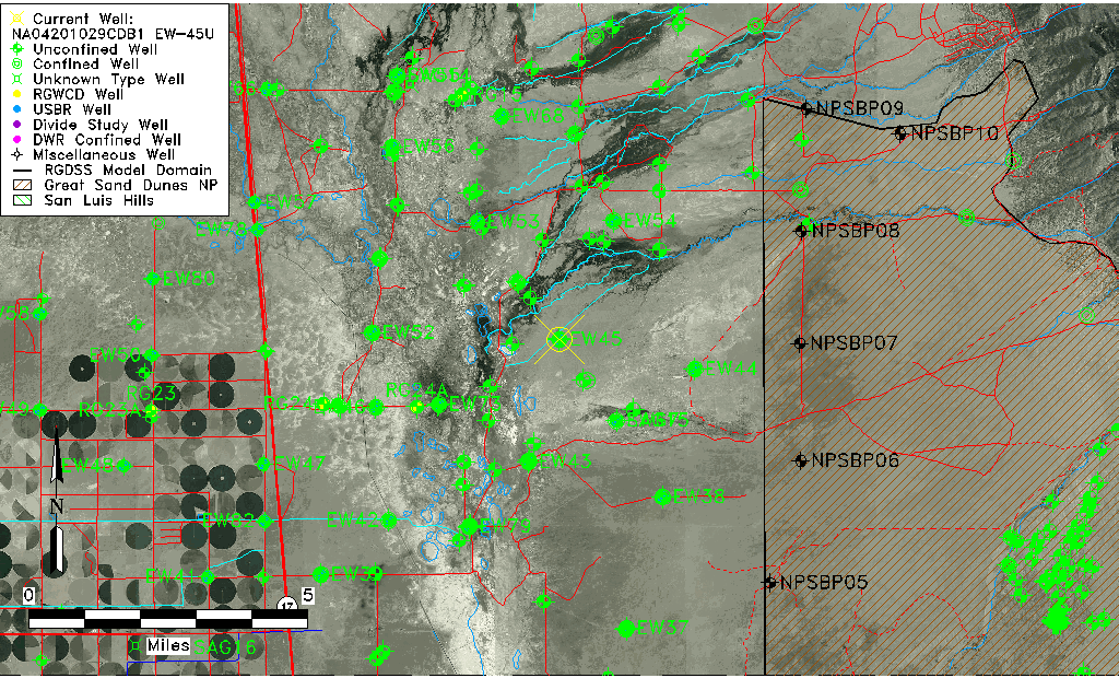
| USGS County | Saguache County |
| USGS Map Name | DEADMAN CAMP |
| USGS Map Scale | 24000 |
| Elevation and Depth Data |
|---|
| Ground Elevation (ft NAVD88) | 7545.32 |
| Elevation Data Source | USBOR EW well database |
| USBR Ground Elevation (ft NGVD29) | 7541.3 |
| USGS Ground Elevation (ft NGVD29) | 7541.30 |
| 1/3-Arc Second NED Ground Elevation (ft NAVD88) | 7543.98 |
| 1-Arc Second NED Ground Elevation (ft NAVD88) | 7544.42 |
| SRTM Ground Elevation (ft NAVD88) | 7545.75 |
| Total Depth (ft) | 45.00 |
| USBR Total Depth (ft) | 45 |
| USGS Hole Depth (ft) | 133.00 |
| USGS Well Depth (ft) | 42.20 |
| Model Layer | 1 |
| Model Layer Source | Aquifer Type |
| Depth of Bottom of Layer 1 | 113 |
| Depth of Bottom of Layer 2 | 348 |
| Depth of Bottom of Layer 3 | 1685 |
| Depth of Bottom of Layer 4 | 4437 |
| Additional Well Information | Logs, Construction |
| Aquifer Information |
|---|
| Aquifer Type | Unconfined |
| Aquifer Type Source | EW_AQFR |
| USGS Hydrologic Unit | San Luis |
| USGS Data Available | Water-level (GW.LEV) |
| Water-level Database Information |
|---|
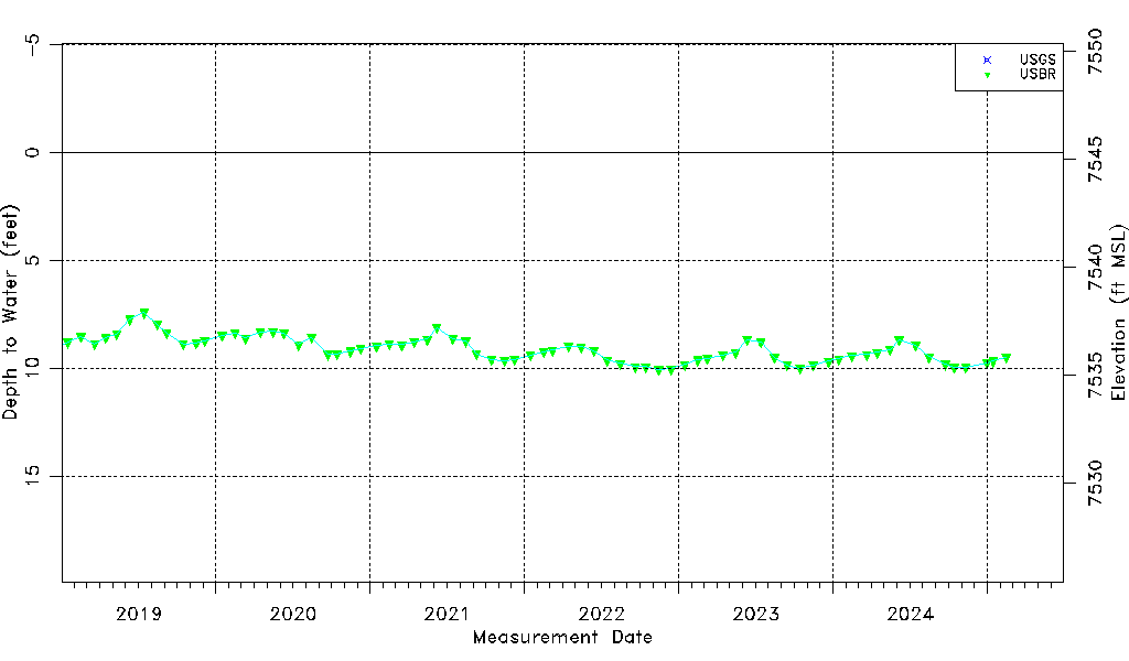
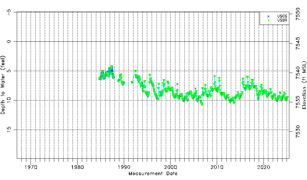
| Water-level Count | 647 |
| Water-level Date Range | 09/14/1984 thru 09/16/2025 |
| Monitored within the last 18 months | Yes, most recently on 09/16/2025 |
| Depth-to-Water Range (ft) | 4.18 to 10.65 |
| Water Table Elevation Range (ft NAVD88) | 7534.67 to 7541.14 |
| Water-Level-Source:Number-of-Measurements | USGS:363 USBR:460 |