| Well Information Table |
|---|
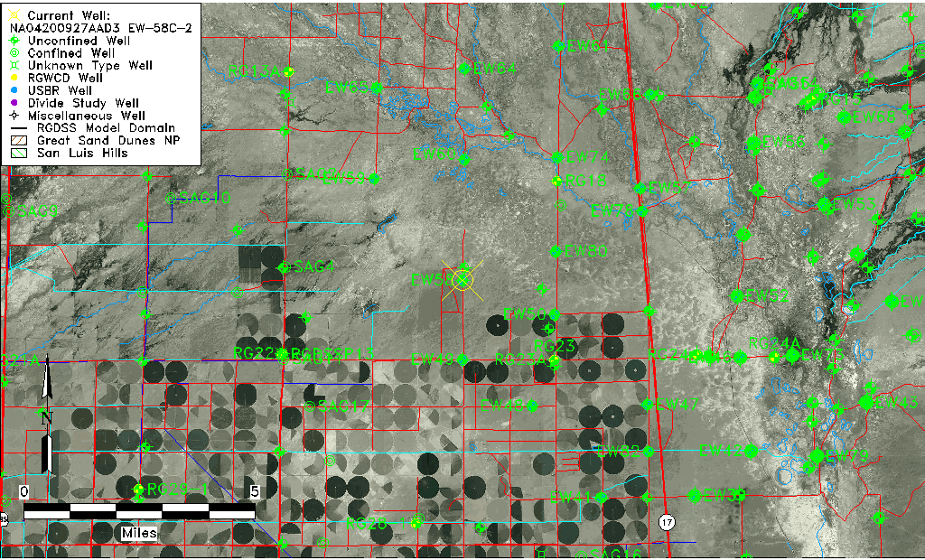
| Common Well ID | NA04200927AAD3 EW-58C-2 |
| USBR Well ID | EW58C2 |
| USGS Well ID | 375143105575303 |
| USGS Station Name | NA04200927AAD3 EW-58C-2 |
| USGS Construction Date | 05/25/1994 |
| USGS Site Type | Well |
| USGS Site Use Information | Observation |
| USGS Groundwater Use Information | Unknown |
| Data Source(s) | USGS, USBR |
| Location Data |
|---|
| TRS | NA04200927AAD3 EW-58C-2 |
| USBR TRS | NA04200927AAD3 |
| USGS TRS 1 | NA04200927AAD3 EW-58C-2 |
| Longitude/Latitude (NAD83) | -105.96548881 , 37.86100046 |
| Longitude/Latitude Data Source | USBOR EW well locations |
| USGS Longitude/Latitude (NAD83) | -105.965297900 , 37.861943970 |
| USBR Longitude/Latitude (NAD27) | -105.964913059271 , 37.8610009365042 |
| Easting, Northing RGDSS-NAD83 (US ft) | 115906.14 , 315058.93 |
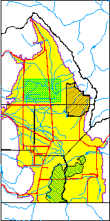
| USGS County | Saguache County |
| Elevation and Depth Data |
|---|
| Ground Elevation (ft NAVD88) | 7555.32 |
| Elevation Data Source | USBOR EW well database |
| USBR Ground Elevation (ft NGVD29) | 7551.4 |
| USGS Ground Elevation (ft NGVD29) | 7543.60 |
| 1/3-Arc Second NED Ground Elevation (ft NAVD88) | 7555.97 |
| 1-Arc Second NED Ground Elevation (ft NAVD88) | 7555.10 |
| SRTM Ground Elevation (ft NAVD88) | 7564.51 |
| Total Depth (ft) | 180.00 |
| USBR Total Depth (ft) | 180 |
| USGS Well Depth (ft) | 146.00 |
| Model Layer | 3 |
| Model Layer Source | Well Depth |
| Depth of Bottom of Layer 1 | 92 |
| Depth of Bottom of Layer 2 | 168 |
| Depth of Bottom of Layer 3 | 827 |
| Depth of Bottom of Layer 4 | 2818 |
| Additional Well Information | Construction |
| Aquifer Information |
|---|
| Aquifer Type | Confined |
| Aquifer Type Source | EW_AQFR |
| USGS Aquifer Type | Confined Single Aquifer |
| USGS Hydrologic Unit | Saguache |
| USGS Data Available | Water-level (GW.LEV) |
| Water-level Database Information |
|---|
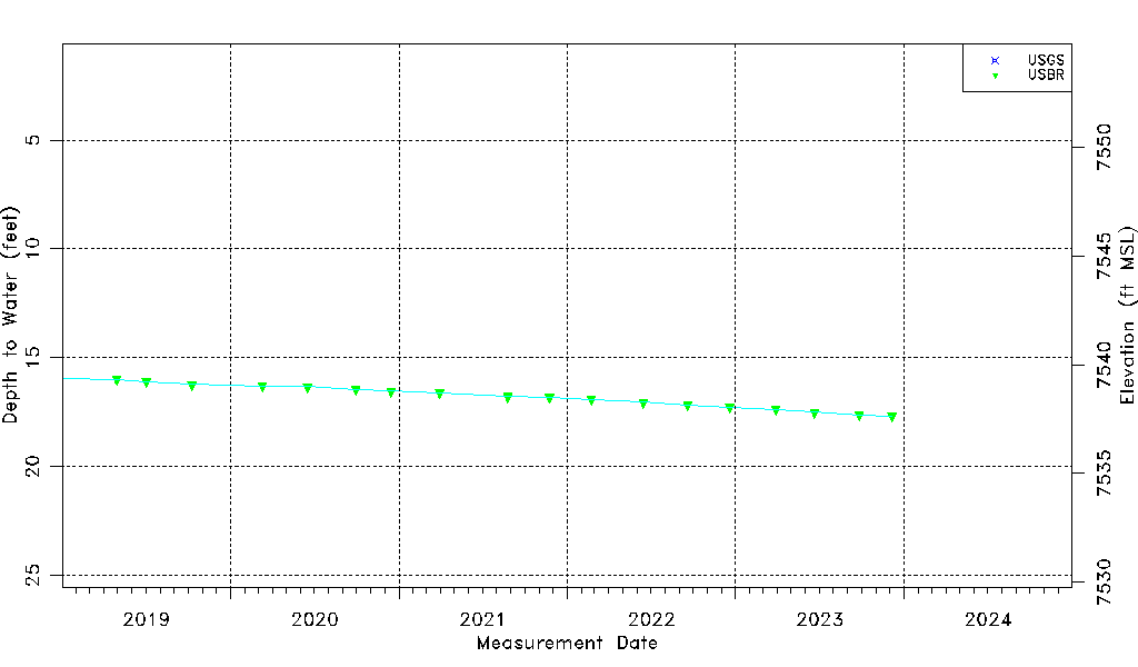
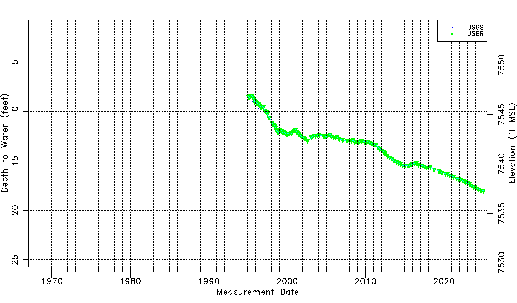
| Water-level Count | 170 |
| Water-level Date Range | 01/25/1995 thru 09/04/2025 |
| Monitored within the last 18 months | Yes, most recently on 09/04/2025 |
| Depth-to-Water Range (ft) | 8.43 to 18.46 |
| Water Table Elevation Range (ft NAVD88) | 7536.86 to 7546.89 |
| Water-Level-Source:Number-of-Measurements | USGS:27 USBR:168 |