| Well Information Table |
|---|
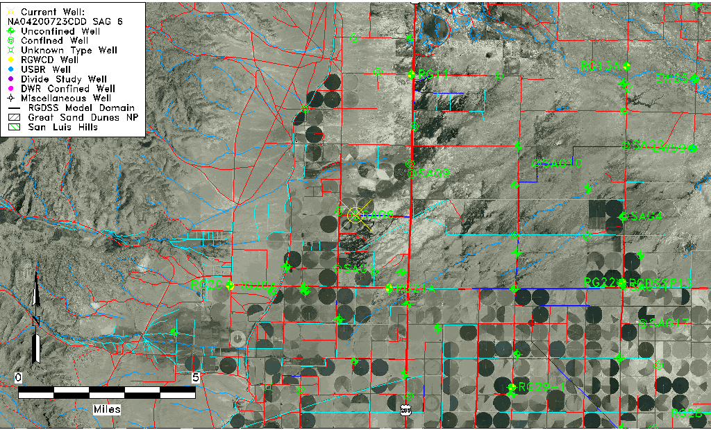
| Common Well ID | NA04200723CDD SAG 6 |
| RGWCD Confined Aquifer Well ID | SAG6 |
| USGS Well ID | 375154106102501 |
| USGS Station Name | NA04200723CDD SAG 6 |
| USGS Site Type | Well |
| USGS Site Use Information | Unused |
| USGS Groundwater Use Information | Unknown |
| Data Source(s) | USGS |
| Location Data |
|---|
| TRS | NA04200723CDD SAG 6 |
| USGS TRS 1 | NA04200723CDD SAG 6 |
| Longitude/Latitude (NAD83) | -106.17434131 , 37.86494816 |
| Longitude/Latitude Data Source | Davis Engineering Survey |
| USGS Longitude/Latitude (NAD83) | -106.174193800 , 37.865000840 |
| Easting, Northing RGDSS-NAD83 (US ft) | 55634.96 , 316757.67 |
| USGS Topography | Valley flat |
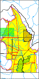
| USGS County | Saguache County |
| USGS Map Name | LA GARITA |
| USGS Map Scale | 24000 |
| Elevation and Depth Data |
|---|
| Ground Elevation (ft NAVD88) | 7635.31 |
| Elevation Data Source | Davis Engineering Survey |
| USGS Ground Elevation (ft NGVD29) | 7630.00 |
| 1/3-Arc Second NED Ground Elevation (ft NAVD88) | 7635.10 |
| 1-Arc Second NED Ground Elevation (ft NAVD88) | 7635.09 |
| SRTM Ground Elevation (ft NAVD88) | 7647.25 |
| Total Depth (ft) | 120.00 |
| USGS Well Depth (ft) | 120.00 |
| Model Layer | 2 |
| Model Layer Source | Well Depth |
| Depth of Bottom of Layer 1 | 107 |
| Depth of Bottom of Layer 2 | 184 |
| Depth of Bottom of Layer 3 | 339 |
| Depth of Bottom of Layer 4 | 1586 |
| Additional Well Information | NONE |
| Aquifer Information |
|---|
| Aquifer Type | Confined |
| Aquifer Type Source | RGWCD_AQ |
| USGS Hydrologic Unit | Saguache |
| USGS Data Available | Water-level (GW.LEV) |
| Water-level Database Information |
|---|
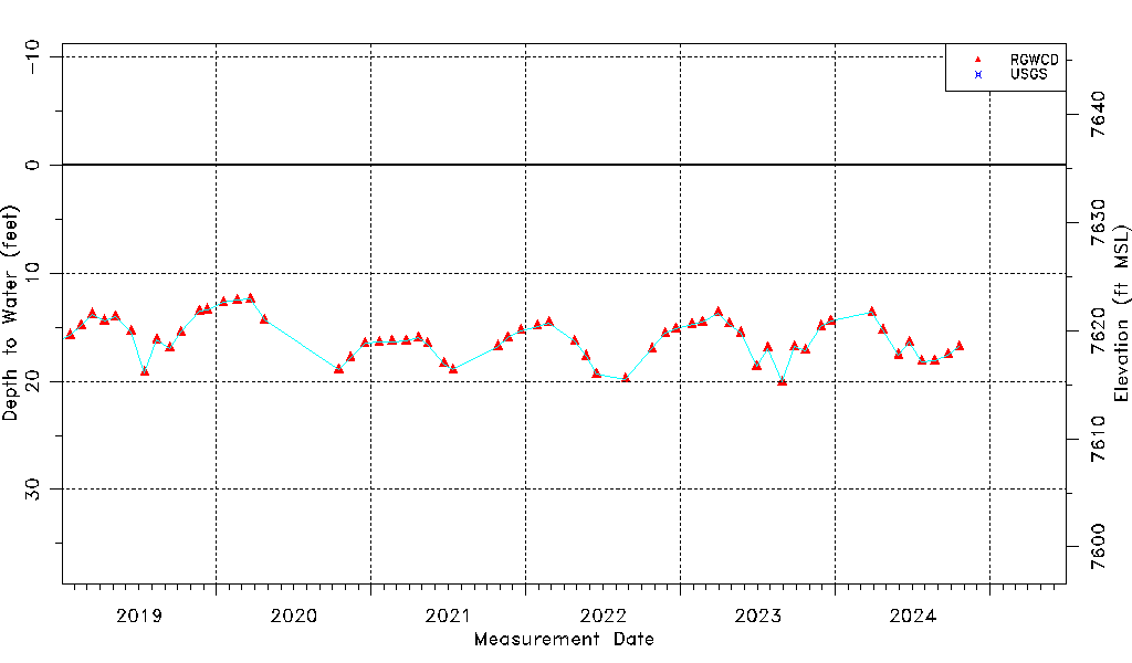
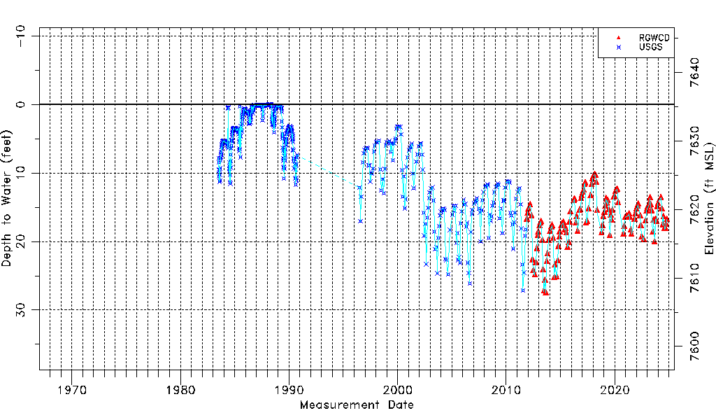
| Water-level Count | 731 |
| Water-level Date Range | 07/13/1983 thru 03/17/2026 |
| Monitored within the last 18 months | Yes, most recently on 03/17/2026 |
| Depth-to-Water Range (ft) | -0.03 to 27.49 |
| Water Table Elevation Range (ft NAVD88) | 7607.82 to 7635.34 |
| Water-Level-Source:Number-of-Measurements | RGWCD:157 USGS:574 |