| Well Information Table |
|---|
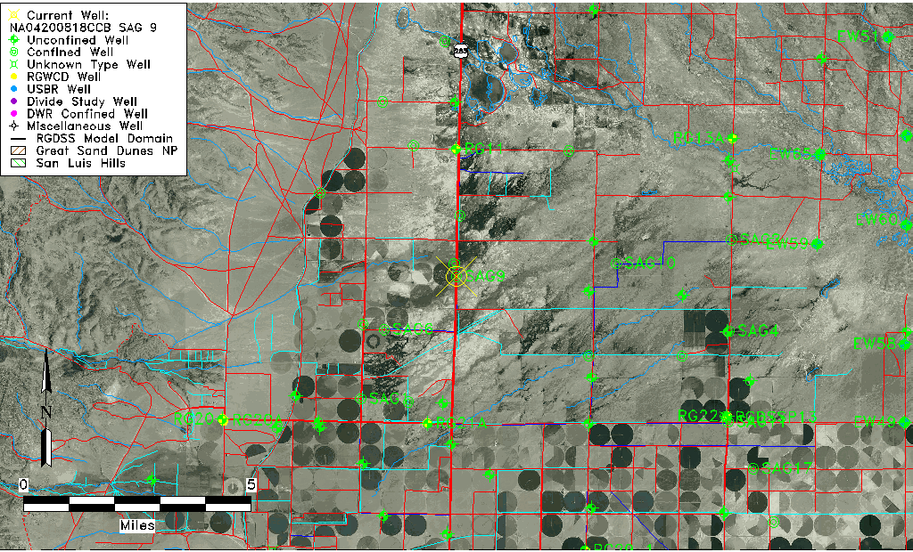
| Common Well ID | NA04200818CCB SAG 9 |
| RGWCD Confined Aquifer Well ID | SAG9 |
| USGS Well ID | 375255106084401 |
| USGS Station Name | NA04200818CCB SAG 9 |
| USGS Site Type | Well |
| USGS Site Use Information | Withdrawal of Water |
| USGS Groundwater Use Information | Unknown |
| Data Source(s) | USGS |
| Location Data |
|---|
| TRS | NA04200818CCB SAG 9 |
| USGS TRS 1 | NA04200818CCB SAG 9 |
| Longitude/Latitude (NAD83) | -106.14547614 , 37.88204129 |
| Longitude/Latitude Data Source | Davis Engineering Survey |
| USGS Longitude/Latitude (NAD83) | -106.146136900 , 37.881945000 |
| Easting, Northing RGDSS-NAD83 (US ft) | 63997.77 , 322936.20 |
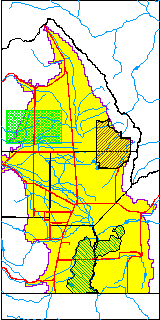
| USGS County | Saguache County |
| USGS Map Name | SWEDE CORNERS |
| USGS Map Scale | 24000 |
| Elevation and Depth Data |
|---|
| Ground Elevation (ft NAVD88) | 7610.90 |
| Elevation Data Source | Davis Engineering Survey |
| USGS Ground Elevation (ft NGVD29) | 7605.00 |
| 1/3-Arc Second NED Ground Elevation (ft NAVD88) | 7610.07 |
| 1-Arc Second NED Ground Elevation (ft NAVD88) | 7610.05 |
| SRTM Ground Elevation (ft NAVD88) | 7620.45 |
| Total Depth (ft) | 900.00 |
| USGS Well Depth (ft) | 900.00 |
| Model Layer | 4 |
| Model Layer Source | Well Depth |
| Depth of Bottom of Layer 1 | 88 |
| Depth of Bottom of Layer 2 | 160 |
| Depth of Bottom of Layer 3 | 370 |
| Depth of Bottom of Layer 4 | 1917 |
| Additional Well Information | NONE |
| Aquifer Information |
|---|
| Aquifer Type | Confined |
| Aquifer Type Source | RGWCD_AQ |
| USGS Hydrologic Unit | Saguache |
| USGS Data Available | Water-level (GW.LEV) |
| Water-level Database Information |
|---|
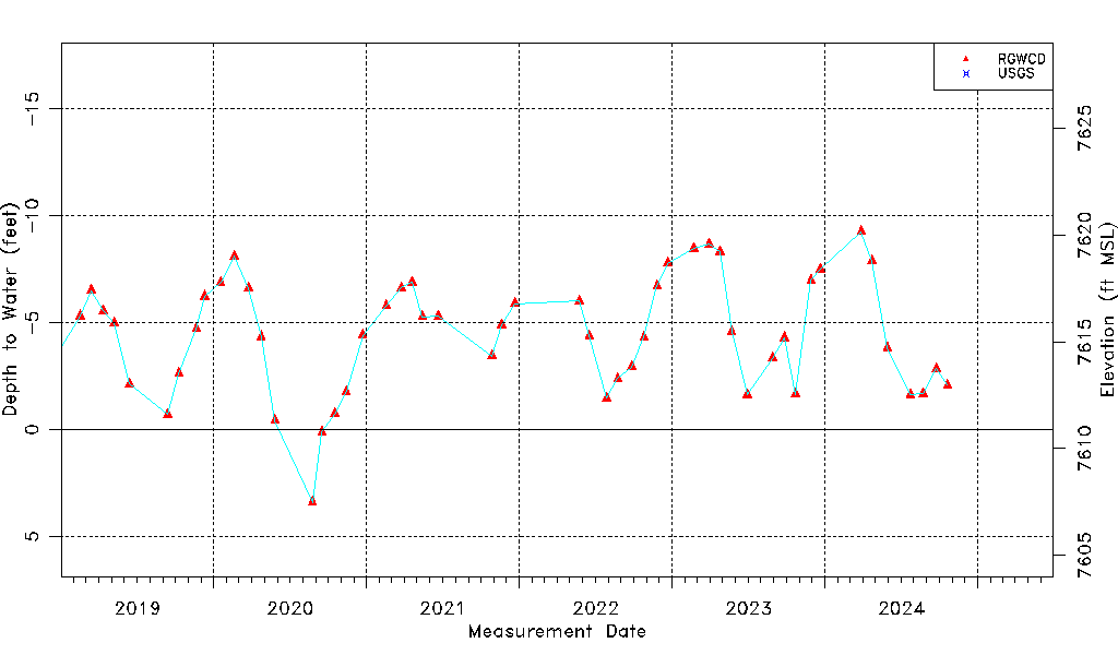
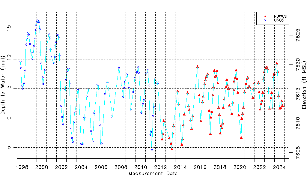
| Water-level Count | 224 |
| Water-level Date Range | 05/18/1998 thru 03/28/2025 |
| Monitored within the last 18 months | Yes, most recently on 03/28/2025 |
| Depth-to-Water Range (ft) | -16.60 to 5.40 |
| Water Table Elevation Range (ft NAVD88) | 7605.50 to 7627.50 |
| Water-Level-Source:Number-of-Measurements | RGWCD:119 USGS:105 |