| Well Information Table |
|---|
| Common Well ID | BACA-2 |
| Baca Well Name | BACA-2 |
| USGS Well ID | 375311105394301 |
| GSDNP Well Name | BACA-2 |
| USGS Station Name | BACA-2 |
| USGS Construction Date | 02/16/1996 |
| USGS Site Type | Well |
| USGS Site Use Information | Observation |
| USGS Groundwater Use Information | Unknown |
| Data Source(s) | USGS, HRS |
| Location Data |
|---|
| TRS | BACA-2 |
| USGS TRS 1 | BACA-2 |
| Longitude/Latitude (NAD83) | -105.66188826 , 37.88638864 |
| Longitude/Latitude Data Source | Davis Engineering Survey |
| USGS Longitude/Latitude (NAD83) | -105.661888900 , 37.886388890 |
| Halapaska & Assoc. Easting/Northing (CO-S) | 1953076.00000000 , 444152.000000000 |
| Easting, Northing RGDSS-NAD83 (US ft) | 203527.77 , 324161.10 |
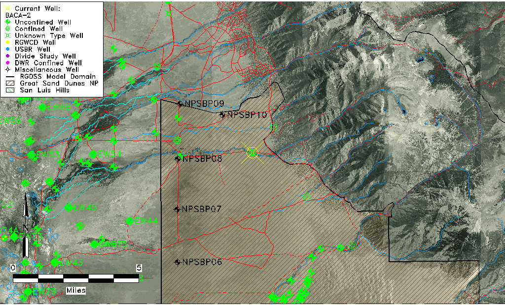
| USGS County | Saguache County |
| USGS Map Name | CRESTONE |
| USGS Map Scale | 24000 |
| Elevation and Depth Data |
|---|
| Ground Elevation (ft NAVD88) | 7747.78 |
| Elevation Data Source | Davis Engineering Survey |
| USGS Ground Elevation (ft NAVD88) | 7735.45 |
| BACA Well database (Halapaska & Assoc, ft NGVD29) | 7720 |
| HRS Dunes Well database (ft NGVD29) | 7720.00000 |
| 1/3-Arc Second NED Ground Elevation (ft NAVD88) | 7727.58 |
| 1-Arc Second NED Ground Elevation (ft NAVD88) | 7738.31 |
| SRTM Ground Elevation (ft NAVD88) | 7746.06 |
| Total Depth (ft) | 740.00 |
| USGS Hole Depth (ft) | 1000.00 |
| USGS Well Depth (ft) | 740.00 |
| Model Layer | 3 |
| Model Layer Source | Dunes Layer |
| Depth of Bottom of Layer 1 | 279 |
| Depth of Bottom of Layer 2 | 681 |
| Depth of Bottom of Layer 3 | 1278 |
| Depth of Bottom of Layer 4 | 2317 |
| Additional Well Information | NONE |
| Aquifer Information |
|---|
| Aquifer Type | Confined |
| Aquifer Type Source | HRS_AQUIFER |
| USGS Primary Aquifer | Valley-fill Deposits |
| USGS Aquifer Type | Confined Multiple Aquifers |
| USGS Hydrologic Unit | San Luis |
| USGS Data Available | Discharge (GW.DISC) |
| Water-level Database Information |
|---|
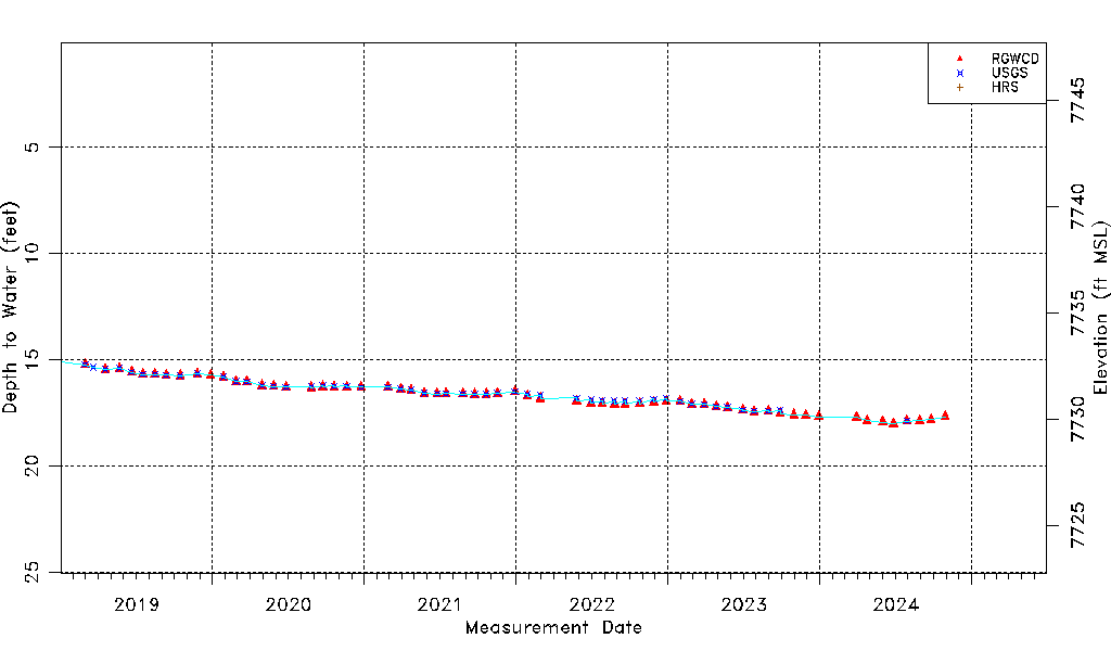
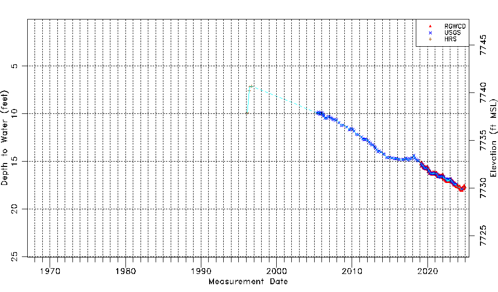
| Water-level Count | 162 |
| Water-level Date Range | 02/17/1996 thru 10/29/2024 |
| Monitored within the last 18 months | No, most recently on 10/29/2024 |
| Depth-to-Water Range (ft) | 7.10 to 18.00 |
| Water Table Elevation Range (ft NAVD88) | 7729.78 to 7740.68 |
| Water-Level-Source:Number-of-Measurements | RGWCD:63 USGS:128 HRS:4 |