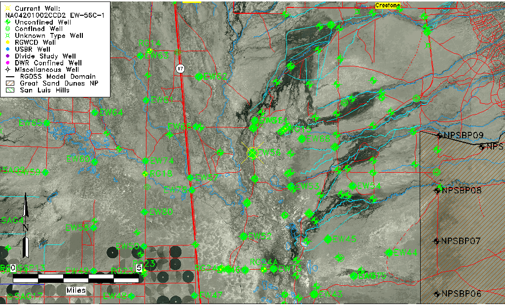
| Well Information Table |
|---|
| Common Well ID | NA04201002CCD2 EW-56C-1 |
| USBR Well ID | EW56C1 |
| USGS Well ID | 375415105505602 |
| GSDNP Well Name | 375415105505602 |
| USGS Station Name | NA04201002CCD2 EW-56C-1 |
| USGS Site Type | Well |
| USGS Site Use Information | Observation |
| USGS Groundwater Use Information | Unknown |
| Data Source(s) | USGS, USBR |
| Location Data |
|---|
| TRS | NA04201002CCD2 EW-56C-1 |
| USBR TRS | NA04201002CCD2 |
| USGS TRS 1 | NA04201002CCD2 EW-56C-1 |
| Longitude/Latitude (NAD83) | -105.85023719 , 37.90458187 |
| Longitude/Latitude Data Source | USBOR EW well locations |
| USGS Longitude/Latitude (NAD83) | -105.849461000 , 37.904166000 |
| USBR Longitude/Latitude (NAD27) | -105.849664965328 , 37.9045825095421 |
| Easting, Northing RGDSS-NAD83 (US ft) | 149200.83 , 330837.38 |
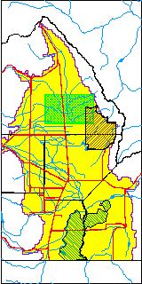
| USGS County | Saguache County |
| Elevation and Depth Data |
|---|
| Ground Elevation (ft NAVD88) | 7541.70 |
| Elevation Data Source | USBOR EW well database |
| USBR Ground Elevation (ft NGVD29) | 7537.8 |
| USGS Ground Elevation (ft NGVD29) | 7537.85 |
| 1/3-Arc Second NED Ground Elevation (ft NAVD88) | 7541.50 |
| 1-Arc Second NED Ground Elevation (ft NAVD88) | 7541.07 |
| SRTM Ground Elevation (ft NAVD88) | 7549.18 |
| Total Depth (ft) | 123.00 |
| USBR Total Depth (ft) | 123 |
| USGS Well Depth (ft) | 108.00 |
| Model Layer | 2 |
| Model Layer Source | Well Depth |
| Depth of Bottom of Layer 1 | 91 |
| Depth of Bottom of Layer 2 | 245 |
| Depth of Bottom of Layer 3 | 1446 |
| Depth of Bottom of Layer 4 | 4869 |
| Additional Well Information | NONE |
| Aquifer Information |
|---|
| Aquifer Type | Confined |
| Aquifer Type Source | EW_AQFR |
| USGS Hydrologic Unit | San Luis |
| USGS Data Available | Water-level (GW.LEV) |
| Water-level Database Information |
|---|
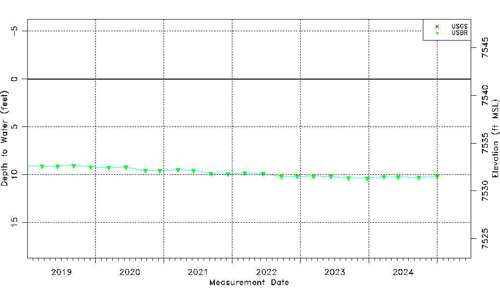
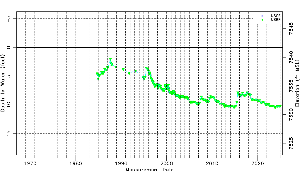
| Water-level Count | 301 |
| Water-level Date Range | 09/14/1984 thru 09/16/2025 |
| Monitored within the last 18 months | Yes, most recently on 09/16/2025 |
| Depth-to-Water Range (ft) | 2.08 to 10.57 |
| Water Table Elevation Range (ft NAVD88) | 7531.13 to 7539.62 |
| Water-Level-Source:Number-of-Measurements | USGS:161 USBR:233 |