| Well Information Table |
|---|
| Common Well ID | BACA SW-6 |
| Baca Well Name | SW-6 |
| USGS Well ID | 375501105440101 |
| GSDNP Well Name | SW-6 |
| USGS Station Name | BACA SW-6 |
| USGS Construction Date | 11/01/1995 |
| USGS Site Type | Well |
| USGS Site Use Information | Observation |
| USGS Groundwater Use Information | Unknown |
| Data Source(s) | USGS, HRS |
| Location Data |
|---|
| TRS | BACA SW-6 |
| USGS TRS 1 | BACA SW-6 |
| Longitude/Latitude (NAD83) | -105.73356256 , 37.91690949 |
| Longitude/Latitude Data Source | Davis Engineering Survey |
| USGS Longitude/Latitude (NAD83) | -105.733566700 , 37.916908300 |
| Halapaska & Assoc. Easting/Northing (CO-S) | 1932784.00000000 , 455311.000000000 |
| Easting, Northing RGDSS-NAD83 (US ft) | 182857.59 , 335278.90 |
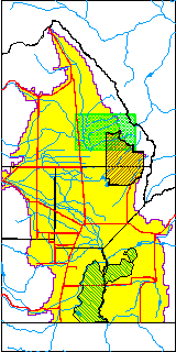
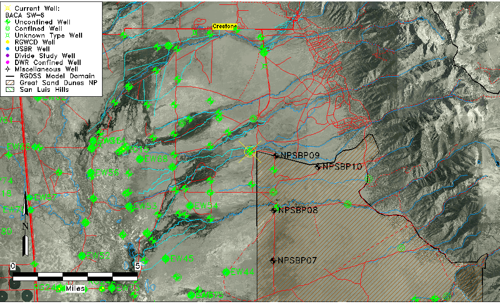
| USGS County | Saguache County |
| USGS Map Name | SHEDS CAMP |
| USGS Map Scale | 24000 |
| Elevation and Depth Data |
|---|
| Ground Elevation (ft NAVD88) | 7618.09 |
| Elevation Data Source | USGS GWSI database |
| USGS Ground Elevation (ft NAVD88) | 7618.09 |
| BACA Well database (Halapaska & Assoc, ft NGVD29) | 7620 |
| HRS Dunes Well database (ft NGVD29) | 7620.00000 |
| 1/3-Arc Second NED Ground Elevation (ft NAVD88) | 7621.24 |
| 1-Arc Second NED Ground Elevation (ft NAVD88) | 7618.50 |
| SRTM Ground Elevation (ft NAVD88) | 7627.95 |
| Total Depth (ft) | 161.00 |
| USGS Hole Depth (ft) | 180.00 |
| USGS Well Depth (ft) | 161.00 |
| Model Layer | 1 |
| Model Layer Source | Dunes Layer |
| Depth of Bottom of Layer 1 | 163 |
| Depth of Bottom of Layer 2 | 549 |
| Depth of Bottom of Layer 3 | 1435 |
| Depth of Bottom of Layer 4 | 3641 |
| Additional Well Information | NONE |
| Aquifer Information |
|---|
| Aquifer Type | Unconfined |
| Aquifer Type Source | HRS_AQUIFER |
| USGS Primary Aquifer | Valley-fill Deposits |
| USGS Aquifer Type | Unconfined Single Aquifer |
| USGS Hydrologic Unit | San Luis |
| USGS Data Available | Discharge (GW.DISC) |
| Water-level Database Information |
|---|
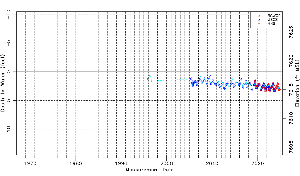
| Water-level Count | 163 |
| Water-level Date Range | 11/02/1995 thru 10/29/2024 |
| Monitored within the last 18 months | No, most recently on 10/29/2024 |
| Depth-to-Water Range (ft) | 0.60 to 3.38 |
| Water Table Elevation Range (ft NAVD88) | 7614.71 to 7617.49 |
| Water-Level-Source:Number-of-Measurements | RGWCD:63 USGS:132 HRS:4 |