| Well Information Table |
|---|
| Common Well ID | BACA SW-8 |
| Baca Well Name | SW-8 |
| USGS Well ID | 375507105510011 |
| GSDNP Well Name | SW-8 |
| USGS Station Name | BACA SW-8 |
| USGS Construction Date | 11/07/1995 |
| USGS Site Type | Well |
| USGS Site Use Information | Observation |
| USGS Groundwater Use Information | Unknown |
| Data Source(s) | USGS, HRS |
| Location Data |
|---|
| TRS | BACA SW-8 |
| USGS TRS 1 | BACA SW-8 |
| Longitude/Latitude (NAD83) | -105.84978697 , 37.91868820 |
| Longitude/Latitude Data Source | BACA wells reported by Halepaska |
| USGS Longitude/Latitude (NAD83) | -105.849775000 , 37.918697200 |
| Halapaska & Assoc. Easting/Northing (CO-S) | 1899261.00000000 , 456065.000000000 |
| Easting, Northing RGDSS-NAD83 (US ft) | 149340.92 , 335972.31 |
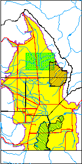
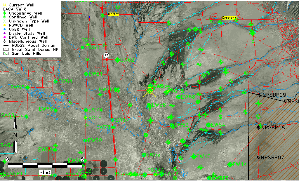
| USGS County | Saguache County |
| USGS Map Name | SHEDS CAMP |
| USGS Map Scale | 24000 |
| Elevation and Depth Data |
|---|
| Ground Elevation (ft NAVD88) | 7542.57 |
| Elevation Data Source | USGS GWSI database |
| USGS Ground Elevation (ft NAVD88) | 7542.57 |
| BACA Well database (Halapaska & Assoc, ft NGVD29) | 7541 |
| HRS Dunes Well database (ft NGVD29) | 7540.00000 |
| 1/3-Arc Second NED Ground Elevation (ft NAVD88) | 7544.14 |
| 1-Arc Second NED Ground Elevation (ft NAVD88) | 7543.96 |
| SRTM Ground Elevation (ft NAVD88) | 7555.77 |
| Total Depth (ft) | 99.00 |
| USGS Hole Depth (ft) | 140.00 |
| USGS Well Depth (ft) | 99.00 |
| Model Layer | 1 |
| Model Layer Source | Dunes Layer |
| Depth of Bottom of Layer 1 | 85 |
| Depth of Bottom of Layer 2 | 240 |
| Depth of Bottom of Layer 3 | 1437 |
| Depth of Bottom of Layer 4 | 5006 |
| Additional Well Information | NONE |
| Aquifer Information |
|---|
| Aquifer Type | Unconfined |
| Aquifer Type Source | HRS_AQUIFER |
| USGS Primary Aquifer | Valley-fill Deposits |
| USGS Aquifer Type | Unconfined Single Aquifer |
| USGS Hydrologic Unit | San Luis |
| USGS Data Available | Discharge (GW.DISC) |
| Water-level Database Information |
|---|
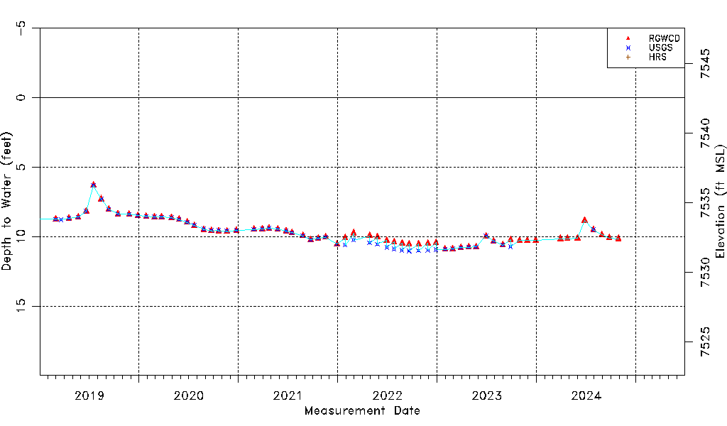
| Water-level Count | 176 |
| Water-level Date Range | 11/29/1995 thru 10/29/2024 |
| Monitored within the last 18 months | No, most recently on 10/29/2024 |
| Depth-to-Water Range (ft) | 3.90 to 11.04 |
| Water Table Elevation Range (ft NAVD88) | 7531.53 to 7538.67 |
| Water-Level-Source:Number-of-Measurements | RGWCD:65 USGS:144 HRS:6 |