| Well Information Table |
|---|
| Common Well ID | NA04301035CAC1 EW-55U |
| USBR Well ID | EW55U |
| USGS Well ID | 375523105505301 |
| GSDNP Well Name | 375523105505301 |
| USGS Station Name | NA04301035CAC1 EW-55U |
| USGS Site Type | Well |
| USGS Site Use Information | Observation |
| USGS Groundwater Use Information | Unknown |
| Data Source(s) | USGS, USBR |
| Location Data |
|---|
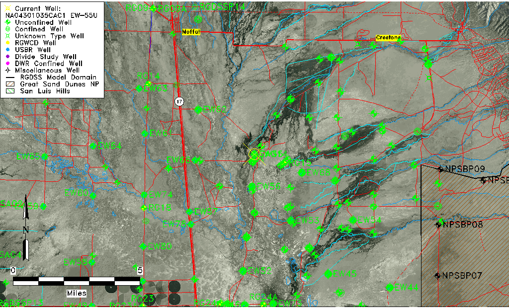
| TRS | NA04301035CAC1 EW-55U |
| USBR TRS | NA04301035CAC1 |
| USGS TRS 1 | NA04301035CAC1 EW-55U |
| Longitude/Latitude (NAD83) | -105.84855232 , 37.92302001 |
| Longitude/Latitude Data Source | USBOR EW well locations |
| USGS Longitude/Latitude (NAD83) | -105.848627300 , 37.923054870 |
| USBR Longitude/Latitude (NAD27) | -105.847980581690 , 37.9230206924459 |
| Easting, Northing RGDSS-NAD83 (US ft) | 149700.09 , 337548.53 |
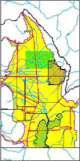
| USGS County | Saguache County |
| Elevation and Depth Data |
|---|
| Ground Elevation (ft NAVD88) | 7546.46 |
| Elevation Data Source | USBOR EW well database |
| USBR Ground Elevation (ft NGVD29) | 7542.5 |
| USGS Ground Elevation (ft NGVD29) | 7542.51 |
| 1/3-Arc Second NED Ground Elevation (ft NAVD88) | 7544.34 |
| 1-Arc Second NED Ground Elevation (ft NAVD88) | 7545.27 |
| SRTM Ground Elevation (ft NAVD88) | 7552.49 |
| Total Depth (ft) | 43.00 |
| USBR Total Depth (ft) | 43 |
| USGS Well Depth (ft) | 38.00 |
| Model Layer | 1 |
| Model Layer Source | Aquifer Type |
| Depth of Bottom of Layer 1 | 91 |
| Depth of Bottom of Layer 2 | 244 |
| Depth of Bottom of Layer 3 | 1420 |
| Depth of Bottom of Layer 4 | 4916 |
| Additional Well Information | NONE |
| Aquifer Information |
|---|
| Aquifer Type | Unconfined |
| Aquifer Type Source | EW_AQFR |
| USGS Hydrologic Unit | San Luis |
| USGS Data Available | Water-level (GW.LEV) |
| Water-level Database Information |
|---|
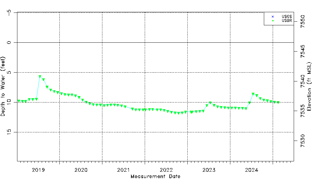
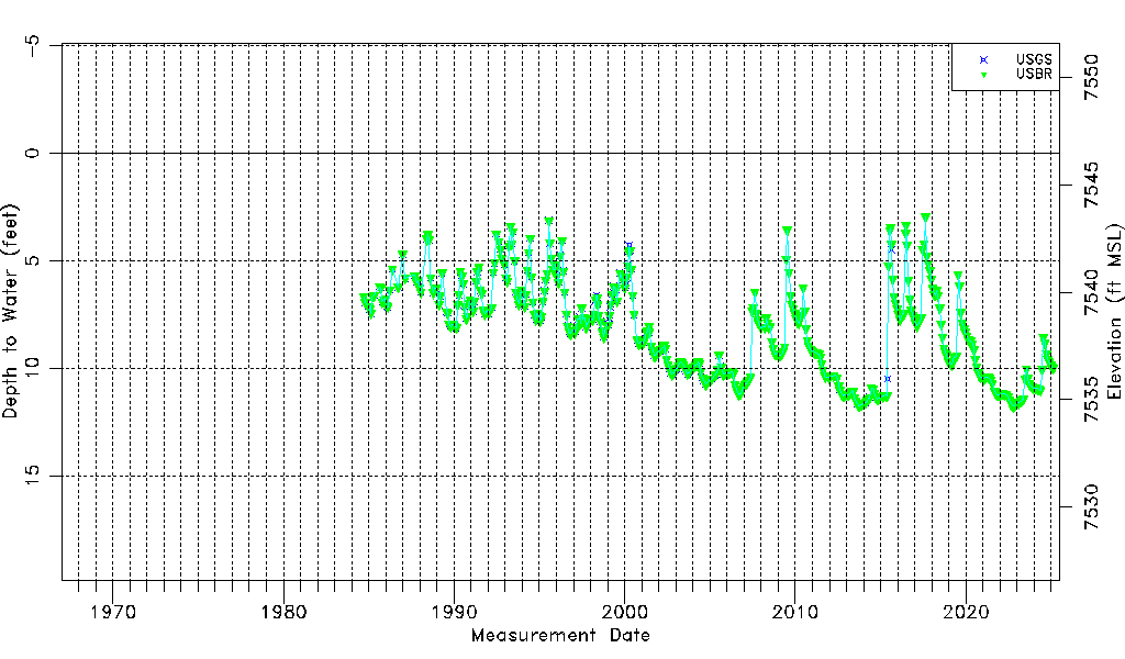
| Water-level Count | 532 |
| Water-level Date Range | 09/14/1984 thru 09/15/2025 |
| Monitored within the last 18 months | Yes, most recently on 09/15/2025 |
| Depth-to-Water Range (ft) | 2.97 to 11.76 |
| Water Table Elevation Range (ft NAVD88) | 7534.70 to 7543.49 |
| Water-Level-Source:Number-of-Measurements | USGS:253 USBR:456 |