| Well Information Table |
|---|
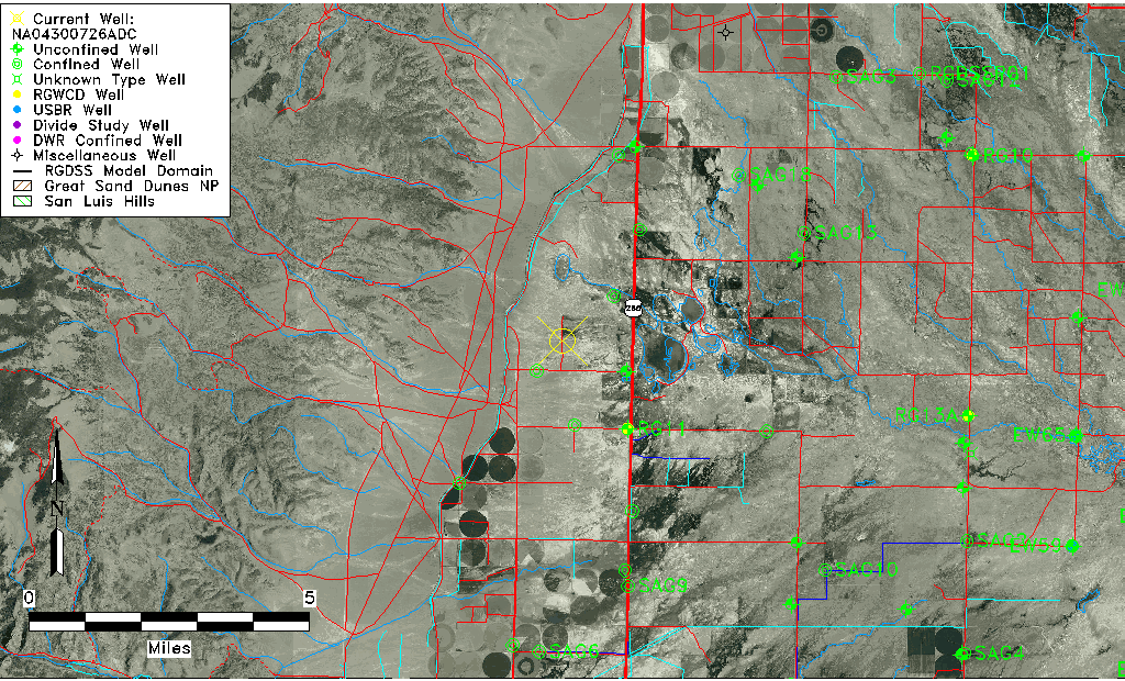
| Common Well ID | NA04300726ADC |
| USGS Station Name | NA04300726ADC |
| USGS Site Type | NNNNNYNNNNNNNNNNNNNN |
| USGS Site Use Information | Unknown |
| USGS Groundwater Use Information | Unknown |
| Data Source(s) | USGS |
| Location Data |
|---|
| TRS | NA04300726ADC |
| USGS TRS 1 | NA04300726ADC |
| Longitude/Latitude (NAD83) | -106.16724778 , 37.94527833 |
| Longitude/Latitude Data Source | GWSI decimal LAT/LONG field |
| USGS Longitude/Latitude (NAD83) | -106.167247778 , 37.945278333 |
| Easting, Northing RGDSS-NAD83 (US ft) | 57839.99 , 345990.88 |
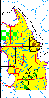
| USGS County | Saguache County |
| Elevation and Depth Data |
|---|
| Ground Elevation (ft NAVD88) | 7614.53 |
| Elevation Data Source | USGS GWSI database |
| USGS Ground Elevation (ft NGVD29) | 7610.00 |
| 1/3-Arc Second NED Ground Elevation (ft NAVD88) | 7618.39 |
| 1-Arc Second NED Ground Elevation (ft NAVD88) | 7617.97 |
| SRTM Ground Elevation (ft NAVD88) | 7634.20 |
| Depth of Bottom of Layer 1 | 80 |
| Depth of Bottom of Layer 2 | 195 |
| Additional Well Information | NONE |
| Aquifer Information |
|---|
| Aquifer Type | Unknown |
| Aquifer Type Source | None |
| Water-level Database Information |
|---|
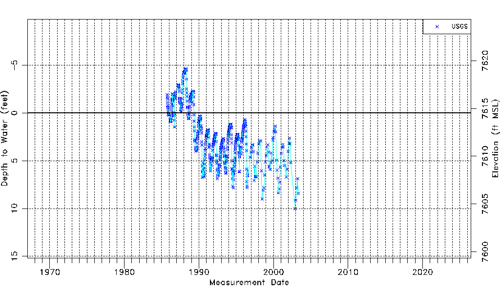
| Water-level Count | 554 |
| Water-level Date Range | 10/01/1985 thru 04/29/2003 |
| Monitored within the last 18 months | No, most recently on 04/29/2003 |
| Depth-to-Water Range (ft) | -4.63 to 9.99 |
| Water Table Elevation Range (ft NAVD88) | 7604.54 to 7619.16 |
| Water-Level-Source:Number-of-Measurements | USGS:554 |