| Well Information Table |
|---|
| Common Well ID | BACA SW-3 |
| Baca Well Name | SW-3 |
| USGS Well ID | 375717105492001 |
| GSDNP Well Name | SW-3 |
| USGS Station Name | BACA SW-3 |
| USGS Construction Date | 10/28/1995 |
| USGS Site Type | Well |
| USGS Site Use Information | Observation |
| USGS Groundwater Use Information | Unknown |
| Data Source(s) | USGS, HRS |
| Location Data |
|---|
| TRS | BACA SW-3 |
| USGS TRS 1 | BACA SW-3 |
| Longitude/Latitude (NAD83) | -105.82224601 , 37.95454563 |
| Longitude/Latitude Data Source | Davis Engineering Survey |
| USGS Longitude/Latitude (NAD83) | -105.822250000 , 37.954547200 |
| Halapaska & Assoc. Easting/Northing (CO-S) | 1907246.00000000 , 469093.000000000 |
| Easting, Northing RGDSS-NAD83 (US ft) | 157305.51 , 349010.98 |
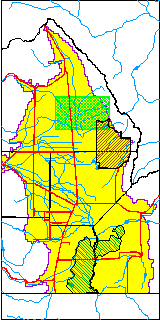
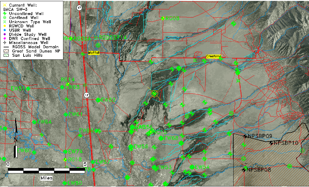
| USGS County | Saguache County |
| USGS Map Name | SHEDS CAMP |
| USGS Map Scale | 24000 |
| Elevation and Depth Data |
|---|
| Ground Elevation (ft NAVD88) | 7571.85 |
| Elevation Data Source | USGS GWSI database |
| USGS Ground Elevation (ft NAVD88) | 7571.85 |
| BACA Well database (Halapaska & Assoc, ft NGVD29) | 7567 |
| HRS Dunes Well database (ft NGVD29) | 7567.00000 |
| 1/3-Arc Second NED Ground Elevation (ft NAVD88) | 7570.48 |
| 1-Arc Second NED Ground Elevation (ft NAVD88) | 7573.94 |
| SRTM Ground Elevation (ft NAVD88) | 7578.64 |
| Total Depth (ft) | 221.00 |
| USGS Hole Depth (ft) | 230.00 |
| USGS Well Depth (ft) | 221.00 |
| Model Layer | 1 |
| Model Layer Source | Dunes Layer |
| Depth of Bottom of Layer 1 | 131 |
| Depth of Bottom of Layer 2 | 314 |
| Depth of Bottom of Layer 3 | 1458 |
| Depth of Bottom of Layer 4 | 4499 |
| Additional Well Information | NONE |
| Aquifer Information |
|---|
| Aquifer Type | Unconfined |
| Aquifer Type Source | HRS_AQUIFER |
| USGS Primary Aquifer | Valley-fill Deposits |
| USGS Aquifer Type | Unconfined Single Aquifer |
| USGS Hydrologic Unit | San Luis |
| USGS Data Available | Discharge (GW.DISC) |
| Water-level Database Information |
|---|
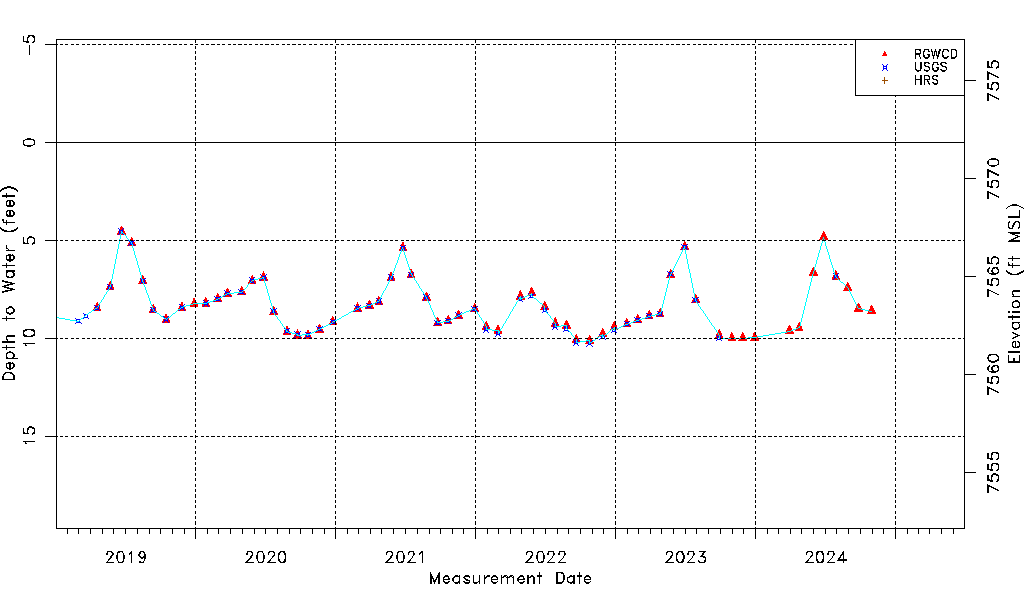
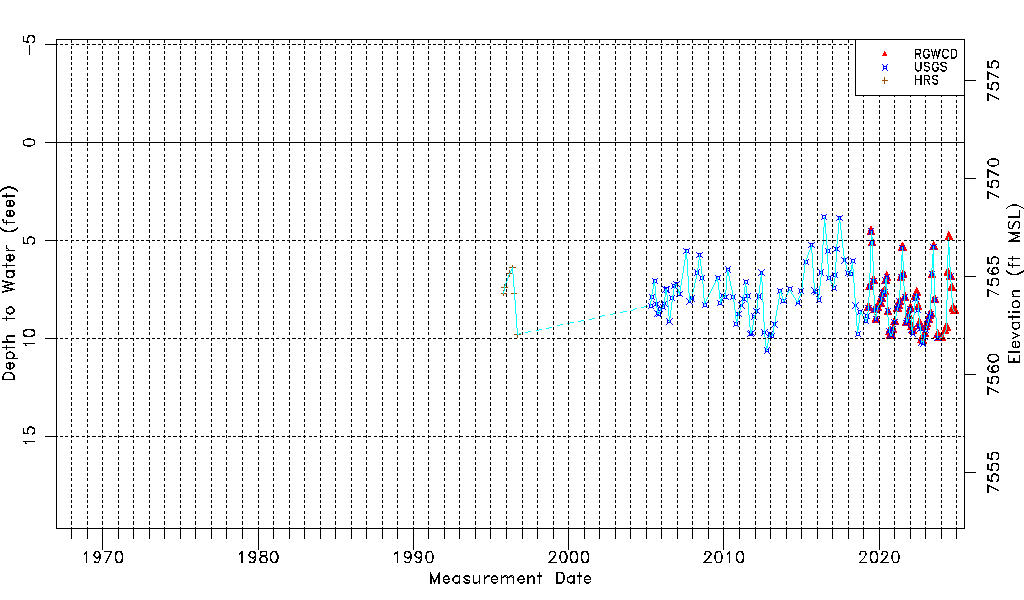
| Water-level Count | 161 |
| Water-level Date Range | 11/01/1995 thru 10/30/2024 |
| Monitored within the last 18 months | No, most recently on 10/30/2024 |
| Depth-to-Water Range (ft) | 3.81 to 10.62 |
| Water Table Elevation Range (ft NAVD88) | 7561.23 to 7568.04 |
| Water-Level-Source:Number-of-Measurements | RGWCD:64 USGS:126 HRS:6 |