| Well Information Table |
|---|
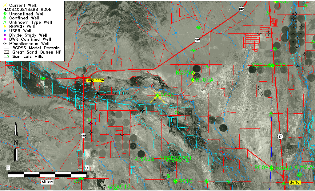
| Common Well ID | NA04400814ABB RG06 |
| RGWCD Well ID | RG06 |
| USGS Well ID | 380421106033001 |
| USGS Station Name | NA04400814ABB RG06 |
| USGS Site Type | Well |
| USGS Site Use Information | Observation |
| USGS Groundwater Use Information | Unused |
| Data Source(s) | USGS, RGWCD |
| Location Data |
|---|
| TRS | NA04400814ABB RG06 |
| RGWCD TRS | NA04400814ABB |
| USGS TRS 1 | NA04400814ABB RG06 |
| Longitude/Latitude (NAD83) | -106.05515689 , 38.07239557 |
| Longitude/Latitude Data Source | RGWCD/Davis Engineering |
| RGWCD Longitude/Latitude (NAD83) | -106:03:18.5648 , 38:04:20.62404 |
| USGS Longitude/Latitude (NAD83) | -106.058908100 , 38.072499680 |
| Easting, Northing RGDSS-NAD83 (US ft) | 90350.23 , 392112.79 |
| USGS Topography | Valley flat |
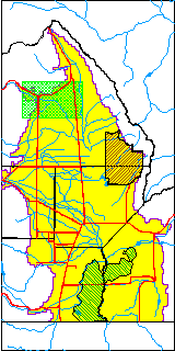
| USGS County | Saguache County |
| USGS Map Name | HICKEY BRIDGE |
| USGS Map Scale | 24000 |
| Elevation and Depth Data |
|---|
| Ground Elevation (ft NAVD88) | 7625.07 |
| Elevation Data Source | RGWCD well database |
| RGWCD Measuring Point Elevation (ft NAVD88) | 7627.070 |
| RGWCD Well Riser Height (ft) | 2.000 |
| RGWCD Ground Surface (ft NAVD88) | 7625.07 |
| USGS Ground Elevation (ft NGVD29) | 7625.00 |
| 1/3-Arc Second NED Ground Elevation (ft NAVD88) | 7624.62 |
| 1-Arc Second NED Ground Elevation (ft NAVD88) | 7624.88 |
| SRTM Ground Elevation (ft NAVD88) | 7631.23 |
| Total Depth (ft) | 63.30 |
| USGS Well Depth (ft) | 63.30 |
| Model Layer | 1 |
| Model Layer Source | RGWCD |
| Depth of Bottom of Layer 1 | 136 |
| Depth of Bottom of Layer 2 | 236 |
| Depth of Bottom of Layer 3 | 556 |
| Depth of Bottom of Layer 4 | 1196 |
| Additional Well Information | NONE |
| Aquifer Information |
|---|
| Aquifer Type | Unconfined |
| Aquifer Type Source | RGWCD_AQ |
| USGS Hydrologic Unit | Saguache |
| USGS Data Available | Water-level (GW.LEV) |
| Water-level Database Information |
|---|
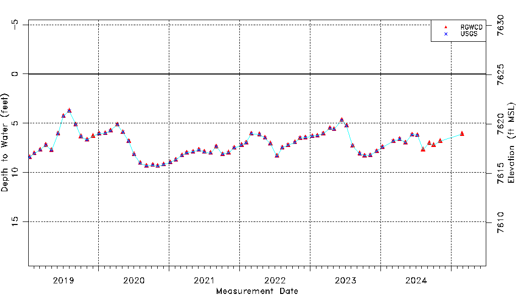
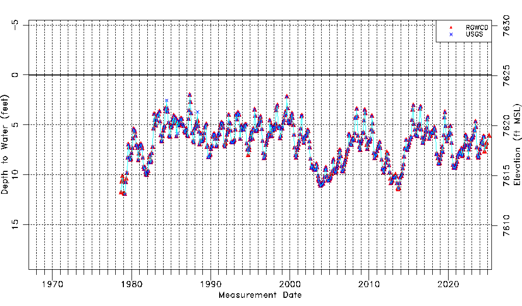
| Water-level Count | 578 |
| Water-level Date Range | 09/05/1978 thru 06/12/2026 |
| Monitored within the last 18 months | Yes, most recently on 06/12/2026 |
| Depth-to-Water Range (ft) | 2.02 to 11.95 |
| Water Table Elevation Range (ft NAVD88) | 7613.12 to 7623.05 |
| Water-Level-Source:Number-of-Measurements | RGWCD:569 USGS:530 |