| Well Information Table |
|---|
| Common Well ID | NA04400906DDD2 RG05A |
| RGWCD Well ID | RG05A |
| USGS Well ID | 380512106004901 |
| USGS Station Name | NA04400906DDD2 RG05A |
| USGS Construction Date | 09/25/1979 |
| USGS Site Type | Well |
| USGS Site Use Information | Observation |
| USGS Groundwater Use Information | Unused |
| Data Source(s) | USGS, RGWCD |
| Location Data |
|---|
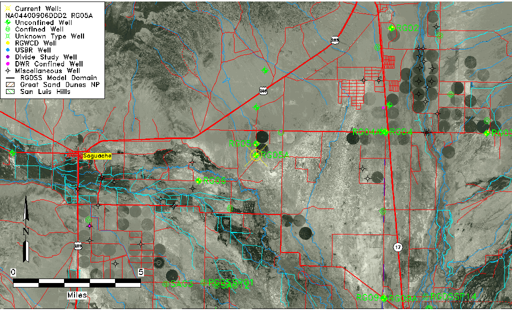
| TRS | NA04400906DDD2 RG05A |
| RGWCD TRS | NA04400906DDD2 |
| USGS TRS 1 | NA04400906DDD2 RG05A |
| Longitude/Latitude (NAD83) | -106.01397358 , 38.08711388 |
| Longitude/Latitude Data Source | RGWCD/Davis Engineering |
| RGWCD Longitude/Latitude (NAD83) | -106:00:50.3049 , 38:05:13.60996 |
| USGS Longitude/Latitude (NAD83) | -106.014183900 , 38.086666160 |
| Easting, Northing RGDSS-NAD83 (US ft) | 102222.78 , 397423.47 |
| USGS Topography | Valley flat |
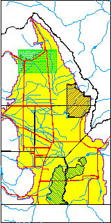
| USGS County | Saguache County |
| USGS Map Name | HICKEY BRIDGE |
| USGS Map Scale | 24000 |
| Elevation and Depth Data |
|---|
| Ground Elevation (ft NAVD88) | 7632.77 |
| Elevation Data Source | RGWCD well database |
| RGWCD Measuring Point Elevation (ft NAVD88) | 7634.767 |
| RGWCD Well Riser Height (ft) | 2.000 |
| RGWCD Ground Surface (ft NAVD88) | 7632.77 |
| USGS Ground Elevation (ft NGVD29) | 7628.00 |
| 1/3-Arc Second NED Ground Elevation (ft NAVD88) | 7631.78 |
| 1-Arc Second NED Ground Elevation (ft NAVD88) | 7631.49 |
| SRTM Ground Elevation (ft NAVD88) | 7640.91 |
| Total Depth (ft) | 86.00 |
| USGS Hole Depth (ft) | 86.00 |
| USGS Well Depth (ft) | 86.00 |
| Model Layer | 1 |
| Model Layer Source | RGWCD |
| Depth of Bottom of Layer 1 | 175 |
| Depth of Bottom of Layer 2 | 276 |
| Depth of Bottom of Layer 3 | 607 |
| Depth of Bottom of Layer 4 | 1545 |
| Additional Well Information | Production, Logs, Construction |
| Aquifer Information |
|---|
| Aquifer Type | Unconfined |
| Aquifer Type Source | RGWCD_AQ |
| USGS Hydrologic Unit | Saguache |
| USGS Data Available | Water-level (GW.LEV) |
| Water-level Database Information |
|---|
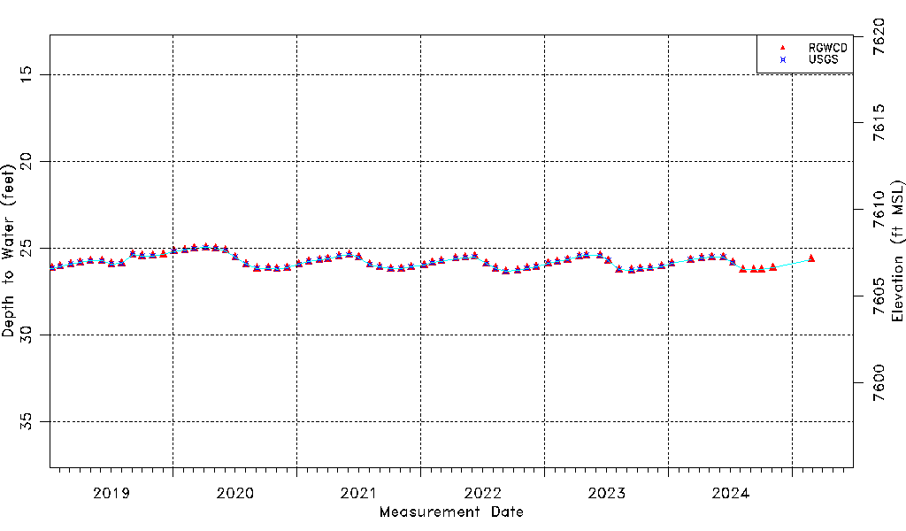
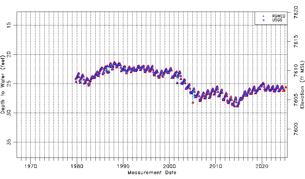
| Water-level Count | 579 |
| Water-level Date Range | 10/02/1979 thru 07/09/2026 |
| Monitored within the last 18 months | Yes, most recently on 07/09/2026 |
| Depth-to-Water Range (ft) | 21.41 to 28.92 |
| Water Table Elevation Range (ft NAVD88) | 7603.85 to 7611.36 |
| Water-Level-Source:Number-of-Measurements | RGWCD:557 USGS:521 |