| Well Information Table |
|---|
| Common Well ID | NA04500920BAA |
| USGS Station Name | NA04500920BAA |
| USGS Construction Date | 10/11/1982 |
| USGS Site Type | NNNNNYNNNNNNNNNNNNNN |
| USGS Site Use Information | Unknown |
| USGS Groundwater Use Information | Unknown |
| Data Source(s) | USGS |
| Location Data |
|---|
| TRS | NA04500920BAA |
| USGS TRS 1 | NA04500920BAA |
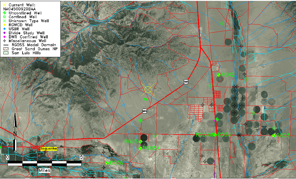
| USGS TRS | NWNENES20 T45 R9N |
| Longitude/Latitude (NAD83) | -106.00473833 , 38.14472167 |
| Longitude/Latitude Data Source | GWSI decimal LAT/LONG field |
| USGS Longitude/Latitude (NAD83) | -106.004738333 , 38.144721667 |
| Easting, Northing RGDSS-NAD83 (US ft) | 104957.72 , 418385.91 |
| USGS Topography | Hillside (slope) |
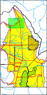
| USGS County | Saguache County |
| USGS Map Name | GRAVEYARD GULCH |
| USGS Map Scale | 24000 |
| Elevation and Depth Data |
|---|
| Ground Elevation (ft NAVD88) | 7964.50 |
| Elevation Data Source | USGS GWSI database |
| USGS Ground Elevation (ft NGVD29) | 7960.00 |
| 1/3-Arc Second NED Ground Elevation (ft NAVD88) | 7987.91 |
| 1-Arc Second NED Ground Elevation (ft NAVD88) | 7986.68 |
| SRTM Ground Elevation (ft NAVD88) | 7992.12 |
| Total Depth (ft) | 315.00 |
| USGS Well Depth (ft) | 315.00 |
| Model Layer | 1 |
| Model Layer Source | Well Depth |
| Depth of Bottom of Layer 1 | 348 |
| Depth of Bottom of Layer 2 | 380 |
| Additional Well Information | Production, Logs, Construction |
| Aquifer Information |
|---|
| Aquifer Type | Unconfined |
| Aquifer Type Source | TD Elevation/Model Layer |
| USGS Hydrologic Unit | Saguache |
| Water-level Database Information |
|---|
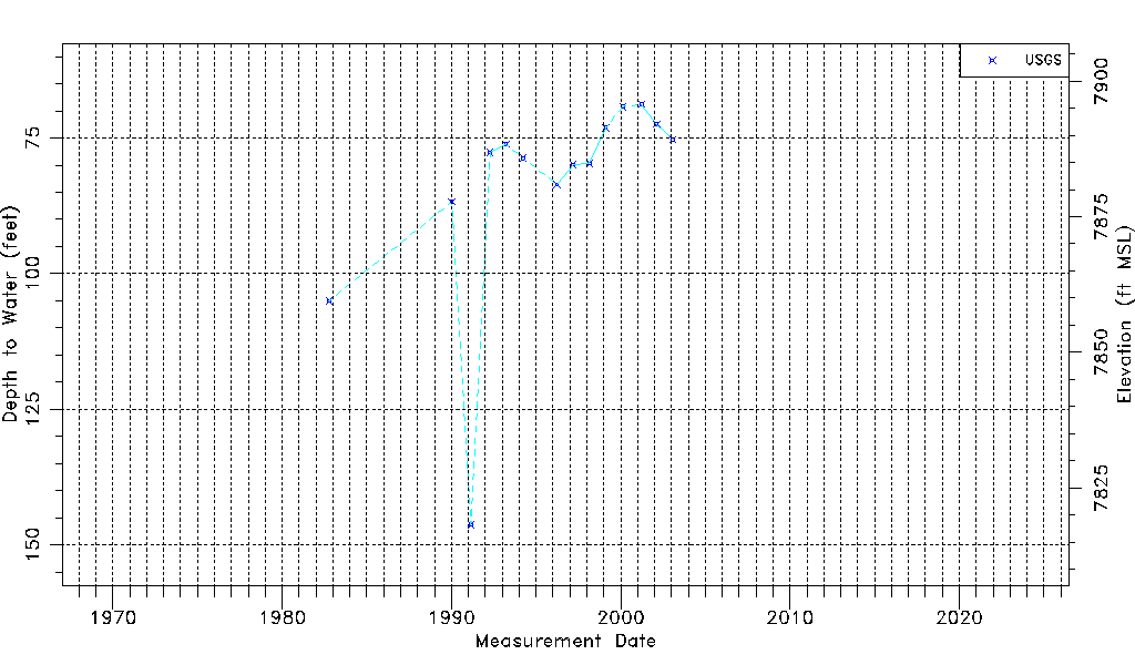
| Water-level Count | 14 |
| Water-level Date Range | 10/11/1982 thru 01/29/2003 |
| Monitored within the last 18 months | No, most recently on 01/29/2003 |
| Depth-to-Water Range (ft) | 68.77 to 146.28 |
| Water Table Elevation Range (ft NAVD88) | 7818.22 to 7895.73 |
| Water-Level-Source:Number-of-Measurements | USGS:14 |