| Well Information Table |
|---|
| Common Well ID | Coombs Well |
| CWCD Well Name | Coombs Well |
| USGS Site Use Information | Unknown |
| USGS Groundwater Use Information | Unknown |
| Data Source(s) | DWR, CWCD |
| Location Data |
|---|
| TRS | Coombs Well |
| Longitude/Latitude (NAD83) | -105.97278000 , 37.18161000 |
| Longitude/Latitude Data Source | Conejos WCD |
| Easting, Northing RGDSS-NAD83 (US ft) | 113005.67 , 67756.18 |
| Elevation and Depth Data |
|---|
| Ground Elevation (ft NAVD88) | 7709.00 |
| Elevation Data Source | CWCD data |
| 1/3-Arc Second NED Ground Elevation (ft NAVD88) | 7708.63 |
| 1-Arc Second NED Ground Elevation (ft NAVD88) | 7709.21 |
| SRTM Ground Elevation (ft NAVD88) | 7715.87 |
| Total Depth (ft) | 694.00 |
| Depth to Top of Screen (ft) | 107.0 |
| Depth to Bottom of Screen (ft) | 694.00 |
| Model Layer | 4 |
| Model Layer Source | CWCD/HRS |
| Depth of Bottom of Layer 1 | 34 |
| Depth of Bottom of Layer 2 | 223 |
| Depth of Bottom of Layer 3 | 378 |
| Depth of Bottom of Layer 4 | 1551 |
| Additional Well Information | NONE |
| Aquifer Information |
|---|
| Aquifer Type | Confined |
| Aquifer Type Source | CWCD_AQFR |
| Water-level Database Information |
|---|
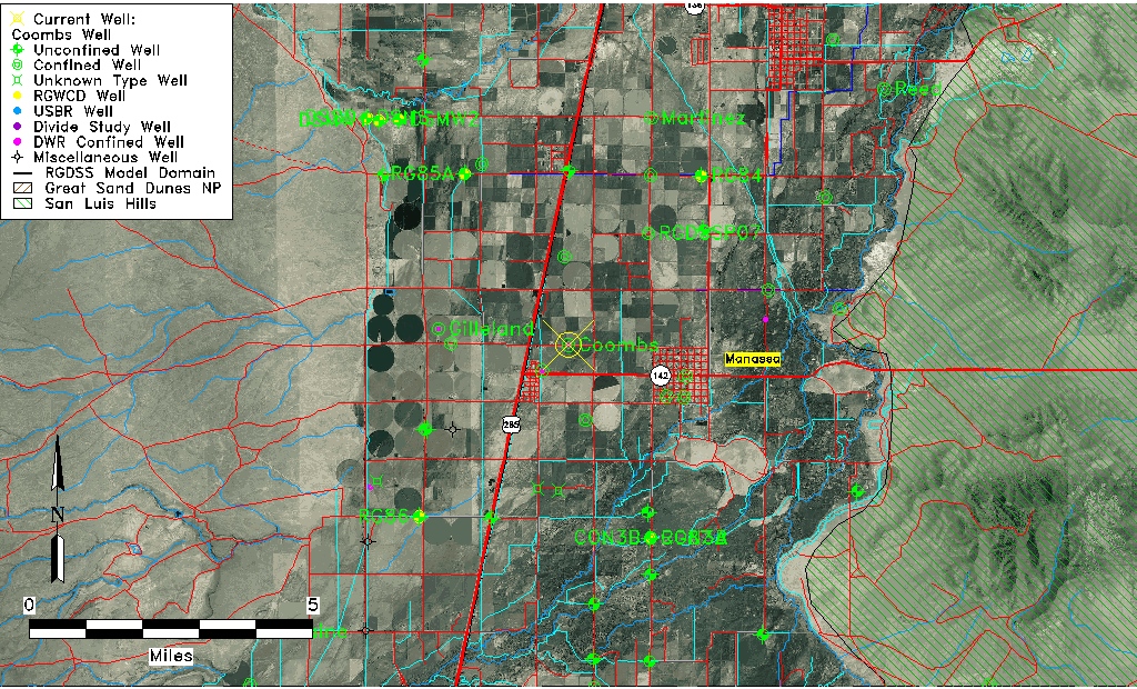
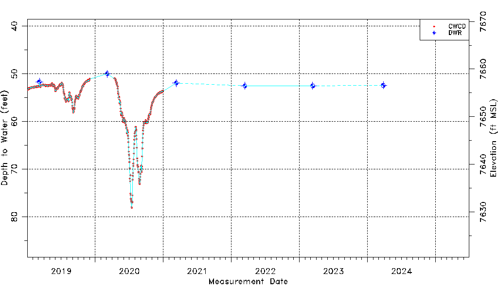
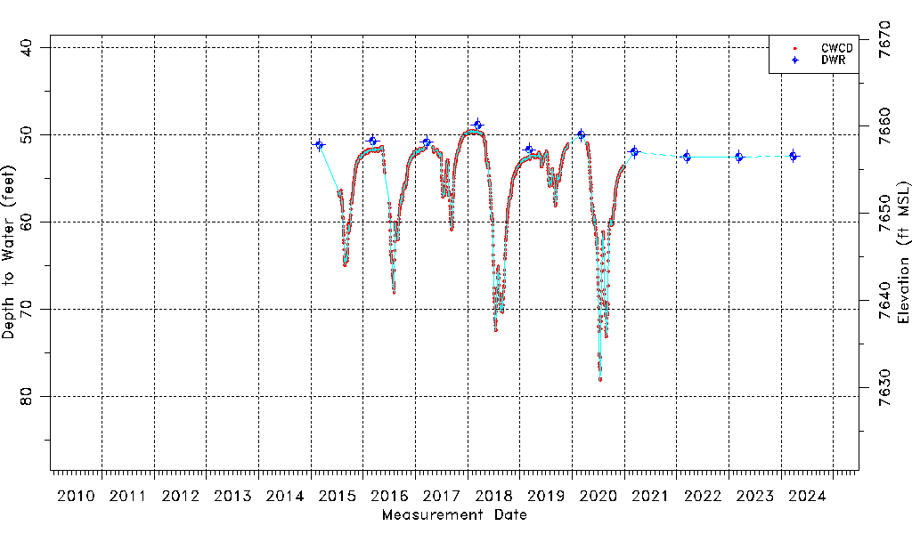
| Water-level Count | 1744 |
| Water-level Date Range | 02/27/2015 thru 03/12/2026 |
| Monitored within the last 18 months | Yes, most recently on 03/12/2026 |
| Depth-to-Water Range (ft) | 48.83 to 78.13 |
| Water Table Elevation Range (ft NAVD88) | 7630.87 to 7660.17 |
| Water-Level-Source:Number-of-Measurements | CWCD:1732 DWR:12 |