| Well Information Table |
|---|
| Common Well ID | Gerald Faucette |
| CWCD Well Name | Gerald Faucette |
| USGS Site Use Information | Unknown |
| USGS Groundwater Use Information | Unknown |
| Data Source(s) | CWCD |
| Location Data |
|---|
| TRS | Gerald Faucette |
| Longitude/Latitude (NAD83) | -106.06594000 , 37.31999000 |
| Longitude/Latitude Data Source | Conejos WCD |
| Easting, Northing RGDSS-NAD83 (US ft) | 86081.60 , 118225.82 |
| Elevation and Depth Data |
|---|
| Ground Elevation (ft NAVD88) | 7715.70 |
| Elevation Data Source | NED3 data |
| 1/3-Arc Second NED Ground Elevation (ft NAVD88) | 7715.70 |
| 1-Arc Second NED Ground Elevation (ft NAVD88) | 7715.62 |
| SRTM Ground Elevation (ft NAVD88) | 7719.05 |
| Depth of Bottom of Layer 1 | 39 |
| Depth of Bottom of Layer 2 | 232 |
| Depth of Bottom of Layer 3 | 298 |
| Depth of Bottom of Layer 4 | 1463 |
| Additional Well Information | NONE |
| Aquifer Information |
|---|
| Aquifer Type | Confined |
| Aquifer Type Source | CWCD_AQFR |
| Water-level Database Information |
|---|
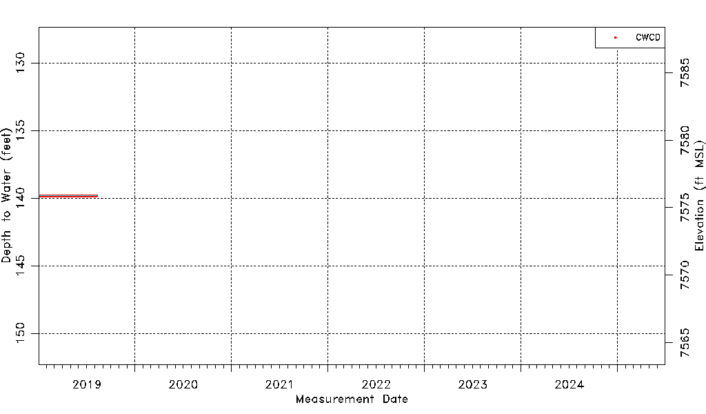
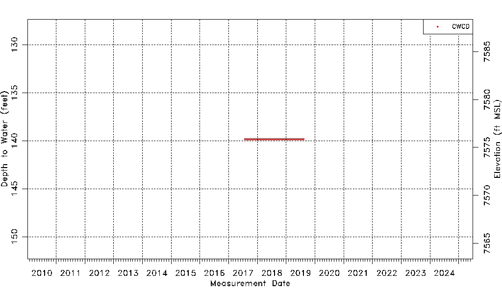
| Water-level Count | 744 |
| Water-level Date Range | 07/27/2017 thru 08/09/2019 |
| Monitored within the last 18 months | No, most recently on 08/09/2019 |
| Depth-to-Water Range (ft) | 139.82 to 139.82 |
| Water Table Elevation Range (ft NAVD88) | 7575.88 to 7575.88 |
| Water-Level-Source:Number-of-Measurements | CWCD:744 |