| Well Information Table |
|---|
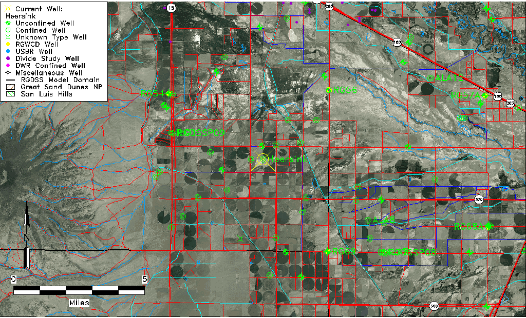
| Common Well ID | Heersink |
| CWCD Well Name | Heersink |
| USGS Site Use Information | Unknown |
| USGS Groundwater Use Information | Unknown |
| Data Source(s) | CWCD |
| Location Data |
|---|
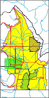
| TRS | Heersink |
| Longitude/Latitude (NAD83) | -106.08471000 , 37.45179700 |
| Longitude/Latitude Data Source | Conejos WCD |
| Easting, Northing RGDSS-NAD83 (US ft) | 80834.68 , 166228.80 |
| Elevation and Depth Data |
|---|
| Ground Elevation (ft NAVD88) | 7635.00 |
| Elevation Data Source | CWCD data |
| 1/3-Arc Second NED Ground Elevation (ft NAVD88) | 7635.12 |
| 1-Arc Second NED Ground Elevation (ft NAVD88) | 7634.12 |
| SRTM Ground Elevation (ft NAVD88) | 7634.66 |
| Total Depth (ft) | 555.00 |
| Depth to Top of Screen (ft) | 146.0 |
| Depth to Bottom of Screen (ft) | 555.00 |
| Model Layer | 4 |
| Model Layer Source | CWCD/HRS |
| Depth of Bottom of Layer 1 | 38 |
| Depth of Bottom of Layer 2 | 207 |
| Depth of Bottom of Layer 3 | 363 |
| Depth of Bottom of Layer 4 | 2099 |
| Additional Well Information | NONE |
| Aquifer Information |
|---|
| Aquifer Type | Confined |
| Aquifer Type Source | CWCD_AQFR |
| Water-level Database Information |
|---|
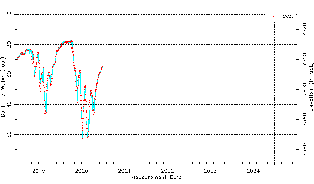
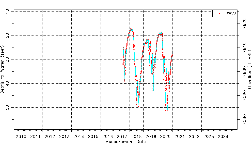
| Water-level Count | 1250 |
| Water-level Date Range | 07/26/2017 thru 12/31/2020 |
| Monitored within the last 18 months | No, most recently on 12/31/2020 |
| Depth-to-Water Range (ft) | 17.16 to 51.15 |
| Water Table Elevation Range (ft NAVD88) | 7583.85 to 7617.84 |
| Water-Level-Source:Number-of-Measurements | CWCD:1250 |