| Well Information Table |
|---|
| Common Well ID | DIV0016075A |
| USGS Site Use Information | Unknown |
| USGS Groundwater Use Information | Unknown |
| Data Source(s) | Divide Study |
| Location Data |
|---|
| Longitude/Latitude (NAD83) | -105.85805590 , 37.55315001 |
| Longitude/Latitude Data Source | Divide Study |
| Easting, Northing RGDSS-NAD83 (US ft) | 146684.31 , 202912.57 |
| Elevation and Depth Data |
|---|
| Ground Elevation (ft NAVD88) | 7548.40 |
| Elevation Data Source | Divide study surveying by Davis Engineering |
| 1/3-Arc Second NED Ground Elevation (ft NAVD88) | 7548.84 |
| 1-Arc Second NED Ground Elevation (ft NAVD88) | 7550.23 |
| SRTM Ground Elevation (ft NAVD88) | 7555.77 |
| Model Layer | 1 |
| Model Layer Source | Aquifer Type |
| Depth of Bottom of Layer 1 | 54 |
| Depth of Bottom of Layer 2 | 509 |
| Depth of Bottom of Layer 3 | 934 |
| Depth of Bottom of Layer 4 | 2505 |
| Additional Well Information | NONE |
| Aquifer Information |
|---|
| Aquifer Type | Unconfined |
| Aquifer Type Source | DIV_AQ |
| Water-level Database Information |
|---|
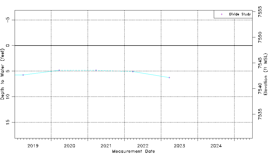
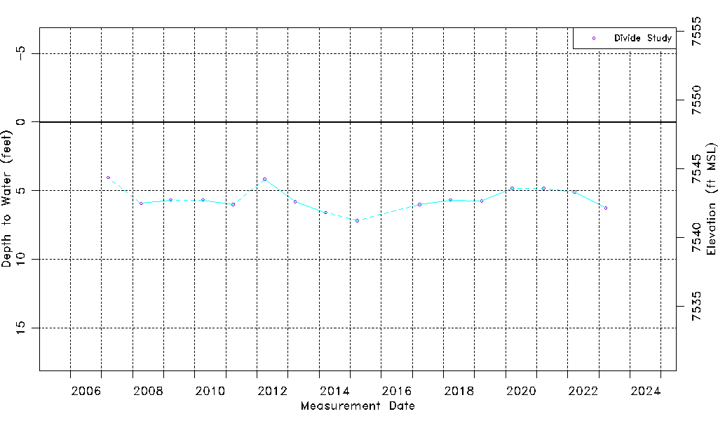
| Water-level Count | 16 |
| Water-level Date Range | 03/20/2007 thru 03/24/2023 |
| Monitored within the last 18 months | No, most recently on 03/24/2023 |
| Depth-to-Water Range (ft) | 4.04 to 7.17 |
| Water Table Elevation Range (ft NAVD88) | 7541.23 to 7544.36 |
| Water-Level-Source:Number-of-Measurements | Divide Study:16 |