| Well Information Table |
|---|
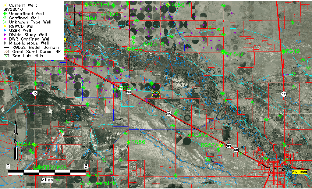
| Common Well ID | DIV08010 |
| USGS Site Use Information | Unknown |
| USGS Groundwater Use Information | Unknown |
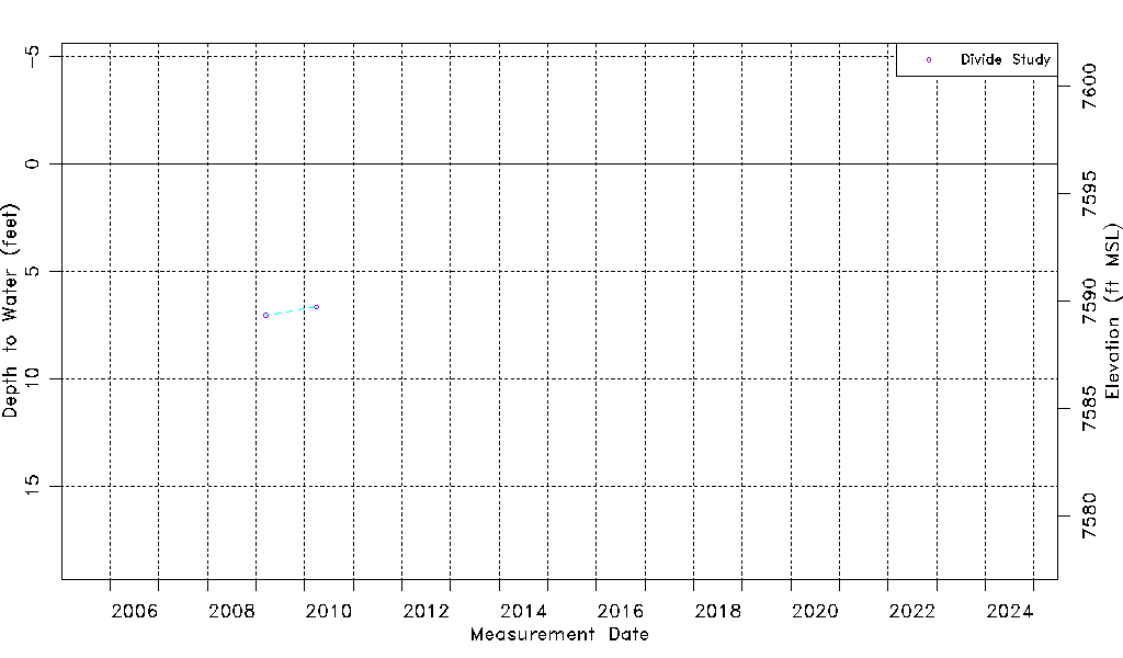
| Data Source(s) | Divide Study |
| Location Data |
|---|
| Longitude/Latitude (NAD83) | -106.00723767 , 37.53452310 |
| Longitude/Latitude Data Source | Divide Study |
| Easting, Northing RGDSS-NAD83 (US ft) | 103425.51 , 196253.04 |
| Elevation and Depth Data |
|---|
| Ground Elevation (ft NAVD88) | 7596.39 |
| Elevation Data Source | Divide study surveying by Davis Engineering |
| 1/3-Arc Second NED Ground Elevation (ft NAVD88) | 7595.78 |
| 1-Arc Second NED Ground Elevation (ft NAVD88) | 7595.97 |
| SRTM Ground Elevation (ft NAVD88) | 7598.42 |
| Model Layer | 1 |
| Model Layer Source | Aquifer Type |
| Depth of Bottom of Layer 1 | 59 |
| Depth of Bottom of Layer 2 | 257 |
| Depth of Bottom of Layer 3 | 805 |
| Depth of Bottom of Layer 4 | 2122 |
| Additional Well Information | NONE |
| Aquifer Information |
|---|
| Aquifer Type | Unconfined |
| Aquifer Type Source | DIV_AQ |
| Water-level Database Information |
|---|
| Water-level Count | 2 |
| Water-level Date Range | 03/19/2009 thru 03/30/2010 |
| Monitored within the last 18 months | No, most recently on 03/30/2010 |
| Depth-to-Water Range (ft) | 6.67 to 7.04 |
| Water Table Elevation Range (ft NAVD88) | 7589.35 to 7589.72 |
| Water-Level-Source:Number-of-Measurements | Divide Study:2 |