| Well Information Table |
|---|
| Common Well ID | DIV10402 |
| USGS Site Use Information | Unknown |
| USGS Groundwater Use Information | Unknown |
| Data Source(s) | Divide Study |
| Location Data |
|---|
| Longitude/Latitude (NAD83) | -106.06888634 , 37.61088936 |
| Longitude/Latitude Data Source | Divide Study |
| Easting, Northing RGDSS-NAD83 (US ft) | 85672.61 , 224122.30 |
| Elevation and Depth Data |
|---|
| Ground Elevation (ft NAVD88) | 7630.77 |
| Elevation Data Source | Divide study surveying by Davis Engineering |
| 1/3-Arc Second NED Ground Elevation (ft NAVD88) | 7630.81 |
| 1-Arc Second NED Ground Elevation (ft NAVD88) | 7630.31 |
| SRTM Ground Elevation (ft NAVD88) | 7637.79 |
| Model Layer | 1 |
| Model Layer Source | Aquifer Type |
| Depth of Bottom of Layer 1 | 85 |
| Depth of Bottom of Layer 2 | 235 |
| Depth of Bottom of Layer 3 | 599 |
| Depth of Bottom of Layer 4 | 2261 |
| Additional Well Information | NONE |
| Aquifer Information |
|---|
| Aquifer Type | Unconfined |
| Aquifer Type Source | DIV_AQ |
| Water-level Database Information |
|---|
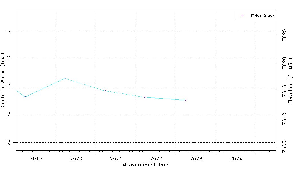
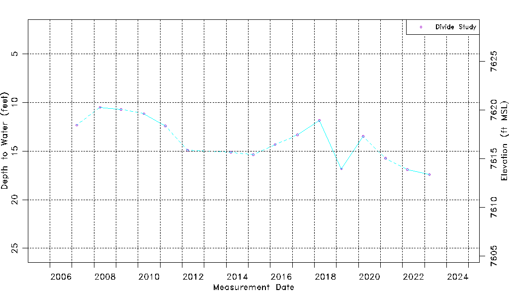
| Water-level Count | 16 |
| Water-level Date Range | 03/21/2007 thru 03/24/2023 |
| Monitored within the last 18 months | No, most recently on 03/24/2023 |
| Depth-to-Water Range (ft) | 10.50 to 17.41 |
| Water Table Elevation Range (ft NAVD88) | 7613.36 to 7620.27 |
| Water-Level-Source:Number-of-Measurements | Divide Study:16 |