| Well Information Table |
|---|
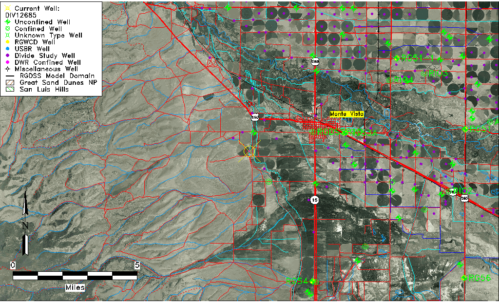
| Common Well ID | DIV12685 |
| USGS Site Use Information | Unknown |
| USGS Groundwater Use Information | Unknown |
| Data Source(s) | Divide Study |
| Location Data |
|---|
| Longitude/Latitude (NAD83) | -106.19675242 , 37.56348176 |
| Longitude/Latitude Data Source | Divide Study |
| Easting, Northing RGDSS-NAD83 (US ft) | 48546.14 , 207047.44 |
| Elevation and Depth Data |
|---|
| Ground Elevation (ft NAVD88) | 7710.91 |
| Elevation Data Source | Divide study surveying by Davis Engineering |
| 1/3-Arc Second NED Ground Elevation (ft NAVD88) | 7711.09 |
| 1-Arc Second NED Ground Elevation (ft NAVD88) | 7711.14 |
| SRTM Ground Elevation (ft NAVD88) | 7722.08 |
| Model Layer | 1 |
| Model Layer Source | Aquifer Type |
| Depth of Bottom of Layer 1 | 100 |
| Depth of Bottom of Layer 2 | 224 |
| Additional Well Information | NONE |
| Aquifer Information |
|---|
| Aquifer Type | Unconfined |
| Aquifer Type Source | DIV_AQ |
| Water-level Database Information |
|---|
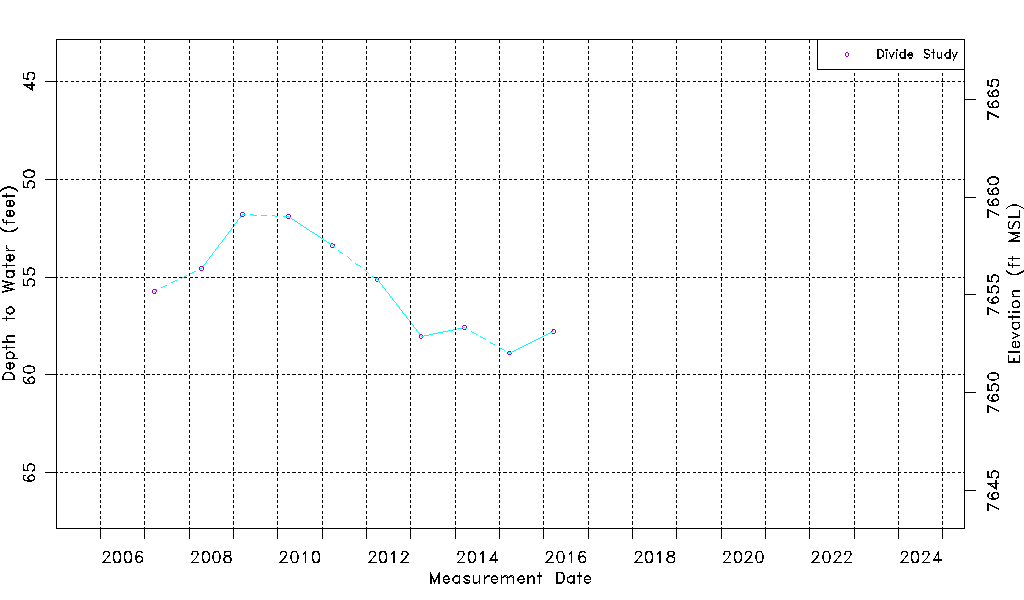
| Water-level Count | 10 |
| Water-level Date Range | 03/22/2007 thru 03/22/2016 |
| Monitored within the last 18 months | No, most recently on 03/22/2016 |
| Depth-to-Water Range (ft) | 51.80 to 58.88 |
| Water Table Elevation Range (ft NAVD88) | 7652.03 to 7659.11 |
| Water-Level-Source:Number-of-Measurements | Divide Study:10 |