| Well Information Table |
|---|
| Common Well ID | DIV13329 |
| USGS Site Use Information | Unknown |
| USGS Groundwater Use Information | Unknown |
| Data Source(s) | Divide Study |
| Location Data |
|---|
| Longitude/Latitude (NAD83) | -106.16237073 , 37.67167471 |
| Longitude/Latitude Data Source | Divide Study |
| Easting, Northing RGDSS-NAD83 (US ft) | 58716.58 , 246379.22 |
| Elevation and Depth Data |
|---|
| Ground Elevation (ft NAVD88) | 7696.28 |
| Elevation Data Source | Divide study surveying by Davis Engineering |
| 1/3-Arc Second NED Ground Elevation (ft NAVD88) | 7695.94 |
| 1-Arc Second NED Ground Elevation (ft NAVD88) | 7695.65 |
| SRTM Ground Elevation (ft NAVD88) | 7701.56 |
| Model Layer | 1 |
| Model Layer Source | Aquifer Type |
| Depth of Bottom of Layer 1 | 83 |
| Depth of Bottom of Layer 2 | 207 |
| Depth of Bottom of Layer 3 | 282 |
| Depth of Bottom of Layer 4 | 1977 |
| Additional Well Information | NONE |
| Aquifer Information |
|---|
| Aquifer Type | Unconfined |
| Aquifer Type Source | DIV_AQ |
| Water-level Database Information |
|---|
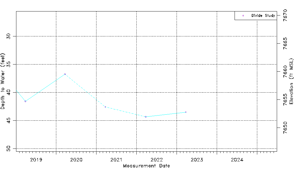
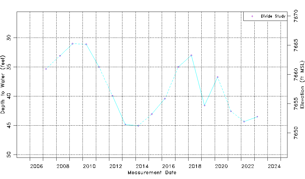
| Water-level Count | 17 |
| Water-level Date Range | 03/20/2007 thru 03/24/2023 |
| Monitored within the last 18 months | No, most recently on 03/24/2023 |
| Depth-to-Water Range (ft) | 31.00 to 45.04 |
| Water Table Elevation Range (ft NAVD88) | 7651.24 to 7665.28 |
| Water-Level-Source:Number-of-Measurements | Divide Study:17 |