| Well Information Table |
|---|
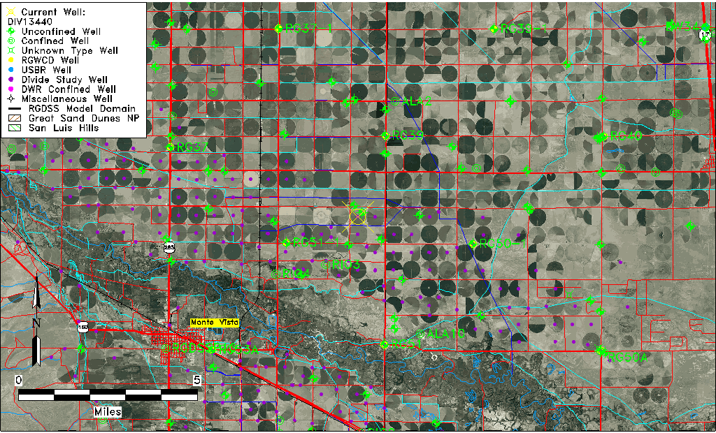
| Common Well ID | DIV13440 |
| USGS Site Use Information | Unknown |
| USGS Groundwater Use Information | Unknown |
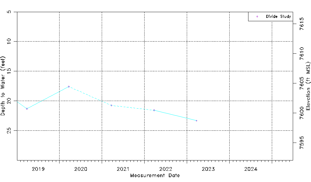
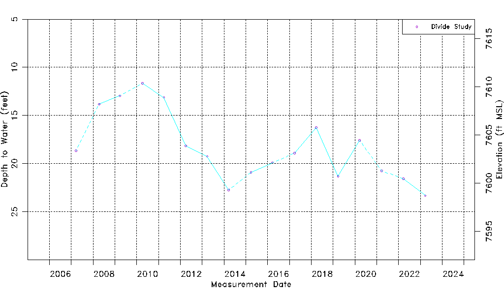
| Data Source(s) | Divide Study |
| Location Data |
|---|
| Longitude/Latitude (NAD83) | -106.05274537 , 37.62878242 |
| Longitude/Latitude Data Source | Divide Study |
| Easting, Northing RGDSS-NAD83 (US ft) | 90373.58 , 230616.33 |
| Elevation and Depth Data |
|---|
| Ground Elevation (ft NAVD88) | 7622.03 |
| Elevation Data Source | Divide study surveying by Davis Engineering |
| 1/3-Arc Second NED Ground Elevation (ft NAVD88) | 7621.58 |
| 1-Arc Second NED Ground Elevation (ft NAVD88) | 7621.25 |
| SRTM Ground Elevation (ft NAVD88) | 7624.38 |
| Model Layer | 1 |
| Model Layer Source | Aquifer Type |
| Depth of Bottom of Layer 1 | 85 |
| Depth of Bottom of Layer 2 | 231 |
| Depth of Bottom of Layer 3 | 626 |
| Depth of Bottom of Layer 4 | 2248 |
| Additional Well Information | NONE |
| Aquifer Information |
|---|
| Aquifer Type | Unconfined |
| Aquifer Type Source | DIV_AQ |
| Water-level Database Information |
|---|
| Water-level Count | 17 |
| Water-level Date Range | 03/20/2007 thru 03/24/2023 |
| Monitored within the last 18 months | No, most recently on 03/24/2023 |
| Depth-to-Water Range (ft) | 11.66 to 23.33 |
| Water Table Elevation Range (ft NAVD88) | 7598.70 to 7610.37 |
| Water-Level-Source:Number-of-Measurements | Divide Study:17 |