| Well Information Table |
|---|
| Common Well ID | DIV5880 |
| USGS Site Use Information | Unknown |
| USGS Groundwater Use Information | Unknown |
| Data Source(s) | Divide Study |
| Location Data |
|---|
| Longitude/Latitude (NAD83) | -106.11252273 , 37.57000363 |
| Longitude/Latitude Data Source | Divide Study |
| Easting, Northing RGDSS-NAD83 (US ft) | 72965.47 , 209295.52 |
| Elevation and Depth Data |
|---|
| Ground Elevation (ft NAVD88) | 7643.26 |
| Elevation Data Source | Divide study surveying by Davis Engineering |
| 1/3-Arc Second NED Ground Elevation (ft NAVD88) | 7644.24 |
| 1-Arc Second NED Ground Elevation (ft NAVD88) | 7643.69 |
| SRTM Ground Elevation (ft NAVD88) | 7657.48 |
| Model Layer | 1 |
| Model Layer Source | Aquifer Type |
| Depth of Bottom of Layer 1 | 63 |
| Depth of Bottom of Layer 2 | 163 |
| Depth of Bottom of Layer 3 | 528 |
| Depth of Bottom of Layer 4 | 1951 |
| Additional Well Information | NONE |
| Aquifer Information |
|---|
| Aquifer Type | Unconfined |
| Aquifer Type Source | DIV_AQ |
| Water-level Database Information |
|---|
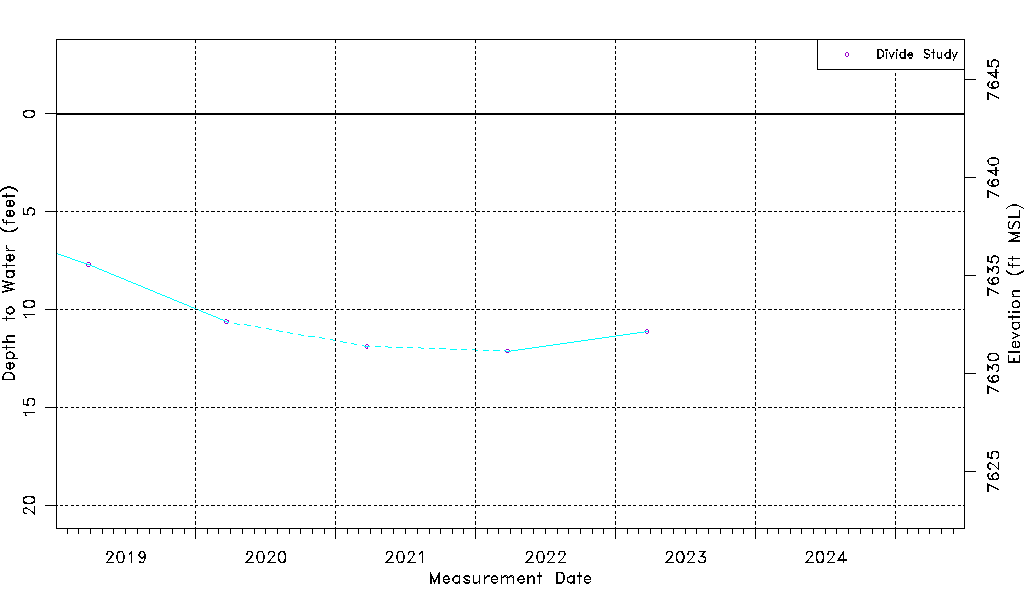
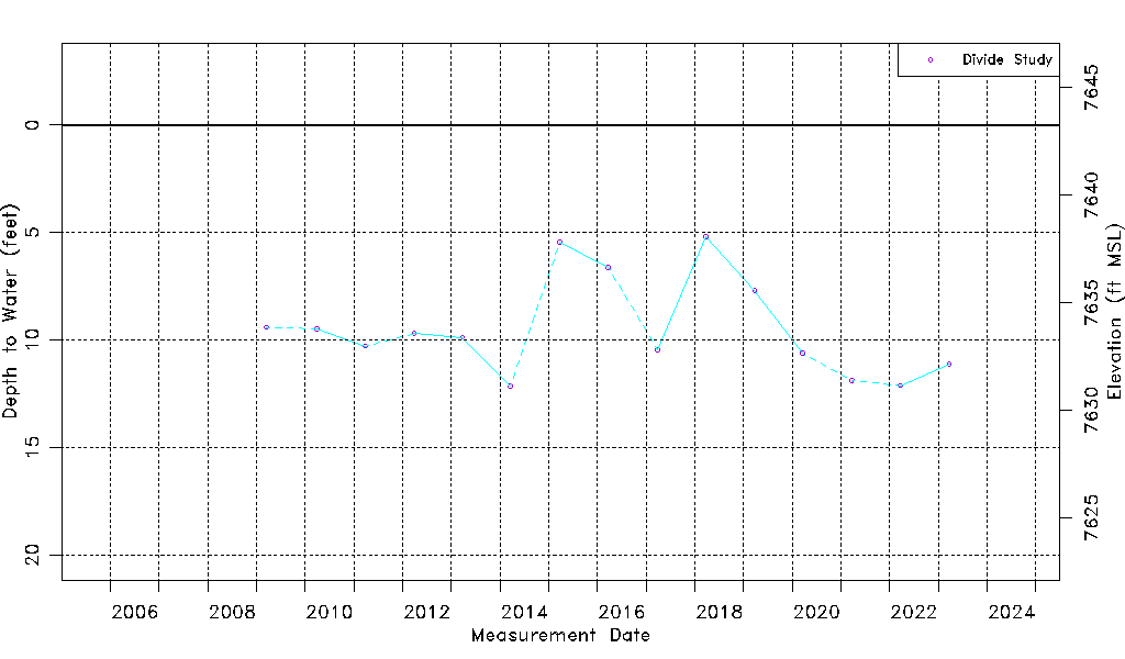
| Water-level Count | 15 |
| Water-level Date Range | 03/18/2009 thru 03/24/2023 |
| Monitored within the last 18 months | No, most recently on 03/24/2023 |
| Depth-to-Water Range (ft) | 5.20 to 12.16 |
| Water Table Elevation Range (ft NAVD88) | 7631.10 to 7638.06 |
| Water-Level-Source:Number-of-Measurements | Divide Study:15 |