| Well Information Table |
|---|
| Common Well ID | DIV6375B |
| USGS Site Use Information | Unknown |
| USGS Groundwater Use Information | Unknown |
| Data Source(s) | Divide Study |
| Location Data |
|---|
| Longitude/Latitude (NAD83) | -106.22240239 , 37.66215949 |
| Longitude/Latitude Data Source | Divide Study |
| Easting, Northing RGDSS-NAD83 (US ft) | 41325.16 , 243012.53 |
| Elevation and Depth Data |
|---|
| Ground Elevation (ft NAVD88) | 7751.53 |
| Elevation Data Source | Divide study surveying by Davis Engineering |
| 1/3-Arc Second NED Ground Elevation (ft NAVD88) | 7752.00 |
| 1-Arc Second NED Ground Elevation (ft NAVD88) | 7751.36 |
| SRTM Ground Elevation (ft NAVD88) | 7759.19 |
| Model Layer | 1 |
| Model Layer Source | Aquifer Type |
| Depth of Bottom of Layer 1 | 52 |
| Depth of Bottom of Layer 2 | 177 |
| Depth of Bottom of Layer 3 | 310 |
| Depth of Bottom of Layer 4 | 857 |
| Additional Well Information | NONE |
| Aquifer Information |
|---|
| Aquifer Type | Unconfined |
| Aquifer Type Source | DIV_AQ |
| Water-level Database Information |
|---|
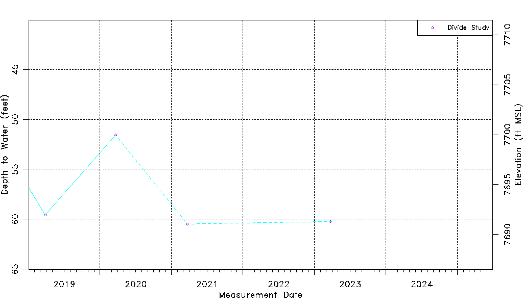
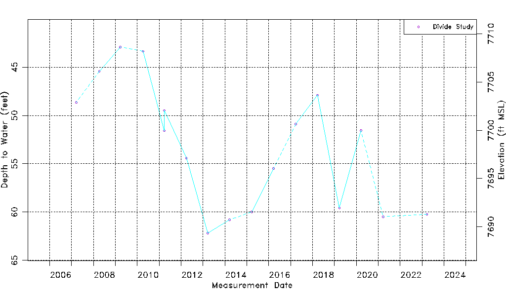
| Water-level Count | 17 |
| Water-level Date Range | 03/20/2007 thru 03/24/2023 |
| Monitored within the last 18 months | No, most recently on 03/24/2023 |
| Depth-to-Water Range (ft) | 42.91 to 62.16 |
| Water Table Elevation Range (ft NAVD88) | 7689.37 to 7708.62 |
| Water-Level-Source:Number-of-Measurements | Divide Study:17 |